
| INDIANAPOLIS EXECUTIVE INDIANAPOLIS IN |
| |
| Lat: N 4001.7 Long: W 08615.1 Elev: 922 Var: +03 Longest Runway: 7001 | ||
| Clr Del: 118.175 AWOS: 120.72 CTAF: 123.05 | ||
| |||||||||||||||||||||||||||||||||||||||||||||||||||||||||||||||||||||
| |||||||||||||||||||||||||||||||||||||||||||||||||||||||||||||||||||||
| |||||||||||||||||||||||||||||||||||||||||||||||||||||||||||||||||||||
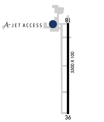
| Rwy | Rwy | |||||||
| 7001x100 | 7001' | 7001x100 | 7001' | 111.30 - 002° | ||||
| Runway ID | Single Wheel | Double Wheel | Double Tandem Wheel | Dual Double Wheel |
| 18/36 | 45,000 | 90,000 | N/A | N/A |
| These numbers are Advisory and are not limits. The Airport Manager should have more accurate Weight Limits | ||||
 Airport Diagram might not be current. | |
| Facility Name: | INDIANAPOLIS EXEC |
| City Name: | INDIANAPOLIS |
| County: | BOONE |
| State abbrev: | IN |
| State Name: | INDIANA |
| Ownership: | PUBLICLY OWNED |
| Use: | OPEN TO THE PUBLIC |
| Owner's Name: | HAMILTON COUNTY AIRPORT AUTHORITY |
| Address: | 11329 E. STATE RD 32 |
| ZIONSVILLE, IN 46077 | |
| Owner's Phone: | (317) 385-3015 |
| Manager's Name: | SAM SACHS |
| Address: | 11329 E. STATE RD 32 |
| ZIONSVILLE, IN 46077 | |
| Phone: | 317-385-3015 |
| FAA Region: | GREAT LAKES |
| FAA Field Office: | CHI |
| Date | Sunrise | Sunset |
|---|---|---|
| 05/01/26 Friday | 6:45 | 20:40 |
| 05/02/26 Saturday | 6:44 | 20:41 |
| 05/03/26 Sunday | 6:43 | 20:42 |
| 05/04/26 Monday | 6:42 | 20:43 |
| 05/05/26 Tuesday | 6:40 | 20:44 |
| 05/06/26 Wednesday | 6:39 | 20:45 |
| 05/07/26 Thursday | 6:38 | 20:46 |
| 05/08/26 Friday | 6:37 | 20:47 |
| 05/09/26 Saturday | 6:36 | 20:48 |
| 05/10/26 Sunday | 6:35 | 20:49 |
| 05/11/26 Monday | 6:34 | 20:49 |
| 05/12/26 Tuesday | 6:33 | 20:50 |
| 05/13/26 Wednesday | 6:32 | 20:51 |
| 05/14/26 Thursday | 6:31 | 20:52 |
| Airport Attendance Schedule | 7 Days A Week 0600-2000; SVC AFT HR - 317-769-4487. |
| Airport Status | OPERATIONAL (This Status can change at any time - please check NOTAMS) |
| Airport Lighting Schedule | ACTVT REIL RWY 18 & 36; HIRL RWY 18/36 - CTAF. HIRL RWY 18/36 PRESET MED INTST DUSK - DAWN; INCR INTST- CTAF. PAPI RWY 18 & 36 OPR CONSLY. |
| Airport Storage Available | Tie Downs, Hanger |
| Extra Services Available | Air Freight, Air Ambulance, Avionics, Cargo Handling, Charter, Flight Instruction, Aircraft Rental, Aircraft Sales |
| Wind Indicator | YES - (lighted) |
| Control Tower | NO |
| CTAF Frequency | 123.050 |
| Unicom Frequency | 123.050 |
| Rotating Beacon Color | WG |
| Segmented Circle | NO |
| Landing Fee | NO |
| Airport Inspected | STATE - performed by STATE AERONAUTICAL PERSONNEL |
| Inspection Date | 07/26/2023 |
| Type of Fuel Available | Grade 100LL, JET A (freeze point -40C), JET A; -10100LL SELF SVC H24 WITH CREDIT CARD. |
| Airframe Repair Service | MAJOR |
| Power Plant Repair Service | MAJOR |
| Latitude | N4001.7 |
| Longitude | W08615.1 (ESTIMATED) |
| Arpt Elevation | 922ft (SURVEYED) |
| Magnetic Variation | 03W |
| 14 miles NW | of INDIANAPOLIS |
| Traffic Pattern Altitude | |
| Sectional Chart | CHICAGO |
| Operations (Reported) | Yearly | Avg. Daily |
|---|---|---|
| General Aviation Transient | 0 | 0 |
| General Aviation Local | 0 | 0 |
| Air Taxi | 0 | 0 |
| Commerical | 0 | 0 |
| Commuter | 0 | 0 |
| Military | 0 | 0 |
| Aircraft based on Field | |
|---|---|
| General Aviation Singles | 0 |
| General Aviation Multi | 0 |
| Jet Aircraft | 0 |
| General Aviation Helicopters | 0 |
| Military Aircraft | 0 |
| Gliders | 0 |
| Ultralights | 0 |
| FSS on field | NO |
| FSS tie-in | TERRE HAUTE |
| FSS Phone | 1-800-WX-BRIEF |
| Who issues Notams | HUF |
| Notam D service at airport | YES |
| ARTCC Name | CHICAGO |
| Airport Certification | |
| Aircraft Rescue & Firefighting Index | None |
| Airport of Entry | No |
| Custom Landing Rights | No |
| Joint Civil/Military | No |
| Military Landing rights | YES |
| NATIONAL PLAN OF INTEGRATED AIRPORT SYSTEMS (NPIAS) |
| GRANT AGREEMENTS UNDER FAAP/ADAP/AIP |
| ASSURANCES PURSUANT TO TITLE VI, CIVIL RIGHTS ACT OF 1964 |
| BIRDS ON & INVOF ARPT |
| FOR CD CTC INDIANAPOLIS APCH AT 317-227-5743. |
| COND NOT MNT 2000-0600. |
| REMOTE CTL ACFT ACT 0.1 NM W OF RWY 18/36 SFC-400 FT. |
| FUEL & SVC - 130.4 |
| RWY 18/3 6 RWY 36 CALM/XWIND RWY. |
Airport Communications & Frequencies:
| |||||||||||||||||||||||
| Runway: 18 | Runway: 36 | ||
| Mag heading: | 182° | Mag heading: | 2° |
| Rwy Slope: | .00% | Rwy Slope: | .00% |
| Approach: | Approach: | ILS | |
| Pattern: | Left Traffic | Pattern: | Left Traffic |
| Markings: | NONPRECISION INSTRUMENT | Markings: | PRECISION INSTRUMENT |
| Marking Condition: | GOOD | Marking Condition: | GOOD |
| Arresting Dev: | Arresting Dev: | ||
| Lat & Long: | N4002.3 W08615.1 | Lat. & Long.: | N4001.1 W08615.1 |
| Elev: | 921.9 ft. MSL | Elev: | 921.9 ft. MSL |
| TCH: | 52 ft. AGL | TCH: | 52 ft. AGL |
| Visual Glide Path: | 3.00 degrees | Visual Glide Path: | 3.00 degrees |
| Displaced Threshold: | No | Displaced Threshold: | No |
| Touchdown Zone: | YES | Touchdown Zone: | YES |
| Touchdown Elev.: | 922.2 feet | Touchdown Elev.: | 922.2 feet |
| Visual Glide Slope: | 4-Light PAPI on LEFT side of Runway | Visual Glide Slope: | 4-Light PAPI on LEFT side of Runway |
| RVR Equipment: | RVR Equipment: | ||
| RVV Equipment: | NO | RVV Equipment: | NO |
| Approach Lights: | Approach Lights: | ||
| REIL: | YES | REIL: | YES |
| Centerline Lights: | NO | Centerline Lights: | NO |
| Touchdown lights: | NO | Touchdown lights: | NO |
| Runway Category: | Runway with a Non-precision Approach having visibility minimums greater than 3/4 mile | Runway Category: | Precision Instrument Runway |
| Declared Distances: | Declared Distances: | ||
| Obstructions: | HANGAR | Obstructions: | TREE |
| Marked: | NOT Marked/Lighted | Marked: | NOT Marked/Lighted |
| Clearance slope: | 19:1 | Clearance slope: | 27:1 |
| Obstruction height: | 24 feet AGL | Obstruction height: | 35 feet AGL |
| Dist. from runway: | 670 feet | Dist. from runway: | 1175 feet |
| Centerline offset: | 540 right of centerline | Centerline offset: | 200 feet right of centerline |
| Comments: | 10 FT CROPS 230 FT E OF RWY CNTRLN. | Comments: |
Thanks for using FltPlan.com
all rights reserved © 1999-2026 by Flight Plan LLC


