
| TALLAHASSEE INTL TALLAHASSEE FL |
| |
| Lat: N 3023.8 Long: W 08421.1 Elev: 83 Var: +05 Longest Runway: 8000 | ||
| Clr Del: 126.65 Dept. ATIS: 119.45 Arr. ATIS: 119.45 AWOS: 119.45 Ground: 121.9 Tower: 118.7 | ||

| ||||||||||||||||||||||||||||||||||||||||||||
| ||||||||||||||||||||||||||||||||||||||||||||
| ||||||||||||||||||||||||||||||||||||||||||||
| Rwy | Rwy | |||||||
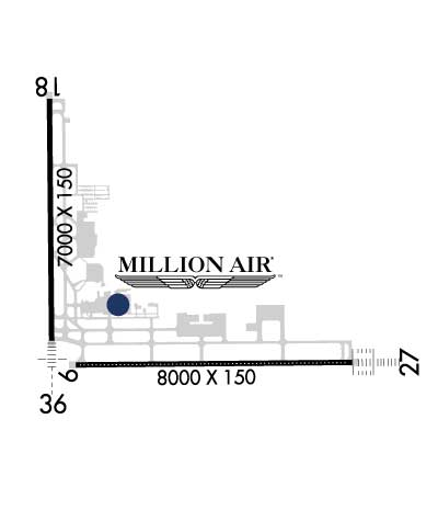
| 8000x150 | 8000' | 8000x150 | 8000' | 111.90 - 274° | ||||
| 7000x150 | 7000' | 7000x150 | 7000' | 110.30 - 004° | ||||
| Runway ID | Single Wheel | Double Wheel | Double Tandem Wheel | Dual Double Wheel |
| 09/27 | 115,000 | 170,000 | 330,000 | N/A |
| 18/36 | 115,000 | 170,000 | 330,000 | N/A |
| These numbers are Advisory and are not limits. The Airport Manager should have more accurate Weight Limits | ||||
 Airport Diagram might not be current. | |
| Facility Name: | TALLAHASSEE INTL |
| City Name: | TALLAHASSEE |
| County: | LEON |
| State abbrev: | FL |
| State Name: | FLORIDA |
| Ownership: | PUBLICLY OWNED |
| Use: | OPEN TO THE PUBLIC |
| Owner's Name: | CITY OF TALLAHASSEE |
| Address: | CITY HALL |
| TALLAHASSEE, FL 32304 | |
| Owner's Phone: | 850-891-7802 |
| Manager's Name: | DAVID POLLARD |
| Address: | 3300 CAPITAL CIRCLE SW |
| TALLAHASSEE, FL 32310 | |
| Phone: | 850-891-7802 |
| FAA Region: | SOUTHERN |
| FAA Field Office: | ORL |

| Date | Sunrise | Sunset |
|---|---|---|
| 09/24/21 Friday | 7:27 | 19:32 |
| 09/25/21 Saturday | 7:27 | 19:30 |
| 09/26/21 Sunday | 7:28 | 19:29 |
| 09/27/21 Monday | 7:28 | 19:28 |
| 09/28/21 Tuesday | 7:29 | 19:27 |
| 09/29/21 Wednesday | 7:30 | 19:25 |
| 09/30/21 Thursday | 7:30 | 19:24 |
| 10/01/21 Friday | 7:31 | 19:23 |
| 10/02/21 Saturday | 7:31 | 19:22 |
| 10/03/21 Sunday | 7:32 | 19:21 |
| 10/04/21 Monday | 7:33 | 19:19 |
| 10/05/21 Tuesday | 7:33 | 19:18 |
| 10/06/21 Wednesday | 7:34 | 19:17 |
| 10/07/21 Thursday | 7:34 | 19:16 |
| Airport Attendance Schedule | CONTINUOUS |
| Airport Status | OPERATIONAL (This Status can change at any time - please check NOTAMS) |
| Airport Lighting Schedule | WHEN ATCT CLSD ACTVT MALSR 36; REIL RWY 9 & 18; PAPI RWY 9, 27, 18 & 36; HIRL RWY 9/27 & 18/36 - CTAF. ALSF2 RWY 27 PRESET ON MED INTST. |
| Airport Storage Available | Hanger |
| Extra Services Available | Air Freight, Air Ambulance, Avionics, Cargo Handling, Charter, Flight Instruction, Aircraft Rental, Aircraft Sales |
| Wind Indicator | YES - (lighted) |
| Control Tower | YES |
| CTAF Frequency | 118.700 |
| Unicom Frequency | 123.075 |
| Rotating Beacon Color | CLEAR-GREEN (Light Land Airport) |
| Segmented Circle | YES |
| Landing Fee | NO |
| Airport Inspected | FEDERAL - performed by FAA AIRPORTS FIELD PERSONNEL |
| Inspection Date | 07/13/2020 |
| Type of Fuel Available | Grade 100LL, JET A (freeze point -40C) |
| Airframe Repair Service | MAJOR |
| Power Plant Repair Service | MAJOR |
| Latitude | N3023.8 |
| Longitude | W08421.1 (ESTIMATED) |
| Arpt Elevation | 83ft (SURVEYED) |
| Magnetic Variation | 05W |
| 4 miles SW | of TALLAHASSEE |
| Traffic Pattern Altitude | |
| Sectional Chart | JACKSONVILLE |
| Operations (Reported) | Yearly | Avg. Daily |
|---|---|---|
| General Aviation Transient | 24022 | 66 |
| General Aviation Local | 11199 | 31 |
| Air Taxi | 9237 | 25 |
| Commerical | 8881 | 24 |
| Commuter | 0 | 0 |
| Military | 13395 | 37 |
| Aircraft based on Field | |
|---|---|
| General Aviation Singles | 150 |
| General Aviation Multi | 11 |
| Jet Aircraft | 5 |
| General Aviation Helicopters | 12 |
| Military Aircraft | 0 |
| Gliders | 0 |
| Ultralights | 0 |
| FSS on field | NO |
| FSS tie-in | GAINESVILLE |
| FSS Phone | 1-800-WX-BRIEF |
| Who issues Notams | TLH |
| Notam D service at airport | YES |
| ARTCC Name | JACKSONVILLE |
| Airport Certification | AIRPORT RECEIVING SCHEDULED AIR CARRIER SERVICE FROM CARRIERS CERTIFICATED BY THE CIVIL AERONAUTICS BOARD |
| Aircraft Rescue & Firefighting Index | AIRPORT HAS A CERTIFICATE UNDER CFR PART 139 |
| Airport of Entry | No |
| Custom Landing Rights | No |
| Joint Civil/Military | No |
| Military Landing rights | YES |
| NATIONAL PLAN OF INTEGRATED AIRPORT SYSTEMS (NPIAS) |
| GRANT AGREEMENTS UNDER FAAP/ADAP/AIP |
| CONVEYANCE UNDER SCETION 16, FEDERAL AIRPORT ACT OF 1946 OR SECTION 23, AIRPORT AND AIRWAY DEVELOPMENT ACT OF 1970 |
| ASSURANCES PURSUANT TO TITLE VI, CIVIL RIGHTS ACT OF 1964 |
| MOVEMENT AREA OF TWY 'Z' BEGINS AT THE INTXN OF TWY 'B8' & PROCEEDS E TO THE INTXN OF TWY 'B7' THIS TWY IS NOT FOR USE BY ACR OPNS; ASPH BTN TWYS 'B8' & 'A12' IS FOR HEL OPNS; TWY 'Z' FM TWY 'A12' TO THE RAMP IS OPEN TO ACFT WITH WINGSPAN OF 50 FT OR LESS. |
| BIRDS ON & INVOF ARPT. |
| FOR CD IF UNA TO CTC ON FSS FREQ, CTC TALLAHASSEE APCH AT 850-942-8311, WHEN APCH CLSD CTC JACKSONVILLE ARTCC AT 904-845-1592. |
| RWY 18/3 6 LONGL AND TRANSVERSE CRACKS PRSNT ON RWY 18/36. |
Airport Communications & Frequencies:
| |||||||||||||||||||||||||||||||||||||||||||||||||||||||||||||||
| Runway: 09 | Runway: 27 | ||
| Mag heading: | 94° | Mag heading: | 274° |
| Rwy Slope: | -.15% Down | Rwy Slope: | .15% Up |
| Approach: | Approach: | ILS/DME | |
| Pattern: | Left Traffic | Pattern: | Left Traffic |
| Markings: | PRECISION INSTRUMENT | Markings: | PRECISION INSTRUMENT |
| Marking Condition: | GOOD | Marking Condition: | GOOD |
| Arresting Dev: | Arresting Dev: | ||
| Lat & Long: | N3023.5 W08421.4 | Lat. & Long.: | N3023.5 W08419.9 |
| Elev: | 60.6 ft. MSL | Elev: | 48.5 ft. MSL |
| TCH: | 58 ft. AGL | TCH: | 58 ft. AGL |
| Visual Glide Path: | 3.00 degrees | Visual Glide Path: | 3.00 degrees |
| Displaced Threshold: | No | Displaced Threshold: | No |
| Touchdown Zone: | YES | Touchdown Zone: | YES |
| Touchdown Elev.: | 65.5 feet | Touchdown Elev.: | 58.1 feet |
| Visual Glide Slope: | 4-Light PAPI on LEFT side of Runway | Visual Glide Slope: | 4-Light PAPI on LEFT side of Runway |
| RVR Equipment: | TOUCHDOWN-ROLLOUT | RVR Equipment: | TOUCHDOWN-ROLLOUT |
| RVV Equipment: | YES | RVV Equipment: | YES |
| Approach Lights: | Approach Lights: | ALSF2 - standard 2,400 foot high intensity approach lighting system with sequenced flashers, Category II or III | |
| REIL: | YES | REIL: | NO |
| Centerline Lights: | YES | Centerline Lights: | YES |
| Touchdown lights: | NO | Touchdown lights: | YES |
| Runway Category: | Precision Instrument Runway | Runway Category: | Precision Instrument Runway |
| Declared Distances: | Declared Distances: | ||
| Obstructions: | TREES | Obstructions: | |
| Marked: | NOT Marked/Lighted | Marked: | |
| Clearance slope: | 50:1 | Clearance slope: | 50:1 |
| Obstruction height: | 51 feet AGL | Obstruction height: | |
| Dist. from runway: | 2750 feet | Dist. from runway: | |
| Centerline offset: | 415 right of centerline | Centerline offset: | |
| Comments: | Comments: |
| Runway: 18 | Runway: 36 | ||
| Mag heading: | 184° | Mag heading: | 4° |
| Rwy Slope: | -.38% Down | Rwy Slope: | .38% Up |
| Approach: | Approach: | ILS/DME | |
| Pattern: | Left Traffic | Pattern: | Left Traffic |
| Markings: | PRECISION INSTRUMENT | Markings: | PRECISION INSTRUMENT |
| Marking Condition: | FAIR | Marking Condition: | FAIR |
| Arresting Dev: | Arresting Dev: | ||
| Lat & Long: | N3024.7 W08421.5 | Lat. & Long.: | N3023.6 W08421.5 |
| Elev: | 83.1 ft. MSL | Elev: | 56.4 ft. MSL |
| TCH: | 55 ft. AGL | TCH: | 54 ft. AGL |
| Visual Glide Path: | 3.00 degrees | Visual Glide Path: | 3.00 degrees |
| Displaced Threshold: | No | Displaced Threshold: | No |
| Touchdown Zone: | YES | Touchdown Zone: | YES |
| Touchdown Elev.: | 83.1 feet | Touchdown Elev.: | 62.2 feet |
| Visual Glide Slope: | 4-Light PAPI on LEFT side of Runway | Visual Glide Slope: | 4-Light PAPI on LEFT side of Runway |
| RVR Equipment: | ROLLOUT | RVR Equipment: | TOUCHDOWN |
| RVV Equipment: | NO | RVV Equipment: | NO |
| Approach Lights: | Approach Lights: | MALSR - 1,400 foot medium intensity approach lighting system with runway alignment indicator lights | |
| REIL: | YES | REIL: | NO |
| Centerline Lights: | NO | Centerline Lights: | NO |
| Touchdown lights: | NO | Touchdown lights: | NO |
| Runway Category: | Runway with a Non-precision Approach having visibility minimums greater than 3/4 mile | Runway Category: | Precision Instrument Runway |
| Declared Distances: | Declared Distances: | ||
| Obstructions: | TREES | Obstructions: | |
| Marked: | NOT Marked/Lighted | Marked: | |
| Clearance slope: | 48:1 | Clearance slope: | 50:1 |
| Obstruction height: | 28 feet AGL | Obstruction height: | |
| Dist. from runway: | 1570 feet | Dist. from runway: | |
| Centerline offset: | 455 left of centerline | Centerline offset: | |
| Comments: | Comments: |
Thanks for using FltPlan.com
all rights reserved © 1999-2021 by Flight Plan LLC