
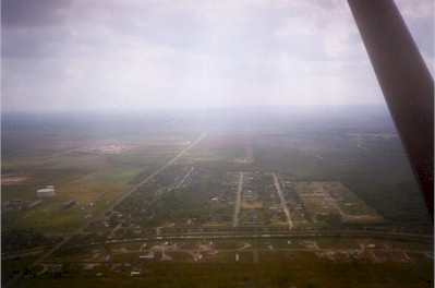
| BENGER AIR PARK FRIONA TX |
| |
| Lat: N 3439.3 Long: W 10241.5 Elev: 4003 Var: -09 Longest Runway: 3013 | ||
| CTAF: 122.9 | ||
| ||||||||||||||||||||||||||||||||||||||||||||
| ||||||||||||||||||||||||||||||||||||||||||||
| Rwy | Rwy | |||||||
| 3013x60 | 3013' | 3013x60 | 3013' | |||||
| 2700x150 | 2700' | 2700x150 | 2700' | |||||
| Runway ID | Single Wheel | Double Wheel | Double Tandem Wheel | Dual Double Wheel |
| 04/22 | N/A | N/A | N/A | N/A |
| 17/35 | N/A | N/A | N/A | N/A |
| These numbers are Advisory and are not limits. The Airport Manager should have more accurate Weight Limits | ||||
| FltPlan does not have IFR approach charts available for KX54. |
| Facility Name: | BENGER AIR PARK |
| City Name: | FRIONA |
| County: | PARMER |
| State abbrev: | TX |
| State Name: | TEXAS |
| Ownership: | PRIVATELY OWNED |
| Use: | OPEN TO THE PUBLIC |
| Owner's Name: | HURST PROPERTY HOLDINGS |
| Address: | BOX 241 |
| FRIONA, TX 79035 | |
| Owner's Phone: | |
| Manager's Name: | ROBERT C. HURST |
| Address: | BOX 241 |
| FRIONA, TX 79035 | |
| Phone: | |
| FAA Region: | SOUTHWEST |
| FAA Field Office: | TEX |
| Date | Sunrise | Sunset |
|---|---|---|
| 07/11/24 Thursday | 6:47 | 21:05 |
| 07/12/24 Friday | 6:48 | 21:05 |
| 07/13/24 Saturday | 6:48 | 21:05 |
| 07/14/24 Sunday | 6:49 | 21:04 |
| 07/15/24 Monday | 6:49 | 21:04 |
| 07/16/24 Tuesday | 6:50 | 21:03 |
| 07/17/24 Wednesday | 6:51 | 21:03 |
| 07/18/24 Thursday | 6:51 | 21:02 |
| 07/19/24 Friday | 6:52 | 21:02 |
| 07/20/24 Saturday | 6:53 | 21:01 |
| 07/21/24 Sunday | 6:53 | 21:01 |
| 07/22/24 Monday | 6:54 | 21:00 |
| 07/23/24 Tuesday | 6:55 | 20:59 |
| 07/24/24 Wednesday | 6:56 | 20:59 |
| Airport Attendance Schedule | UNATTENDED |
| Airport Status | CLOSED INDEFINITELY (This Status can change at any time - please check NOTAMS) |
| Airport Lighting Schedule | |
| Airport Storage Available | NONE |
| Extra Services Available | NONE |
| Wind Indicator | NONE |
| Control Tower | NO |
| CTAF Frequency | 122.900 |
| Unicom Frequency | |
| Rotating Beacon Color | |
| Segmented Circle | NO |
| Landing Fee | NO |
| Airport Inspected | STATE - performed by PRIVATE CONTRACT PERSONNEL |
| Inspection Date | 04/14/2024 |
| Type of Fuel Available | None |
| Airframe Repair Service | NONE |
| Power Plant Repair Service | NONE |
| Latitude | N3439.3 |
| Longitude | W10241.5 (ESTIMATED) |
| Arpt Elevation | 4003ft (ESTIMATED) |
| Magnetic Variation | 09E |
| 2 miles NE | of FRIONA |
| Traffic Pattern Altitude | |
| Sectional Chart | ALBUQUERQUE |
| Operations (Reported) | Yearly | Avg. Daily |
|---|---|---|
| General Aviation Transient | 0 | 0 |
| General Aviation Local | 0 | 0 |
| Air Taxi | 0 | 0 |
| Commerical | 0 | 0 |
| Commuter | 0 | 0 |
| Military | 0 | 0 |
| Aircraft based on Field | |
|---|---|
| General Aviation Singles | 0 |
| General Aviation Multi | 0 |
| Jet Aircraft | 0 |
| General Aviation Helicopters | 0 |
| Military Aircraft | 0 |
| Gliders | 0 |
| Ultralights | 0 |
| FSS on field | NO |
| FSS tie-in | FORT WORTH |
| FSS Phone | 1-800-WX-BRIEF |
| Who issues Notams | FTW |
| Notam D service at airport | YES |
| ARTCC Name | ALBUQUERQUE |
| Airport Certification | |
| Aircraft Rescue & Firefighting Index | None |
| Airport of Entry | No |
| Custom Landing Rights | No |
| Joint Civil/Military | No |
| Military Landing rights | No |
| FOR CD CTC ALBUQUERQUE ARTCC AT 505-856-4861. |
| (ARPT STATUS) ARPT CLSD INDEFLY. |
| RWY 04/2 2 NOT SUITABLE FOR ACFT. |
| RWY 04/2 2 1POT HOLES AND GRVL. |
| RWY 17/3 5 NOT SUITABLE FOR ACFT. |
| RWY 17/3 5 13 FT VEGETATION, RWY NOT MNTND. |
| Runway: 04 | Runway: 22 | ||
| Mag heading: | N/A | Mag heading: | N/A |
| Approach: | Approach: | ||
| Pattern: | Left Traffic | Pattern: | Left Traffic |
| Markings: | Markings: | ||
| Marking Condition: | Marking Condition: | ||
| Arresting Dev: | Arresting Dev: | ||
| Lat & Long: | Lat. & Long.: | ||
| Elev: | N/A | Elev: | N/A |
| TCH: | TCH: | ||
| Visual Glide Path: | Visual Glide Path: | ||
| Displaced Threshold: | No | Displaced Threshold: | No |
| Touchdown Zone: | NO | Touchdown Zone: | NO |
| Touchdown Elev.: | Touchdown Elev.: | ||
| Visual Glide Slope: | Visual Glide Slope: | ||
| RVR Equipment: | RVR Equipment: | ||
| RVV Equipment: | NO | RVV Equipment: | NO |
| Approach Lights: | Approach Lights: | ||
| REIL: | NO | REIL: | NO |
| Centerline Lights: | NO | Centerline Lights: | NO |
| Touchdown lights: | NO | Touchdown lights: | NO |
| Runway Category: | Runway with a Visual Approach | Runway Category: | Runway with a Visual Approach |
| Declared Distances: | Declared Distances: | ||
| Obstructions: | BLDG | Obstructions: | |
| Marked: | NOT Marked/Lighted | Marked: | |
| Clearance slope: | 15:1 | Clearance slope: | 50:1 |
| Obstruction height: | 193 feet AGL | Obstruction height: | |
| Dist. from runway: | 3100 feet | Dist. from runway: | |
| Centerline offset: | 380 left of centerline | Centerline offset: | |
| Comments: | Comments: | ROAD AT THLD 85 FT LEFT; 3) +5 FT STEEL CORNER POSTS 145 FT FM THLD 77 FT RIGHT. |
| Runway: 17 | Runway: 35 | ||
| Mag heading: | N/A | Mag heading: | N/A |
| Approach: | Approach: | ||
| Pattern: | Left Traffic | Pattern: | Left Traffic |
| Markings: | Markings: | ||
| Marking Condition: | Marking Condition: | ||
| Arresting Dev: | Arresting Dev: | ||
| Lat & Long: | Lat. & Long.: | ||
| Elev: | N/A | Elev: | N/A |
| TCH: | TCH: | ||
| Visual Glide Path: | Visual Glide Path: | ||
| Displaced Threshold: | No | Displaced Threshold: | No |
| Touchdown Zone: | NO | Touchdown Zone: | NO |
| Touchdown Elev.: | Touchdown Elev.: | ||
| Visual Glide Slope: | Visual Glide Slope: | ||
| RVR Equipment: | RVR Equipment: | ||
| RVV Equipment: | NO | RVV Equipment: | NO |
| Approach Lights: | Approach Lights: | ||
| REIL: | NO | REIL: | NO |
| Centerline Lights: | NO | Centerline Lights: | NO |
| Touchdown lights: | NO | Touchdown lights: | NO |
| Runway Category: | Runway with a Visual Approach | Runway Category: | Runway with a Visual Approach |
| Declared Distances: | Declared Distances: | ||
| Obstructions: | TREES | Obstructions: | |
| Marked: | NOT Marked/Lighted | Marked: | |
| Clearance slope: | 1:1 | Clearance slope: | 50:1 |
| Obstruction height: | 25 feet AGL | Obstruction height: | |
| Dist. from runway: | 46 feet | Dist. from runway: | |
| Centerline offset: | 63 right of centerline | Centerline offset: | |
| Comments: | Comments: |
Thanks for using FltPlan.com
all rights reserved © 1999-2024 by Flight Plan LLC