
| LIVINGSTON COUNTY - HARDY HOWELL MI |
| |
| Lat: N 4237.8 Long: W 08358.9 Elev: 962 Var: +05 Longest Runway: 5002 | ||
| Clr Del: 121.725 AWOS: 118.87 CTAF: 123.0 | ||
| ||||||||||||||||||||||||||||||||||||||||||||
| ||||||||||||||||||||||||||||||||||||||||||||
| ||||||||||||||||||||||||||||||||||||||||||||
| Rwy | Rwy | |||||||
| 5002x100 | 5002' | 108.55 - 132° | 5002x100 | 5002' | ||||
| Runway ID | Single Wheel | Double Wheel | Double Tandem Wheel | Dual Double Wheel |
| 13/31 | 100,000 | N/A | N/A | N/A |
| These numbers are Advisory and are not limits. The Airport Manager should have more accurate Weight Limits | ||||
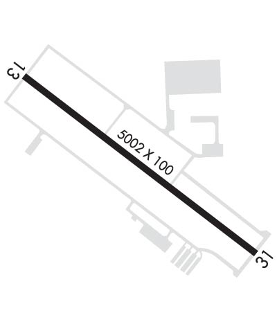 Airport Diagram might not be current. | |
| Facility Name: | LIVINGSTON COUNTY SPENCER J HARDY |
| City Name: | HOWELL |
| County: | LIVINGSTON |
| State abbrev: | MI |
| State Name: | MICHIGAN |
| Ownership: | PUBLICLY OWNED |
| Use: | OPEN TO THE PUBLIC |
| Owner's Name: | LIVINGSTON COUNTY |
| Address: | 3399 COUNTY AIRPORT DRIVE |
| HOWELL, MI 48855 | |
| Owner's Phone: | 517-546-3520 |
| Manager's Name: | MARK D. JOHNSON |
| Address: | 3399 COUNTY AIRPORT DRIVE |
| HOWELL, MI 48855 | |
| Phone: | 517-546-6675 |
| FAA Region: | GREAT LAKES |
| FAA Field Office: | DET |
| Date | Sunrise | Sunset |
|---|---|---|
| 05/11/25 Sunday | 6:18 | 20:47 |
| 05/12/25 Monday | 6:17 | 20:48 |
| 05/13/25 Tuesday | 6:16 | 20:49 |
| 05/14/25 Wednesday | 6:15 | 20:50 |
| 05/15/25 Thursday | 6:14 | 20:51 |
| 05/16/25 Friday | 6:13 | 20:52 |
| 05/17/25 Saturday | 6:12 | 20:53 |
| 05/18/25 Sunday | 6:11 | 20:54 |
| 05/19/25 Monday | 6:10 | 20:55 |
| 05/20/25 Tuesday | 6:09 | 20:56 |
| 05/21/25 Wednesday | 6:08 | 20:57 |
| 05/22/25 Thursday | 6:07 | 20:58 |
| 05/23/25 Friday | 6:07 | 20:59 |
| 05/24/25 Saturday | 6:06 | 21:00 |
| Airport Attendance Schedule | MON-FRI 0700-1700, SAT-SUN 0800-1200 |
| Airport Status | OPERATIONAL (This Status can change at any time - please check NOTAMS) |
| Airport Lighting Schedule | HIRL RY 13/31 OPER LOW INTST DUSK-2200; TO INCR INTST & ACTVT AFT 2200 - CTAF. ACTVT REIL RY 31 & MALSR RY 13 - CTAF. PAPI RYS 13 & 31 OPER DAWN-DUSK, THEREAFTER - CTAF. |
| Airport Storage Available | Tie Downs, Hanger |
| Extra Services Available | Air Ambulance, Charter, Flight Instruction, Aircraft Rental |
| Wind Indicator | YES - (lighted) |
| Control Tower | NO |
| CTAF Frequency | 123.000 |
| Unicom Frequency | 123.000 |
| Rotating Beacon Color | WG |
| Segmented Circle | YES |
| Landing Fee | NO |
| Airport Inspected | STATE - performed by STATE AERONAUTICAL PERSONNEL |
| Inspection Date | 10/11/2022 |
| Type of Fuel Available | Grade 100LL, JET A (freeze point -40C), JET A |
| Airframe Repair Service | MAJOR |
| Power Plant Repair Service | MAJOR |
| Latitude | N4237.8 |
| Longitude | W08358.9 (ESTIMATED) |
| Arpt Elevation | 962ft (SURVEYED) |
| Magnetic Variation | 05W |
| 3 miles NW | of HOWELL |
| Traffic Pattern Altitude | 1039 |
| Sectional Chart | DETROIT |
| Operations (Reported) | Yearly | Avg. Daily |
|---|---|---|
| General Aviation Transient | 0 | 0 |
| General Aviation Local | 0 | 0 |
| Air Taxi | 0 | 0 |
| Commerical | 0 | 0 |
| Commuter | 0 | 0 |
| Military | 0 | 0 |
| Aircraft based on Field | |
|---|---|
| General Aviation Singles | 0 |
| General Aviation Multi | 0 |
| Jet Aircraft | 0 |
| General Aviation Helicopters | 0 |
| Military Aircraft | 0 |
| Gliders | 0 |
| Ultralights | 0 |
| FSS on field | NO |
| FSS tie-in | LANSING |
| FSS Phone | 1-800-WX-BRIEF |
| Who issues Notams | OZW |
| Notam D service at airport | YES |
| ARTCC Name | CLEVELAND |
| Airport Certification | |
| Aircraft Rescue & Firefighting Index | None |
| Airport of Entry | No |
| Custom Landing Rights | No |
| Joint Civil/Military | No |
| Military Landing rights | YES |
| NATIONAL PLAN OF INTEGRATED AIRPORT SYSTEMS (NPIAS) |
| GRANT AGREEMENTS UNDER FAAP/ADAP/AIP |
| ASSURANCES PURSUANT TO TITLE VI, CIVIL RIGHTS ACT OF 1964 |
| DEER & LRG BIRDS ON & INVOF ARPT. |
| GCO AVBL ON FREQ 121.725 THRU DTW CLNC DEL & FLT SVCS. |
| FOR CD CTC DETROIT APCH AT 734-955-1404. |
Airport Communications & Frequencies:
| |||||||||||||||||||
| Runway: 13 | Runway: 31 | ||
| Mag heading: | 132° | Mag heading: | 312° |
| Rwy Slope: | -.38% Down | Rwy Slope: | .38% Up |
| Approach: | ILS/DME | Approach: | |
| Pattern: | Left Traffic | Pattern: | Left Traffic |
| Markings: | PRECISION INSTRUMENT | Markings: | PRECISION INSTRUMENT |
| Marking Condition: | FAIR | Marking Condition: | FAIR |
| Arresting Dev: | Arresting Dev: | ||
| Lat & Long: | N4238.0 W08359.4 | Lat. & Long.: | N4237.5 W08358.5 |
| Elev: | 962.0 ft. MSL | Elev: | 943.2 ft. MSL |
| TCH: | 47 ft. AGL | TCH: | 30 ft. AGL |
| Visual Glide Path: | 3.00 degrees | Visual Glide Path: | 3.00 degrees |
| Displaced Threshold: | No | Displaced Threshold: | No |
| Touchdown Zone: | YES | Touchdown Zone: | YES |
| Touchdown Elev.: | 962.0 feet | Touchdown Elev.: | 943.2 feet |
| Visual Glide Slope: | 4-Light PAPI on LEFT side of Runway | Visual Glide Slope: | 4-Light PAPI on LEFT side of Runway |
| RVR Equipment: | RVR Equipment: | ||
| RVV Equipment: | NO | RVV Equipment: | NO |
| Approach Lights: | MALSR - 1,400 foot medium intensity approach lighting system with runway alignment indicator lights | Approach Lights: | |
| REIL: | NO | REIL: | YES |
| Centerline Lights: | NO | Centerline Lights: | NO |
| Touchdown lights: | NO | Touchdown lights: | NO |
| Runway Category: | Precision Instrument Runway | Runway Category: | D |
| Declared Distances: | Declared Distances: | ||
| Obstructions: | TREES | Obstructions: | TREE |
| Marked: | NOT Marked/Lighted | Marked: | NOT Marked/Lighted |
| Clearance slope: | 49:1 | Clearance slope: | 33:1 |
| Obstruction height: | 55 feet AGL | Obstruction height: | 52 feet AGL |
| Dist. from runway: | 2941 feet | Dist. from runway: | 1951 feet |
| Centerline offset: | 350 right of centerline | Centerline offset: | 585 feet left of centerline |
| Comments: | Comments: |
Thanks for using FltPlan.com
all rights reserved © 1999-2025 by Flight Plan LLC
