
| JOHNSON COUNTY EXECUTIVE OLATHE KS |
| |
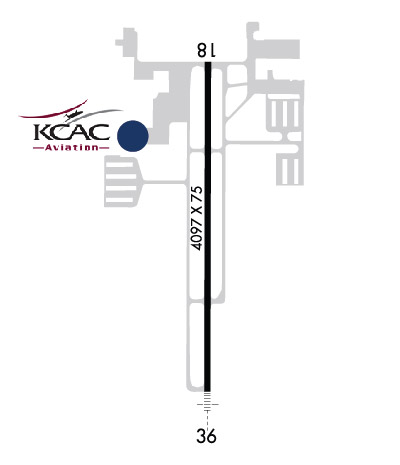
| Lat: N 3850.9 Long: W 09444.3 Elev: 1096 Var: -04 Longest Runway: 4097 | ||
| Dept. ATIS: 119.35 Arr. ATIS: 119.35 Ground: 121.6 Tower: 126.0 | ||
| ||||||||||||||||||||||||||||||||||||||||||||||||||||||||||||||||||||
| ||||||||||||||||||||||||||||||||||||||||||||||||||||||||||||||||||||
| ||||||||||||||||||||||||||||||||||||||||||||||||||||||||||||||||||||
| ||||||||||||||||||||||||||||||||||||||||||||||||||||||||||||||||||||
| ||||||||||||||||||||||||||||||||||||||||||||||||||||||||||||||||||||
| FBOs at nearby airports who want your business: | |||||||||||||||||
| |||||||||||||||||
| Rwy | Rwy | |||||||
| 4097x75 | 4097' | 111.10 - 176° | 4097x75 | 4097' | 108.30 - 356° | |||
| Runway ID | Single Wheel | Double Wheel | Double Tandem Wheel | Dual Double Wheel |
| 18/36 | 28,000 | N/A | N/A | N/A |
| These numbers are Advisory and are not limits. The Airport Manager should have more accurate Weight Limits | ||||
 Airport Diagram might not be current. | |
| Facility Name: | JOHNSON COUNTY EXEC |
| City Name: | OLATHE |
| County: | JOHNSON |
| State abbrev: | KS |
| State Name: | KANSAS |
| Ownership: | PUBLICLY OWNED |
| Use: | OPEN TO THE PUBLIC |
| Owner's Name: | JOHNSON COUNTY |
| Address: | 1 NEW CENTURY PARKWAY |
| OLATHE, KS 66031 | |
| Owner's Phone: | 913-715-6000 |
| Manager's Name: | BRYAN JOHNSON |
| Address: | ONE NEW CENTURY PARKWAY |
| NEW CENTURY, KS 66031 | |
| Phone: | 913-715-6002 |
| FAA Region: | CENTRAL |
| FAA Field Office: | NONE |
| Date | Sunrise | Sunset |
|---|---|---|
| 08/01/25 Friday | 6:20 | 20:30 |
| 08/02/25 Saturday | 6:21 | 20:29 |
| 08/03/25 Sunday | 6:22 | 20:28 |
| 08/04/25 Monday | 6:22 | 20:27 |
| 08/05/25 Tuesday | 6:23 | 20:26 |
| 08/06/25 Wednesday | 6:24 | 20:25 |
| 08/07/25 Thursday | 6:25 | 20:24 |
| 08/08/25 Friday | 6:26 | 20:23 |
| 08/09/25 Saturday | 6:27 | 20:21 |
| 08/10/25 Sunday | 6:28 | 20:20 |
| 08/11/25 Monday | 6:29 | 20:19 |
| 08/12/25 Tuesday | 6:30 | 20:18 |
| 08/13/25 Wednesday | 6:31 | 20:16 |
| 08/14/25 Thursday | 6:31 | 20:15 |
| Airport Attendance Schedule | CONTINUOUS |
| Airport Status | OPERATIONAL (This Status can change at any time - please check NOTAMS) |
| Airport Lighting Schedule | WHEN ATCT CLSD, ACTVT MALSR RWY 36; PAPI RWY 18; MIRL RWY 18-36; TWY LGTS; AND WIND CONE - CTAF. VASI RWY 36 OPR CONSLY. |
| Airport Storage Available | Tie Downs, Hanger |
| Extra Services Available | Air Ambulance, Avionics, Charter, Flight Instruction, Aircraft Rental, Aircraft Sales |
| Wind Indicator | YES - (lighted) |
| Control Tower | YES |
| CTAF Frequency | 126.000 |
| Unicom Frequency | 122.950 |
| Rotating Beacon Color | WG |
| Segmented Circle | NO |
| Landing Fee | NO |
| Airport Inspected | STATE - performed by STATE AERONAUTICAL PERSONNEL |
| Inspection Date | 09/10/2021 |
| Type of Fuel Available | Grade 100LL, JET A (freeze point -40C) |
| Airframe Repair Service | MAJOR |
| Power Plant Repair Service | MAJOR |
| Latitude | N3850.9 |
| Longitude | W09444.3 (ESTIMATED) |
| Arpt Elevation | 1096ft (SURVEYED) |
| Magnetic Variation | 04E |
| 4 miles SE | of OLATHE |
| Traffic Pattern Altitude | 1000; TPA LOW PER ACFT 1000 FT AGL, HIGH PER ACFT 1500 FT AGL |
| Sectional Chart | KANSAS CITY |
| Operations (Reported) | Yearly | Avg. Daily |
|---|---|---|
| General Aviation Transient | 0 | 0 |
| General Aviation Local | 0 | 0 |
| Air Taxi | 0 | 0 |
| Commerical | 0 | 0 |
| Commuter | 0 | 0 |
| Military | 0 | 0 |
| Aircraft based on Field | |
|---|---|
| General Aviation Singles | 0 |
| General Aviation Multi | 0 |
| Jet Aircraft | 0 |
| General Aviation Helicopters | 0 |
| Military Aircraft | 0 |
| Gliders | 0 |
| Ultralights | 0 |
| FSS on field | NO |
| FSS tie-in | COLUMBIA |
| FSS Phone | 1-800-WX-BRIEF |
| Who issues Notams | OJC |
| Notam D service at airport | YES |
| ARTCC Name | KANSAS CITY |
| Airport Certification | |
| Aircraft Rescue & Firefighting Index | None |
| Airport of Entry | No |
| Custom Landing Rights | No |
| Joint Civil/Military | No |
| Military Landing rights | YES |
| NATIONAL PLAN OF INTEGRATED AIRPORT SYSTEMS (NPIAS) |
| GRANT AGREEMENTS UNDER FAAP/ADAP/AIP |
| SURPLUS PROPERTY AGREEMENT UNDER PUBLIC LAW 289 |
| ASSURANCES PURSUANT TO TITLE VI, CIVIL RIGHTS ACT OF 1964 |
| UPON TAKEOFF FOR RYS 18 & 36 MAINTAIN RY HEADING UNTIL PASSING 1,600 FT MSL. |
| BIRDS, WATERFOWL, WILDLIFE ON & INVOF ARPT. |
| TO CONFIRM SNOW REMOVAL AND WINTER CONDITIONS NOV-APR CALL 913-715-6005. |
| FOR CD WHEN ATCT IS CLSD CTC MCI APCH AT 816-329-2710. |
| IT IS ADVISED THAT ROTOCRAFT AVOID THE OVERFLIGHTS OF SURROUNDING NEIGHBORHOODS. |
| RWY 18/3 6 PCR VALUE: 90/R/D/W/T |
Airport Communications & Frequencies:
| ||||||||||||||||||||||
| Runway: 18 | Runway: 36 | ||
| Mag heading: | 176° | Mag heading: | 356° |
| Rwy Slope: | -1.13% Down | Rwy Slope: | 1.13% Up |
| Approach: | LOC/DME | Approach: | LOCALIZER |
| Pattern: | Left Traffic | Pattern: | Left Traffic |
| Markings: | NONPRECISION INSTRUMENT | Markings: | NONPRECISION INSTRUMENT |
| Marking Condition: | GOOD | Marking Condition: | GOOD |
| Arresting Dev: | Arresting Dev: | ||
| Lat & Long: | N3851.2 W09444.3 | Lat. & Long.: | N3850.5 W09444.3 |
| Elev: | 1096.3 ft. MSL | Elev: | 1050.2 ft. MSL |
| TCH: | 40 ft. AGL | TCH: | 40 ft. AGL |
| Visual Glide Path: | 3.00 degrees | Visual Glide Path: | 3.00 degrees |
| Displaced Threshold: | No | Displaced Threshold: | No |
| Touchdown Zone: | YES | Touchdown Zone: | YES |
| Touchdown Elev.: | 1096.3 feet | Touchdown Elev.: | 1086.2 feet |
| Visual Glide Slope: | 4-Light PAPI on RIGHT side of Runway | Visual Glide Slope: | 2-Box VASI on LEFT side of Runway |
| RVR Equipment: | RVR Equipment: | ||
| RVV Equipment: | NO | RVV Equipment: | NO |
| Approach Lights: | Approach Lights: | MALSR - 1,400 foot medium intensity approach lighting system with runway alignment indicator lights | |
| REIL: | NO | REIL: | NO |
| Centerline Lights: | NO | Centerline Lights: | NO |
| Touchdown lights: | NO | Touchdown lights: | NO |
| Runway Category: | Runway with a Non-precision Approach having visibility minimums greater than 3/4 mile | Runway Category: | D |
| Declared Distances: | TORA:4097' TODA:4097' ASDA:4097' LDA:4097' | Declared Distances: | TORA:4097' TODA:4097' ASDA:4097' LDA:4097' |
| Obstructions: | Obstructions: | TREES | |
| Marked: | Marked: | NOT Marked/Lighted | |
| Clearance slope: | 34:1 | Clearance slope: | 20:1 |
| Obstruction height: | Obstruction height: | 34 feet AGL | |
| Dist. from runway: | Dist. from runway: | 901 feet | |
| Centerline offset: | Centerline offset: | 155 feet left of centerline | |
| Comments: | Comments: |
Thanks for using FltPlan.com
all rights reserved © 1999-2025 by Flight Plan LLC