
| EVERETT-STEWART RGNL UNION CITY TN |
| |
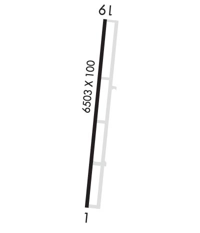
| Lat: N 3622.8 Long: W 08859.1 Elev: 346 Var: -00 Longest Runway: 6503 | ||
| AWOS: 135.32 CTAF: 122.7 | ||
| ||||||
| ||||||
|
| Rwy | Rwy | |||||||
| 6503x100 | 6503' | 109.70 - 006° | 6503x100 | 6503' | ||||
| Runway ID | Single Wheel | Double Wheel | Double Tandem Wheel | Dual Double Wheel |
| 01/19 | 45,000 | 60,000 | N/A | N/A |
| These numbers are Advisory and are not limits. The Airport Manager should have more accurate Weight Limits | ||||
 Airport Diagram might not be current. | |
| Facility Name: | EVERETT-STEWART RGNL |
| City Name: | UNION CITY |
| County: | OBION |
| State abbrev: | TN |
| State Name: | TENNESSEE |
| Ownership: | PUBLICLY OWNED |
| Use: | OPEN TO THE PUBLIC |
| Owner's Name: | OBION COUNTY |
| Address: | COUNTY COURTHOUSE |
| UNION CITY, TN 38261 | |
| Owner's Phone: | 731-885-9611 |
| Manager's Name: | CHRIS RODGERS |
| Address: | 1489 AIRPORT CIRCLE |
| UNION CITY, TN 38261 | |
| Phone: | 731-885-1221 |
| FAA Region: | SOUTHERN |
| FAA Field Office: | MEM |

| Date | Sunrise | Sunset |
|---|---|---|
| 09/24/21 Friday | 6:45 | 18:50 |
| 09/25/21 Saturday | 6:46 | 18:49 |
| 09/26/21 Sunday | 6:47 | 18:47 |
| 09/27/21 Monday | 6:48 | 18:46 |
| 09/28/21 Tuesday | 6:48 | 18:44 |
| 09/29/21 Wednesday | 6:49 | 18:43 |
| 09/30/21 Thursday | 6:50 | 18:41 |
| 10/01/21 Friday | 6:51 | 18:40 |
| 10/02/21 Saturday | 6:52 | 18:38 |
| 10/03/21 Sunday | 6:53 | 18:37 |
| 10/04/21 Monday | 6:53 | 18:35 |
| 10/05/21 Tuesday | 6:54 | 18:34 |
| 10/06/21 Wednesday | 6:55 | 18:33 |
| 10/07/21 Thursday | 6:56 | 18:31 |
| Airport Attendance Schedule | APR-OCT SUN 1230-1700, APR-OCT MON-SAT 0700-1800, NOV-MAR MON-SAT 0730-1700, NOV-MAR SUN 1230-1700 |
| Airport Status | OPERATIONAL (This Status can change at any time - please check NOTAMS) |
| Airport Lighting Schedule | ACTVT ODALS RWY 01 - CTAF. PAPI RWY 01 & 19 H24. |
| Airport Storage Available | Tie Downs, Hanger |
| Extra Services Available | Crop Dusting, Charter, Flight Instruction, Aircraft Rental |
| Wind Indicator | YES - (lighted) |
| Control Tower | NO |
| CTAF Frequency | 122.700 |
| Unicom Frequency | 122.700 |
| Rotating Beacon Color | CLEAR-GREEN (Light Land Airport) |
| Segmented Circle | YES |
| Landing Fee | NO |
| Airport Inspected | STATE - performed by STATE AERONAUTICAL PERSONNEL |
| Inspection Date | 03/26/2021 |
| Type of Fuel Available | Grade 100LL, JET A |
| Airframe Repair Service | MAJOR |
| Power Plant Repair Service | MAJOR |
| Latitude | N3622.8 |
| Longitude | W08859.1 (ESTIMATED) |
| Arpt Elevation | 345ft (SURVEYED) |
| Magnetic Variation | 00E |
| 4 miles SE | of UNION CITY |
| Traffic Pattern Altitude | |
| Sectional Chart | ST LOUIS |
| Operations (Reported) | Yearly | Avg. Daily |
|---|---|---|
| General Aviation Transient | 11800 | 32 |
| General Aviation Local | 15000 | 41 |
| Air Taxi | 1400 | 4 |
| Commerical | 0 | 0 |
| Commuter | 0 | 0 |
| Military | 150 | 0 |
| Aircraft based on Field | |
|---|---|
| General Aviation Singles | 35 |
| General Aviation Multi | 5 |
| Jet Aircraft | 0 |
| General Aviation Helicopters | 2 |
| Military Aircraft | 0 |
| Gliders | 2 |
| Ultralights | 0 |
| FSS on field | NO |
| FSS tie-in | JACKSON |
| FSS Phone | 1-800-WX-BRIEF |
| Who issues Notams | MKL |
| Notam D service at airport | YES |
| ARTCC Name | MEMPHIS |
| Airport Certification | |
| Aircraft Rescue & Firefighting Index | None |
| Airport of Entry | No |
| Custom Landing Rights | No |
| Joint Civil/Military | No |
| Military Landing rights | YES |
| NATIONAL PLAN OF INTEGRATED AIRPORT SYSTEMS (NPIAS) |
| GRANT AGREEMENTS UNDER FAAP/ADAP/AIP |
| SURPLUS PROPERTY AGREEMENT UNDER REGULATION 16-WAA |
| ASSURANCES PURSUANT TO TITLE VI, CIVIL RIGHTS ACT OF 1964 |
| AEROBATIC ACTVTY INVOF ARPT. |
| FOR CD CTC MEMPHIS ARTCC AT 901-368-8453/8449. |
Airport Communications & Frequencies:
| |||||||||
| Runway: 01 | Runway: 19 | ||
| Mag heading: | 6° | Mag heading: | 186° |
| Rwy Slope: | -.56% Down | Rwy Slope: | .56% Up |
| Approach: | ILS | Approach: | |
| Pattern: | Left Traffic; IF SFC WINDS FAVOR RY 01, RIGHT TFC FOR THAT RY IS IN EFFECT WHEN AEROBATIC AREA IS ACTIVE. | Pattern: | Left Traffic |
| Markings: | PRECISION INSTRUMENT | Markings: | PRECISION INSTRUMENT |
| Marking Condition: | GOOD | Marking Condition: | GOOD |
| Arresting Dev: | Arresting Dev: | ||
| Lat & Long: | N3622.3 W08859.2 | Lat. & Long.: | N3623.3 W08859.1 |
| Elev: | 345.7 ft. MSL | Elev: | 309.4 ft. MSL |
| TCH: | 42 ft. AGL | TCH: | 29 ft. AGL |
| Visual Glide Path: | 3.00 degrees | Visual Glide Path: | 3.00 degrees |
| Displaced Threshold: | No | Displaced Threshold: | No |
| Touchdown Zone: | YES | Touchdown Zone: | YES |
| Touchdown Elev.: | 345.7 feet | Touchdown Elev.: | 320.1 feet |
| Visual Glide Slope: | 4-Light PAPI on LEFT side of Runway | Visual Glide Slope: | 4-Light PAPI on LEFT side of Runway |
| RVR Equipment: | RVR Equipment: | ||
| RVV Equipment: | NO | RVV Equipment: | NO |
| Approach Lights: | ODALS - omnidirectional approach lighting system | Approach Lights: | |
| REIL: | YES | REIL: | YES |
| Centerline Lights: | NO | Centerline Lights: | NO |
| Touchdown lights: | NO | Touchdown lights: | NO |
| Runway Category: | Precision Instrument Runway | Runway Category: | Runway with a Non-precision Approach having visibility minimums greater than 3/4 mile |
| Declared Distances: | Declared Distances: | ||
| Obstructions: | RD CROSSES L TO R 1040 FT S OF THR. | Obstructions: | PLINE |
| Marked: | NOT Marked/Lighted | Marked: | MARKED |
| Clearance slope: | 50:1 | Clearance slope: | 43:1 |
| Obstruction height: | Obstruction height: | 75 feet AGL | |
| Dist. from runway: | Dist. from runway: | 3450 feet | |
| Centerline offset: | Centerline offset: | ||
| Comments: | Comments: |
Thanks for using FltPlan.com
all rights reserved © 1999-2021 by Flight Plan LLC