| SHERIDAN COUNTY SHERIDAN WY |
| |
| Lat: N 4446.2 Long: W 10658.8 Elev: 4021 Var: -10 Longest Runway: 8301 | ||
| AWOS: 135.17 CTAF: 123.0 | ||
| |||||||||||||||||||||||||||||||||||||||||||||||||||||||||||||||||||||
| |||||||||||||||||||||||||||||||||||||||||||||||||||||||||||||||||||||
| |||||||||||||||||||||||||||||||||||||||||||||||||||||||||||||||||||||
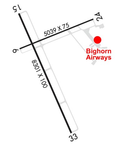
| Rwy | Rwy | |||||||
| 5039x75 | 5039' | 5039x75 | 5039' | |||||
| 8301x100 | 8301' | 8301x100 | 8301' | 108.70 - 326° | ||||
| Runway ID | Single Wheel | Double Wheel | Double Tandem Wheel | Dual Double Wheel |
| 06/24 | 36,000 | 50,000 | N/A | N/A |
| 15/33 | 60,000 | 75,000 | N/A | N/A |
| These numbers are Advisory and are not limits. The Airport Manager should have more accurate Weight Limits | ||||
 Airport Diagram might not be current. | |
| Facility Name: | SHERIDAN COUNTY |
| City Name: | SHERIDAN |
| County: | SHERIDAN |
| State abbrev: | WY |
| State Name: | WYOMING |
| Ownership: | PUBLICLY OWNED |
| Use: | OPEN TO THE PUBLIC |
| Owner's Name: | SHERIDAN COUNTY |
| Address: | 908 W BRUNDAGE LANE |
| SHERIDAN, WY 82801-5896 | |
| Owner's Phone: | 307-674-4222 |
| Manager's Name: | JOHN STOPKA |
| Address: | 908 WEST BRUNDAGE LANE |
| SHERIDAN, WY 82801-5827 | |
| Phone: | 307-674-4222 |
| FAA Region: | NORTHWEST MOUNTAIN |
| FAA Field Office: | DEN |
| Date | Sunrise | Sunset |
|---|---|---|
| 09/24/21 Friday | 6:57 | 19:02 |
| 09/25/21 Saturday | 6:58 | 19:00 |
| 09/26/21 Sunday | 7:00 | 18:58 |
| 09/27/21 Monday | 7:01 | 18:56 |
| 09/28/21 Tuesday | 7:02 | 18:54 |
| 09/29/21 Wednesday | 7:03 | 18:53 |
| 09/30/21 Thursday | 7:04 | 18:51 |
| 10/01/21 Friday | 7:06 | 18:49 |
| 10/02/21 Saturday | 7:07 | 18:47 |
| 10/03/21 Sunday | 7:08 | 18:45 |
| 10/04/21 Monday | 7:09 | 18:43 |
| 10/05/21 Tuesday | 7:11 | 18:41 |
| 10/06/21 Wednesday | 7:12 | 18:40 |
| 10/07/21 Thursday | 7:13 | 18:38 |
| Airport Attendance Schedule | 7 Days A Week DALGT; CONDS NOT MONITORED AT NGT AFT THE LAST ACR ARR TIL 0500L. SEE NOTAMS FOR THE MOST UP-TO-DATE CONDS AND UPDTS. |
| Airport Status | OPERATIONAL (This Status can change at any time - please check NOTAMS) |
| Airport Lighting Schedule | ACTVT MALSR RWY 33; REIL RWY 06, 24 & 15; PAPI RWY 06, 24, 15 & 33; HIRL RWY 15/33; MIRL RWY 06/24 - CTAF. |
| Airport Storage Available | Tie Downs, Hanger |
| Extra Services Available | Air Freight, Air Ambulance, Avionics, Cargo Handling, Charter, Glider, Flight Instruction, Aircraft Rental |
| Wind Indicator | YES - (lighted) |
| Control Tower | NO |
| CTAF Frequency | 123.000 |
| Unicom Frequency | 123.000 |
| Rotating Beacon Color | CLEAR-GREEN (Light Land Airport) |
| Segmented Circle | YES |
| Landing Fee | NO |
| Airport Inspected | FEDERAL - performed by FAA AIRPORTS FIELD PERSONNEL |
| Inspection Date | 05/15/2019 |
| Type of Fuel Available | Grade 100, JET A (freeze point -40C), JET A-1 (icing inhibitor, freeze point -50C) |
| Airframe Repair Service | MAJOR |
| Power Plant Repair Service | MAJOR |
| Latitude | N4446.2 |
| Longitude | W10658.8 (ESTIMATED) |
| Arpt Elevation | 4021ft (SURVEYED) |
| Magnetic Variation | 10E |
| 2 miles SW | of SHERIDAN |
| Traffic Pattern Altitude | 800; TPA: 800 FT AGL SNGL ENG, 1500 FT AGL TURBOPROP/JET. |
| Sectional Chart | BILLINGS |
| Operations (Reported) | Yearly | Avg. Daily |
|---|---|---|
| General Aviation Transient | 15717 | 43 |
| General Aviation Local | 11381 | 31 |
| Air Taxi | 1508 | 4 |
| Commerical | 0 | 0 |
| Commuter | 0 | 0 |
| Military | 50 | 0 |
| Aircraft based on Field | |
|---|---|
| General Aviation Singles | 76 |
| General Aviation Multi | 18 |
| Jet Aircraft | 1 |
| General Aviation Helicopters | 2 |
| Military Aircraft | 0 |
| Gliders | 0 |
| Ultralights | 0 |
| FSS on field | NO |
| FSS tie-in | CASPER |
| FSS Phone | 1-800-WX-BRIEF |
| Who issues Notams | SHR |
| Notam D service at airport | YES |
| ARTCC Name | SALT LAKE CITY |
| Airport Certification | AIRPORT RECEIVING SCHEDULED AIR CARRIER SERVICE FROM CARRIERS CERTIFICATED BY THE CIVIL AERONAUTICS BOARD; PPR UNSKED ACFT OPS WITH MORE THAN 30 PAX SEATS CTC ARFF STN 307-673-1875. |
| Aircraft Rescue & Firefighting Index | AIRPORT HAS A CERTIFICATE UNDER CFR PART 139 |
| Airport of Entry | No |
| Custom Landing Rights | No |
| Joint Civil/Military | No |
| Military Landing rights | YES |
| NATIONAL PLAN OF INTEGRATED AIRPORT SYSTEMS (NPIAS) |
| GRANT AGREEMENTS UNDER FAAP/ADAP/AIP |
| ASSURANCES PURSUANT TO TITLE VI, CIVIL RIGHTS ACT OF 1964 |
| AGREEMENT UNDER DLAND OR DCLA HAS EXPIRED. |
| FW ACFT RSTRD TO RWYS & TWYS ONLY. |
| COLD TEMPERATURE AIRPORT. ALTITUDE CORRECTION REQUIRED AT OR BELOW -19C. |
| FOR CD IF UNA TO CTC ON FSS FREQ, CTC SALT LAKE ARTCC AT 801-320-2568. |
Airport Communications & Frequencies:
| |||||||||
| Runway: 06 | Runway: 24 | ||
| Mag heading: | 58° | Mag heading: | 238° |
| Rwy Slope: | -1.63% Down | Rwy Slope: | 1.63% Up |
| Approach: | Approach: | ||
| Pattern: | Left Traffic | Pattern: | Left Traffic |
| Markings: | NONPRECISION INSTRUMENT | Markings: | NONPRECISION INSTRUMENT |
| Marking Condition: | GOOD | Marking Condition: | GOOD |
| Arresting Dev: | Arresting Dev: | ||
| Lat & Long: | N4446.3 W10659.3 | Lat. & Long.: | N4446.6 W10658.2 |
| Elev: | 4021.1 ft. MSL | Elev: | 3939.1 ft. MSL |
| TCH: | 57 ft. AGL | TCH: | 39 ft. AGL |
| Visual Glide Path: | 4.00 degrees | Visual Glide Path: | 3.00 degrees |
| Displaced Threshold: | No | Displaced Threshold: | No |
| Touchdown Zone: | YES | Touchdown Zone: | YES |
| Touchdown Elev.: | 4021.1 feet | Touchdown Elev.: | 3981.3 feet |
| Visual Glide Slope: | 4-Light PAPI on RIGHT side of Runway | Visual Glide Slope: | 4-Light PAPI on RIGHT side of Runway |
| RVR Equipment: | RVR Equipment: | ||
| RVV Equipment: | NO | RVV Equipment: | NO |
| Approach Lights: | Approach Lights: | ||
| REIL: | YES | REIL: | YES |
| Centerline Lights: | NO | Centerline Lights: | NO |
| Touchdown lights: | NO | Touchdown lights: | NO |
| Runway Category: | Runway with a Visual Approach | Runway Category: | Runway with a Visual Approach |
| Declared Distances: | TORA:5039' TODA:5039' ASDA:5039' LDA:5039' | Declared Distances: | TORA:5039' TODA:5039' ASDA:5039' LDA:5039' |
| Obstructions: | Obstructions: | TREES | |
| Marked: | Marked: | NOT Marked/Lighted | |
| Clearance slope: | 20:1 | Clearance slope: | 20:1 |
| Obstruction height: | Obstruction height: | 40 feet AGL | |
| Dist. from runway: | Dist. from runway: | 750 feet | |
| Centerline offset: | Centerline offset: | 200 feet right of centerline | |
| Comments: | Comments: |
| Runway: 15 | Runway: 33 | ||
| Mag heading: | 146° | Mag heading: | 326° |
| Rwy Slope: | -.47% Down | Rwy Slope: | .47% Up |
| Approach: | Approach: | ILS/DME | |
| Pattern: | Left Traffic | Pattern: | Left Traffic |
| Markings: | NONPRECISION INSTRUMENT | Markings: | PRECISION INSTRUMENT |
| Marking Condition: | GOOD | Marking Condition: | GOOD |
| Arresting Dev: | Arresting Dev: | ||
| Lat & Long: | N4446.6 W10659.3 | Lat. & Long.: | N4445.4 W10658.5 |
| Elev: | 4014.2 ft. MSL | Elev: | 3975.4 ft. MSL |
| TCH: | 50 ft. AGL | TCH: | 53 ft. AGL |
| Visual Glide Path: | 3.00 degrees | Visual Glide Path: | 3.00 degrees |
| Displaced Threshold: | No | Displaced Threshold: | No |
| Touchdown Zone: | YES | Touchdown Zone: | YES |
| Touchdown Elev.: | 4014.2 feet | Touchdown Elev.: | 3984.9 feet |
| Visual Glide Slope: | 4-Light PAPI on LEFT side of Runway | Visual Glide Slope: | 4-Light PAPI on LEFT side of Runway |
| RVR Equipment: | RVR Equipment: | ||
| RVV Equipment: | NO | RVV Equipment: | NO |
| Approach Lights: | Approach Lights: | MALSR - 1,400 foot medium intensity approach lighting system with runway alignment indicator lights | |
| REIL: | YES | REIL: | NO |
| Centerline Lights: | NO | Centerline Lights: | NO |
| Touchdown lights: | NO | Touchdown lights: | NO |
| Runway Category: | Runway with a Non-precision Approach having visibility minimums greater than 3/4 mile | Runway Category: | Precision Instrument Runway |
| Declared Distances: | TORA:8301' TODA:8301' ASDA:8301' LDA:8301' | Declared Distances: | TORA:8301' TODA:8301' ASDA:8301' LDA:8301' |
Thanks for using FltPlan.com
all rights reserved © 1999-2021 by Flight Plan LLC