
| ABILENE MUNI ABILENE KS |
| |
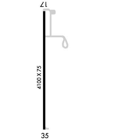
| Lat: N 3854.2 Long: W 09714.2 Elev: 1153 Var: -03 Longest Runway: 4100 | ||
| AWOS: 124.12 CTAF: 122.8 | ||
| ||||||
| ||||||
|
| Rwy | Rwy | |||||||
| 4100x75 | 3914' | 4100x75 | 4100' | |||||
| Runway ID | Single Wheel | Double Wheel | Double Tandem Wheel | Dual Double Wheel |
| 18/36 | 13,000 | 16,000 | N/A | N/A |
| These numbers are Advisory and are not limits. The Airport Manager should have more accurate Weight Limits | ||||
 Airport Diagram might not be current. | |
| Facility Name: | ABILENE MUNI |
| City Name: | ABILENE |
| County: | DICKINSON |
| State abbrev: | KS |
| State Name: | KANSAS |
| Ownership: | PUBLICLY OWNED |
| Use: | OPEN TO THE PUBLIC |
| Owner's Name: | CITY OF ABILENE KANSAS |
| Address: | CITY BUILDING, 419 N. BROADWAY |
| ABILENE, KS 67410 | |
| Owner's Phone: | 785-263-2550 |
| Manager's Name: | JIM CURTIS |
| Address: | 801 S. WASHINGTON |
| ABILENE, KS 67410 | |
| Phone: | 785-263-3970 |
| FAA Region: | CENTRAL |
| FAA Field Office: | NONE |
| Date | Sunrise | Sunset |
|---|---|---|
| 05/12/26 Tuesday | 6:19 | 20:32 |
| 05/13/26 Wednesday | 6:18 | 20:33 |
| 05/14/26 Thursday | 6:17 | 20:34 |
| 05/15/26 Friday | 6:17 | 20:34 |
| 05/16/26 Saturday | 6:16 | 20:35 |
| 05/17/26 Sunday | 6:15 | 20:36 |
| 05/18/26 Monday | 6:14 | 20:37 |
| 05/19/26 Tuesday | 6:13 | 20:38 |
| 05/20/26 Wednesday | 6:12 | 20:39 |
| 05/21/26 Thursday | 6:12 | 20:40 |
| 05/22/26 Friday | 6:11 | 20:41 |
| 05/23/26 Saturday | 6:10 | 20:41 |
| 05/24/26 Sunday | 6:10 | 20:42 |
| 05/25/26 Monday | 6:09 | 20:43 |
| Airport Attendance Schedule | MON-SAT 0800-1700 |
| Airport Status | OPERATIONAL (This Status can change at any time - please check NOTAMS) |
| Airport Lighting Schedule | MIRL RWY 18/36, PAPI RWY 18 & 36, REIL RWY 18 & 36 OPER DUSK-2200; OTHR TIMES ACTVT -- CTAF. |
| Airport Storage Available | Tie Downs, Hanger |
| Extra Services Available | Crop Dusting, Flight Instruction, Parachute Jumping, Aircraft Rental |
| Wind Indicator | YES - (lighted) |
| Control Tower | NO |
| CTAF Frequency | 122.800 |
| Unicom Frequency | 122.800 |
| Rotating Beacon Color | WG |
| Segmented Circle | NO |
| Landing Fee | NO |
| Airport Inspected | STATE - performed by PRIVATE CONTRACT PERSONNEL |
| Inspection Date | 10/09/2025 |
| Type of Fuel Available | Grade 100LL; -1024 HR SELF SERVE FUEL. |
| Airframe Repair Service | MAJOR |
| Power Plant Repair Service | MAJOR |
| Latitude | N3854.2 |
| Longitude | W09714.2 (ESTIMATED) |
| Arpt Elevation | 1152ft (SURVEYED) |
| Magnetic Variation | 03E |
| 1 miles SW | of ABILENE |
| Traffic Pattern Altitude | |
| Sectional Chart | WICHITA |
| Operations (Reported) | Yearly | Avg. Daily |
|---|---|---|
| General Aviation Transient | 0 | 0 |
| General Aviation Local | 0 | 0 |
| Air Taxi | 0 | 0 |
| Commerical | 0 | 0 |
| Commuter | 0 | 0 |
| Military | 0 | 0 |
| Aircraft based on Field | |
|---|---|
| General Aviation Singles | 0 |
| General Aviation Multi | 0 |
| Jet Aircraft | 0 |
| General Aviation Helicopters | 0 |
| Military Aircraft | 0 |
| Gliders | 0 |
| Ultralights | 0 |
| FSS on field | NO |
| FSS tie-in | WICHITA |
| FSS Phone | 1-800-WX-BRIEF |
| Who issues Notams | ICT |
| Notam D service at airport | YES |
| ARTCC Name | KANSAS CITY |
| Airport Certification | |
| Aircraft Rescue & Firefighting Index | None |
| Airport of Entry | No |
| Custom Landing Rights | No |
| Joint Civil/Military | No |
| Military Landing rights | YES |
| NATIONAL PLAN OF INTEGRATED AIRPORT SYSTEMS (NPIAS) |
| GRANT AGREEMENTS UNDER FAAP/ADAP/AIP |
| ASSURANCES PURSUANT TO TITLE VI, CIVIL RIGHTS ACT OF 1964 |
| COURTESY CAR AVBL. |
| FOR CD CTC KANSAS CITY ARTCC AT 913-254-8508. |
Airport Communications & Frequencies:
| |||||||||||||||||
| Runway: 18 | Runway: 36 | ||
| Mag heading: | 177° | Mag heading: | 357° |
| Rwy Slope: | -.07% Down | Rwy Slope: | .07% Up |
| Approach: | Approach: | ||
| Pattern: | Left Traffic | Pattern: | Left Traffic |
| Markings: | NONPRECISION INSTRUMENT | Markings: | NONPRECISION INSTRUMENT |
| Marking Condition: | GOOD | Marking Condition: | GOOD |
| Arresting Dev: | Arresting Dev: | ||
| Lat & Long: | N3854.6 W09714.2 | Lat. & Long.: | N3853.9 W09714.2 |
| Elev: | 1152.9 ft. MSL | Elev: | 1150.2 ft. MSL |
| TCH: | 40 ft. AGL | TCH: | 40 ft. AGL |
| Visual Glide Path: | 3.00 degrees | Visual Glide Path: | 3.00 degrees |
| Displaced Threshold: | 186 feet | Displaced Threshold: | No |
| Touchdown Zone: | YES | Touchdown Zone: | YES |
| Touchdown Elev.: | 1152.2 feet | Touchdown Elev.: | 1150.8 feet |
| Visual Glide Slope: | 2-Light PAPI on LEFT side of Runway | Visual Glide Slope: | 2-Light PAPI on LEFT side of Runway |
| RVR Equipment: | RVR Equipment: | ||
| RVV Equipment: | NO | RVV Equipment: | NO |
| Approach Lights: | Approach Lights: | ||
| REIL: | YES; REIL: LOW/ MEDIUM/ HIGH PILOT CTLD. | REIL: | YES |
| Centerline Lights: | NO | Centerline Lights: | NO |
| Touchdown lights: | NO | Touchdown lights: | NO |
| Runway Category: | Runway with a Non-precision Approach having visibility minimums greater than 3/4 mile | Runway Category: | Runway with a Non-precision Approach having visibility minimums greater than 3/4 mile |
| Declared Distances: | TORA:4100' TODA:4100' ASDA:4100' LDA:3914' | Declared Distances: | TORA:4100' TODA:4100' ASDA:4100' LDA:4100' |
| Obstructions: | TREES | Obstructions: | ROAD |
| Marked: | NOT Marked/Lighted | Marked: | NOT Marked/Lighted |
| Clearance slope: | 15:1; OBSTN CLNC SLOPE 29:1 TO DSPLCD THLD. | Clearance slope: | 36:1 |
| Obstruction height: | 36 feet AGL | Obstruction height: | 15 feet AGL |
| Dist. from runway: | 745 feet; 23 RR, 630 FT FM THLD. | Dist. from runway: | 746 feet |
| Centerline offset: | 370 right of centerline | Centerline offset: | 319 feet left of centerline |
| Comments: | Comments: |
Thanks for using FltPlan.com
all rights reserved © 1999-2026 by Flight Plan LLC