
| CLEARVIEW AIRPARK WESTMINSTER MD |
| |
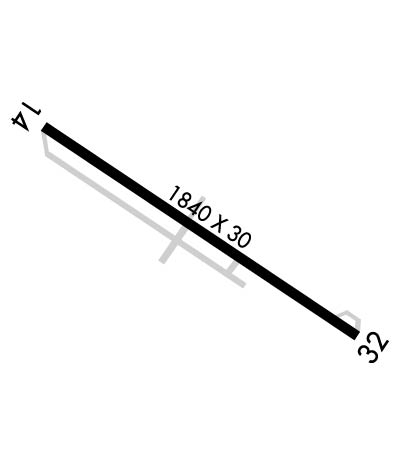
| Lat: N 3928.0 Long: W 07701.0 Elev: 799 Var: +11 Longest Runway: 1840 | ||
| CTAF: 122.8 | ||
| ||||||
|
| Rwy | Rwy | |||||||
| 1840x30 | 1840' | 1840x30 | 1563' | |||||
| Runway ID | Single Wheel | Double Wheel | Double Tandem Wheel | Dual Double Wheel |
| 14/32 | N/A | N/A | N/A | N/A |
| These numbers are Advisory and are not limits. The Airport Manager should have more accurate Weight Limits | ||||
 Airport Diagram might not be current. | |
| Facility Name: | CLEARVIEW AIRPARK |
| City Name: | WESTMINSTER |
| County: | CARROLL |
| State abbrev: | MD |
| State Name: | MARYLAND |
| Ownership: | PRIVATELY OWNED |
| Use: | OPEN TO THE PUBLIC |
| Owner's Name: | CLEARVIEW AIRPORT INC |
| Address: | 526 OAK TREE ROAD |
| WESTMINSTER, MD 21157 | |
| Owner's Phone: | 410-795-1176 |
| Manager's Name: | WALTER S. TEGELER, III |
| Address: | 519 OAK TREE ROAD |
| WESTMINSTER, MD 21157 | |
| Phone: | 410-984-2434 |
| FAA Region: | EASTERN |
| FAA Field Office: | DCA |

| Date | Sunrise | Sunset |
|---|---|---|
| 04/03/26 Friday | 6:50 | 19:34 |
| 04/04/26 Saturday | 6:48 | 19:35 |
| 04/05/26 Sunday | 6:47 | 19:36 |
| 04/06/26 Monday | 6:45 | 19:37 |
| 04/07/26 Tuesday | 6:43 | 19:38 |
| 04/08/26 Wednesday | 6:42 | 19:39 |
| 04/09/26 Thursday | 6:40 | 19:40 |
| 04/10/26 Friday | 6:39 | 19:41 |
| 04/11/26 Saturday | 6:37 | 19:42 |
| 04/12/26 Sunday | 6:36 | 19:43 |
| 04/13/26 Monday | 6:34 | 19:44 |
| 04/14/26 Tuesday | 6:33 | 19:45 |
| 04/15/26 Wednesday | 6:31 | 19:46 |
| 04/16/26 Thursday | 6:30 | 19:47 |
| Airport Attendance Schedule | 7 Days A Week 0900-1700; ARPT UNATNDD THANKSGIVING, CHRISTMAS & NEW YEARS DAY. |
| Airport Status | OPERATIONAL (This Status can change at any time - please check NOTAMS) |
| Airport Lighting Schedule | ACTVT LIRL RWY 14/32 - CTAF.; ACTVT ROTG BCN - CTAF. |
| Airport Storage Available | Tie Downs |
| Extra Services Available | Flight Instruction, Aircraft Rental |
| Wind Indicator | YES - (lighted) |
| Control Tower | NO |
| CTAF Frequency | 122.800 |
| Unicom Frequency | 122.800 |
| Rotating Beacon Color | WG |
| Segmented Circle | NO |
| Landing Fee | NO |
| Airport Inspected | STATE - performed by STATE AERONAUTICAL PERSONNEL |
| Inspection Date | 05/08/2025 |
| Type of Fuel Available | Grade 100LL |
| Airframe Repair Service | NONE |
| Power Plant Repair Service | NONE |
| Latitude | N3928.0 |
| Longitude | W07701.0 (ESTIMATED) |
| Arpt Elevation | 798ft (SURVEYED) |
| Magnetic Variation | 11W |
| 7 miles S | of WESTMINSTER |
| Traffic Pattern Altitude | |
| Sectional Chart | WASHINGTON |
| Operations (Reported) | Yearly | Avg. Daily |
|---|---|---|
| General Aviation Transient | 0 | 0 |
| General Aviation Local | 0 | 0 |
| Air Taxi | 0 | 0 |
| Commerical | 0 | 0 |
| Commuter | 0 | 0 |
| Military | 0 | 0 |
| Aircraft based on Field | |
|---|---|
| General Aviation Singles | 0 |
| General Aviation Multi | 0 |
| Jet Aircraft | 0 |
| General Aviation Helicopters | 0 |
| Military Aircraft | 0 |
| Gliders | 0 |
| Ultralights | 0 |
| FSS on field | NO |
| FSS tie-in | LEESBURG |
| FSS Phone | 1-800-WX-BRIEF |
| Who issues Notams | DCA |
| Notam D service at airport | YES |
| ARTCC Name | NEW YORK |
| Airport Certification | |
| Aircraft Rescue & Firefighting Index | None |
| Airport of Entry | No |
| Custom Landing Rights | No |
| Joint Civil/Military | No |
| Military Landing rights | No |
| 60 FT DROP OFF 125 FT FM AER 14. |
| ULTRALIGHT ACT ON & INVOF ARPT. |
| UNL VEHICLE ACES TO ACFT MOVEMENT AREAS. |
| FOR CD CTC POTOMAC APCH AT 866-429-5882. |
| RWY 14/3 2 NSTD - LGTS 20 FT FM RWY EDGE. |
Airport Communications & Frequencies:
| ||||||||||||||
| Runway: 14 | Runway: 32 | ||
| Mag heading: | 136° | Mag heading: | 316° |
| Rwy Slope: | 2.08% Up | Rwy Slope: | -2.08% Down |
| Approach: | Approach: | ||
| Pattern: | Left Traffic | Pattern: | Left Traffic |
| Markings: | NONPRECISION INSTRUMENT | Markings: | NONPRECISION INSTRUMENT |
| Marking Condition: | GOOD | Marking Condition: | GOOD |
| Arresting Dev: | Arresting Dev: | ||
| Lat & Long: | N3928.1 W07701.2 | Lat. & Long.: | N3927.9 W07700.9 |
| Elev: | 760.3 ft. MSL | Elev: | 798.6 ft. MSL |
| TCH: | 20 ft. AGL | TCH: | 34 ft. AGL |
| Visual Glide Path: | 4.00 degrees | Visual Glide Path: | 7.00 degrees |
| Displaced Threshold: | No | Displaced Threshold: | 277 feet |
| Touchdown Zone: | YES | Touchdown Zone: | YES |
| Touchdown Elev.: | 798.6 feet | Touchdown Elev.: | 786.5 feet |
| Visual Glide Slope: | SYSTEM OF PANELS ON LEFT SIDE OF RUNWAY (May NOT Be Lighted) | Visual Glide Slope: | SYSTEM OF PANELS ON LEFT SIDE OF RUNWAY (May NOT Be Lighted) |
| RVR Equipment: | RVR Equipment: | ||
| RVV Equipment: | NO | RVV Equipment: | NO |
| Approach Lights: | Approach Lights: | ||
| REIL: | NO | REIL: | NO |
| Centerline Lights: | NO | Centerline Lights: | NO |
| Touchdown lights: | NO | Touchdown lights: | NO |
| Runway Category: | Runway with a Non-precision Approach | Runway Category: | Runway with a Non-precision Approach |
| Declared Distances: | Declared Distances: | ||
| Obstructions: | TREES | Obstructions: | TREES |
| Marked: | NOT Marked/Lighted | Marked: | NOT Marked/Lighted |
| Clearance slope: | 14:1 | Clearance slope: | 24:1; APCH RATIO 20:1 TO DSPLCD THR. |
| Obstruction height: | 34 feet AGL | Obstruction height: | 88 feet AGL |
| Dist. from runway: | 693 feet | Dist. from runway: | 2316 feet |
| Centerline offset: | 134 left of centerline | Centerline offset: | 121 feet left of centerline |
| Comments: | 40 FT TREES, 124 FT LEFT OF THLD. | Comments: | 10 FT PVT ROAD AT THLD; 60 FT TREES, 140 FT RIGHT. |
Thanks for using FltPlan.com
all rights reserved © 1999-2026 by Flight Plan LLC