
| LE SUEUR MUNI LE SUEUR MN |
| |
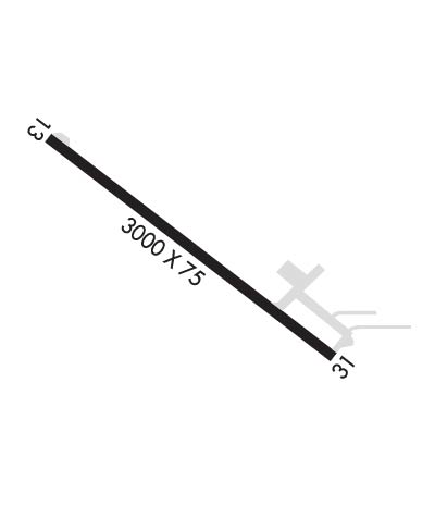
| Lat: N 4426.5 Long: W 09355.0 Elev: 868 Var: -04 Longest Runway: 3000 | ||
| CTAF: 122.9 | ||
| ||||||||||||||||||||||||||||||||
| ||||||||||||||||||||||||||||||||
| Rwy | Rwy | |||||||
| 3000x75 | 3000' | 3000x75 | 3000' | |||||
| Runway ID | Single Wheel | Double Wheel | Double Tandem Wheel | Dual Double Wheel |
| 13/31 | N/A | N/A | N/A | N/A |
| These numbers are Advisory and are not limits. The Airport Manager should have more accurate Weight Limits | ||||
| FltPlan does not have IFR approach charts available for K12Y. |
 Airport Diagram might not be current. | |
| Facility Name: | LE SUEUR MUNI |
| City Name: | LE SUEUR |
| County: | LE SUEUR |
| State abbrev: | MN |
| State Name: | MINNESOTA |
| Ownership: | PUBLICLY OWNED |
| Use: | OPEN TO THE PUBLIC |
| Owner's Name: | CITY OF LE SUEUR |
| Address: | 203 S 2ND ST, PO BOX 176 |
| LE SUEUR, MN 56058 | |
| Owner's Phone: | 507-665-6401 |
| Manager's Name: | JOEL SCHMIDT |
| Address: | 505 BORIGHT ST |
| LE SUEUR, MN 56058-1452 | |
| Phone: | 507-593-8378 |
| FAA Region: | GREAT LAKES |
| FAA Field Office: | DMA |
| Date | Sunrise | Sunset |
|---|---|---|
| 07/15/25 Tuesday | 5:45 | 20:58 |
| 07/16/25 Wednesday | 5:46 | 20:57 |
| 07/17/25 Thursday | 5:47 | 20:56 |
| 07/18/25 Friday | 5:48 | 20:55 |
| 07/19/25 Saturday | 5:49 | 20:55 |
| 07/20/25 Sunday | 5:50 | 20:54 |
| 07/21/25 Monday | 5:51 | 20:53 |
| 07/22/25 Tuesday | 5:52 | 20:52 |
| 07/23/25 Wednesday | 5:53 | 20:51 |
| 07/24/25 Thursday | 5:54 | 20:50 |
| 07/25/25 Friday | 5:55 | 20:49 |
| 07/26/25 Saturday | 5:56 | 20:48 |
| 07/27/25 Sunday | 5:57 | 20:47 |
| 07/28/25 Monday | 5:58 | 20:46 |
| Airport Attendance Schedule | MON-FRI 0800-1700 |
| Airport Status | OPERATIONAL (This Status can change at any time - please check NOTAMS) |
| Airport Lighting Schedule | ACTVT OR INCR INTST REIL RWY 13 & 31; PAPI RWY 13 & 31; MIRL RWY 13/31 - CTAF. MIRL RWY 13/31 PRESET LOW INTST. |
| Airport Storage Available | Tie Downs |
| Extra Services Available | Crop Dusting, Charter, Aircraft Sales, Annual Surveying |
| Wind Indicator | YES - (lighted) |
| Control Tower | NO |
| CTAF Frequency | 122.900 |
| Unicom Frequency | |
| Rotating Beacon Color | WG |
| Segmented Circle | NO |
| Landing Fee | NO |
| Airport Inspected | STATE - performed by STATE AERONAUTICAL PERSONNEL |
| Inspection Date | 04/25/2025 |
| Type of Fuel Available | Grade 100LL, JET A (freeze point -40C); -10100LL AVBL H24 SELF SVC VIA CREDIT CARD. |
| Airframe Repair Service | MINOR |
| Power Plant Repair Service | MINOR |
| Latitude | N4426.5 |
| Longitude | W09355.0 (ESTIMATED) |
| Arpt Elevation | 867ft (SURVEYED) |
| Magnetic Variation | 04E |
| 2 miles S | of LE SUEUR |
| Traffic Pattern Altitude | |
| Sectional Chart | OMAHA |
| Operations (Reported) | Yearly | Avg. Daily |
|---|---|---|
| General Aviation Transient | 0 | 0 |
| General Aviation Local | 0 | 0 |
| Air Taxi | 0 | 0 |
| Commerical | 0 | 0 |
| Commuter | 0 | 0 |
| Military | 0 | 0 |
| Aircraft based on Field | |
|---|---|
| General Aviation Singles | 0 |
| General Aviation Multi | 0 |
| Jet Aircraft | 0 |
| General Aviation Helicopters | 0 |
| Military Aircraft | 0 |
| Gliders | 0 |
| Ultralights | 0 |
| FSS on field | NO |
| FSS tie-in | PRINCETON |
| FSS Phone | 1-800-WX-BRIEF |
| Who issues Notams | PNM |
| Notam D service at airport | YES |
| ARTCC Name | MINNEAPOLIS |
| Airport Certification | |
| Aircraft Rescue & Firefighting Index | None |
| Airport of Entry | No |
| Custom Landing Rights | No |
| Joint Civil/Military | No |
| Military Landing rights | YES |
| NATIONAL PLAN OF INTEGRATED AIRPORT SYSTEMS (NPIAS) |
| GRANT AGREEMENTS UNDER FAAP/ADAP/AIP |
| ASSURANCES PURSUANT TO TITLE VI, CIVIL RIGHTS ACT OF 1964 |
| DEER ON & INVOF ARPT. |
| RWY END 13 NOT VSB FM RWY END 31. |
| FOR CD CTC MINNEAPOLIS ARTCC AT 651-463-5588. |
| Runway: 13 | Runway: 31 | ||
| Mag heading: | 131° | Mag heading: | 311° |
| Rwy Slope: | .97% Up | Rwy Slope: | -.97% Down |
| Approach: | Approach: | ||
| Pattern: | Left Traffic | Pattern: | Left Traffic |
| Markings: | NONPRECISION INSTRUMENT | Markings: | NONPRECISION INSTRUMENT |
| Marking Condition: | GOOD | Marking Condition: | GOOD |
| Arresting Dev: | Arresting Dev: | ||
| Lat & Long: | N4426.6 W09355.2 | Lat. & Long.: | N4426.3 W09354.7 |
| Elev: | 838.2 ft. MSL | Elev: | 867.4 ft. MSL |
| TCH: | 40 ft. AGL | TCH: | 40 ft. AGL |
| Visual Glide Path: | 2.75 degrees | Visual Glide Path: | 2.75 degrees |
| Displaced Threshold: | No | Displaced Threshold: | No |
| Touchdown Zone: | YES | Touchdown Zone: | YES |
| Touchdown Elev.: | 867.5 feet | Touchdown Elev.: | 867.5 feet |
| Visual Glide Slope: | 4-Light PAPI on LEFT side of Runway | Visual Glide Slope: | 4-Light PAPI on LEFT side of Runway |
| RVR Equipment: | RVR Equipment: | ||
| RVV Equipment: | NO | RVV Equipment: | NO |
| Approach Lights: | Approach Lights: | ||
| REIL: | YES | REIL: | YES |
| Centerline Lights: | NO | Centerline Lights: | NO |
| Touchdown lights: | NO | Touchdown lights: | NO |
| Runway Category: | Runway with a Visual Approach | Runway Category: | Runway with a Visual Approach |
| Declared Distances: | Declared Distances: |
Thanks for using FltPlan.com
all rights reserved © 1999-2025 by Flight Plan LLC
