
| DE KALB COUNTY AUBURN IN |
| |
| Lat: N 4118.4 Long: W 08503.9 Elev: 880 Var: +05 Longest Runway: 5000 | ||
| Clr Del: 126.6 AWOS: 124.15 CTAF: 123.0 | ||
| ||||||||||||||||||||||||||||||||||||||||||||
| ||||||||||||||||||||||||||||||||||||||||||||
| ||||||||||||||||||||||||||||||||||||||||||||
| Rwy | Rwy | |||||||
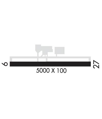
| 5000x100 | 5000' | 5000x100 | 5000' | 108.75 - 274° | ||||
| Runway ID | Single Wheel | Double Wheel | Double Tandem Wheel | Dual Double Wheel |
| 09/27 | 60,000 | 90,000 | 120,000 | N/A |
| These numbers are Advisory and are not limits. The Airport Manager should have more accurate Weight Limits | ||||
 Airport Diagram might not be current. | |
| Facility Name: | DE KALB COUNTY |
| City Name: | AUBURN |
| County: | DE KALB |
| State abbrev: | IN |
| State Name: | INDIANA |
| Ownership: | PUBLICLY OWNED |
| Use: | OPEN TO THE PUBLIC |
| Owner's Name: | DE KALB COUNTY AIRPORT AUTHORITY |
| Address: | 2710 CR 60 SUITE 200 |
| AUBURN, IN 46706 | |
| Owner's Phone: | 260-927-8876 |
| Manager's Name: | RUSS COUCHMAN |
| Address: | 2710 CR 60 SUITE 200 |
| AUBURN, IN 46706 | |
| Phone: | 260-927-8876 |
| FAA Region: | GREAT LAKES |
| FAA Field Office: | CHI |
| Date | Sunrise | Sunset |
|---|---|---|
| 09/24/21 Friday | 7:29 | 19:34 |
| 09/25/21 Saturday | 7:30 | 19:33 |
| 09/26/21 Sunday | 7:32 | 19:31 |
| 09/27/21 Monday | 7:33 | 19:29 |
| 09/28/21 Tuesday | 7:34 | 19:28 |
| 09/29/21 Wednesday | 7:35 | 19:26 |
| 09/30/21 Thursday | 7:36 | 19:24 |
| 10/01/21 Friday | 7:37 | 19:23 |
| 10/02/21 Saturday | 7:38 | 19:21 |
| 10/03/21 Sunday | 7:39 | 19:19 |
| 10/04/21 Monday | 7:40 | 19:17 |
| 10/05/21 Tuesday | 7:41 | 19:16 |
| 10/06/21 Wednesday | 7:42 | 19:14 |
| 10/07/21 Thursday | 7:43 | 19:13 |
| Airport Attendance Schedule | SAT-SUN 0900-1700, MON-FRI 0800-1700; ATTENDANT CTC 260-348-6998. |
| Airport Status | OPERATIONAL (This Status can change at any time - please check NOTAMS) |
| Airport Lighting Schedule | ACTVT MALSR RWY 27; REIL RWY 09 & 27; MIRL RWY 09/27 - CTAF. MIRL RWY 09/27 PRESET LOW INTST DUSK TO DAWN, TO INCR INTST - CTAF. PAPI RWY 09 & 27 OPR CONSLY. |
| Airport Storage Available | Tie Downs, Hanger |
| Extra Services Available | Crop Dusting, Air Ambulance, Cargo Handling, Charter, Flight Instruction, Aircraft Rental |
| Wind Indicator | YES - (lighted) |
| Control Tower | NO |
| CTAF Frequency | 123.000 |
| Unicom Frequency | 123.000 |
| Rotating Beacon Color | CLEAR-GREEN (Light Land Airport) |
| Segmented Circle | NO |
| Landing Fee | NO |
| Airport Inspected | STATE - performed by STATE AERONAUTICAL PERSONNEL |
| Inspection Date | 09/18/2020 |
| Type of Fuel Available | Grade 100LL, JET A |
| Airframe Repair Service | MAJOR |
| Power Plant Repair Service | MAJOR |
| Latitude | N4118.4 |
| Longitude | W08503.9 (ESTIMATED) |
| Arpt Elevation | 880ft (SURVEYED) |
| Magnetic Variation | 05W |
| 3 miles S | of AUBURN |
| Traffic Pattern Altitude | |
| Sectional Chart | CHICAGO |
| Operations (Reported) | Yearly | Avg. Daily |
|---|---|---|
| General Aviation Transient | 1242 | 3 |
| General Aviation Local | 10429 | 29 |
| Air Taxi | 745 | 2 |
| Commerical | 0 | 0 |
| Commuter | 0 | 0 |
| Military | 0 | 0 |
| Aircraft based on Field | |
|---|---|
| General Aviation Singles | 51 |
| General Aviation Multi | 3 |
| Jet Aircraft | 5 |
| General Aviation Helicopters | 2 |
| Military Aircraft | 0 |
| Gliders | 0 |
| Ultralights | 0 |
| FSS on field | NO |
| FSS tie-in | TERRE HAUTE |
| FSS Phone | 1-800-WX-BRIEF |
| Who issues Notams | HUF |
| Notam D service at airport | YES |
| ARTCC Name | CHICAGO |
| Airport Certification | |
| Aircraft Rescue & Firefighting Index | None |
| Airport of Entry | No |
| Custom Landing Rights | No |
| Joint Civil/Military | No |
| Military Landing rights | YES |
| NATIONAL PLAN OF INTEGRATED AIRPORT SYSTEMS (NPIAS) |
| GRANT AGREEMENTS UNDER FAAP/ADAP/AIP |
| ASSURANCES PURSUANT TO TITLE VI, CIVIL RIGHTS ACT OF 1964 |
| FOR CD CTC CHICAGO ARTCC AT 630-906-8921. |
| SNOW REMOVAL OPERATIONS IN PROG DURG WINTER MONTHS. COND NOT MONITORED WHEN AIRPORT UNATTENDED, UNLESS REQ BY CALLING AIRPORT ADMIN PHONE 260-927-8876. |
| RWY 27 CALM/CROSSWIND RWY. |
Airport Communications & Frequencies:
| |||||||||||||||||||||||||||||
| Runway: 09 | Runway: 27 | ||
| Mag heading: | 94° | Mag heading: | 274° |
| Rwy Slope: | .18% Up | Rwy Slope: | -.18% Down |
| Approach: | Approach: | ILS/DME | |
| Pattern: | Left Traffic | Pattern: | Left Traffic |
| Markings: | NONPRECISION INSTRUMENT | Markings: | PRECISION INSTRUMENT |
| Marking Condition: | FAIR | Marking Condition: | FAIR |
| Arresting Dev: | Arresting Dev: | ||
| Lat & Long: | N4118.4 W08504.4 | Lat. & Long.: | N4118.4 W08503.3 |
| Elev: | 870.4 ft. MSL | Elev: | 879.2 ft. MSL |
| TCH: | 45 ft. AGL | TCH: | 44 ft. AGL |
| Visual Glide Path: | 3.00 degrees | Visual Glide Path: | 3.00 degrees |
| Displaced Threshold: | No | Displaced Threshold: | No |
| Touchdown Zone: | YES | Touchdown Zone: | YES |
| Touchdown Elev.: | 879.9 feet | Touchdown Elev.: | 880.4 feet |
| Visual Glide Slope: | 2-Light PAPI on LEFT side of Runway | Visual Glide Slope: | 2-Light PAPI on LEFT side of Runway |
| RVR Equipment: | RVR Equipment: | ||
| RVV Equipment: | NO | RVV Equipment: | NO |
| Approach Lights: | Approach Lights: | MALSR - 1,400 foot medium intensity approach lighting system with runway alignment indicator lights | |
| REIL: | YES | REIL: | YES |
| Centerline Lights: | NO | Centerline Lights: | NO |
| Touchdown lights: | NO | Touchdown lights: | NO |
| Runway Category: | Runway with a Non-precision Approach | Runway Category: | Precision Instrument Runway |
| Declared Distances: | Declared Distances: |
Thanks for using FltPlan.com
all rights reserved © 1999-2021 by Flight Plan LLC
