
| WINTERSET-MADISON COUNTY WINTERSET IA |
| |
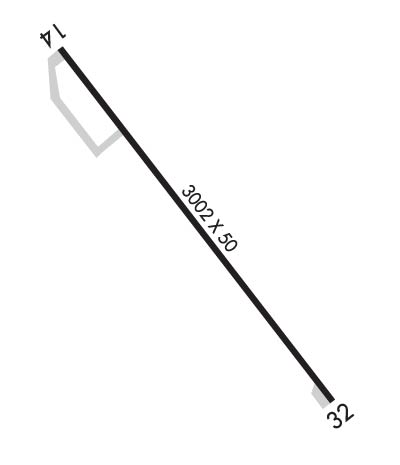
| Lat: N 4121.8 Long: W 09401.3 Elev: 1116 Var: -02 Longest Runway: 3002 | ||
| CTAF: 122.7 | ||
| ||||||
|
| Rwy | Rwy | |||||||
| 3002x50 | 2827' | 3002x50 | 3002' | |||||
| Runway ID | Single Wheel | Double Wheel | Double Tandem Wheel | Dual Double Wheel |
| 14/32 | N/A | N/A | N/A | N/A |
| These numbers are Advisory and are not limits. The Airport Manager should have more accurate Weight Limits | ||||
 Airport Diagram might not be current. | |
| Facility Name: | WINTERSET MUNI |
| City Name: | WINTERSET |
| County: | MADISON |
| State abbrev: | IA |
| State Name: | IOWA |
| Ownership: | PUBLICLY OWNED |
| Use: | OPEN TO THE PUBLIC |
| Owner's Name: | WNTRSET ARPT AUTH; WINTERSET AIRPORT AUTHORITY |
| Address: | 3405 NORTH 8TH AVENUE |
| WINTERSET, IA 50273 | |
| Owner's Phone: | (515) 468-8895 |
| Manager's Name: | ANDREW OVERTON |
| Address: | 3405 NORTH 8TH AVE; EMAIL ADDRESS: ANDREW.G.OVERTON@GMAIL.COM |
| WINTERSET, IA 50273 | |
| Phone: | 515-508-9114 |
| FAA Region: | CENTRAL |
| FAA Field Office: | NONE |
| Date | Sunrise | Sunset |
|---|---|---|
| 09/24/21 Friday | 7:05 | 19:10 |
| 09/25/21 Saturday | 7:06 | 19:08 |
| 09/26/21 Sunday | 7:07 | 19:07 |
| 09/27/21 Monday | 7:08 | 19:05 |
| 09/28/21 Tuesday | 7:09 | 19:03 |
| 09/29/21 Wednesday | 7:10 | 19:02 |
| 09/30/21 Thursday | 7:12 | 19:00 |
| 10/01/21 Friday | 7:13 | 18:58 |
| 10/02/21 Saturday | 7:14 | 18:57 |
| 10/03/21 Sunday | 7:15 | 18:55 |
| 10/04/21 Monday | 7:16 | 18:53 |
| 10/05/21 Tuesday | 7:17 | 18:52 |
| 10/06/21 Wednesday | 7:18 | 18:50 |
| 10/07/21 Thursday | 7:19 | 18:48 |
| Airport Attendance Schedule | MON-FRI 0800-1700, SAT-SUN ON CALL |
| Airport Status | OPERATIONAL (This Status can change at any time - please check NOTAMS) |
| Airport Lighting Schedule | ACTVT MIRL RY 14/32 & PAPI RYS 14 & 32 - CTAF. |
| Airport Storage Available | Tie Downs, Hanger |
| Extra Services Available | Flight Instruction, Parachute Jumping, Aircraft Rental |
| Wind Indicator | YES - (lighted) |
| Control Tower | NO |
| CTAF Frequency | 122.700 |
| Unicom Frequency | 122.700 |
| Rotating Beacon Color | CLEAR-GREEN (Light Land Airport) |
| Segmented Circle | NO |
| Landing Fee | NO |
| Airport Inspected | STATE - performed by STATE AERONAUTICAL PERSONNEL |
| Inspection Date | 09/25/2020 |
| Type of Fuel Available | Grade 100LL, JET A (freeze point -40C) |
| Airframe Repair Service | MAJOR |
| Power Plant Repair Service | MAJOR |
| Latitude | N4121.8 |
| Longitude | W09401.3 (ESTIMATED) |
| Arpt Elevation | 1115ft (SURVEYED) |
| Magnetic Variation | 02E |
| 2 miles N | of WINTERSET |
| Traffic Pattern Altitude | 800 |
| Sectional Chart | OMAHA |
| Operations (Reported) | Yearly | Avg. Daily |
|---|---|---|
| General Aviation Transient | 3490 | 10 |
| General Aviation Local | 3260 | 9 |
| Air Taxi | 0 | 0 |
| Commerical | 0 | 0 |
| Commuter | 0 | 0 |
| Military | 0 | 0 |
| Aircraft based on Field | |
|---|---|
| General Aviation Singles | 24 |
| General Aviation Multi | 2 |
| Jet Aircraft | 0 |
| General Aviation Helicopters | 0 |
| Military Aircraft | 0 |
| Gliders | 0 |
| Ultralights | 0 |
| FSS on field | NO |
| FSS tie-in | FORT DODGE |
| FSS Phone | 1-800-WX-BRIEF |
| Who issues Notams | FOD |
| Notam D service at airport | YES |
| ARTCC Name | MINNEAPOLIS |
| Airport Certification | |
| Aircraft Rescue & Firefighting Index | None |
| Airport of Entry | No |
| Custom Landing Rights | No |
| Joint Civil/Military | No |
| Military Landing rights | No |
| NATIONAL PLAN OF INTEGRATED AIRPORT SYSTEMS (NPIAS) |
| ULTRALIGHT & SKY DIVING ACT ON & INVOF ARPT. |
| RWY 32 END SAFETY AREA EXTDS 240 FT; SHARP DROP AT THAT POINT. |
| INADQT CLNC FOR HLDG ON THE TARND AT THE THR OF RWY 32. |
| RWY 32 IS CALM WIND RWY. |
| FOR CD CTC DES MOINES ATCT AT 515-974-8016. |
| RWY 14/3 2 MIRL - RWY 14/32 ENDS HAVE SIX THLD LGTS AND ALL WHITE LENSES ALONG RWY LEN. |
Airport Communications & Frequencies:
| ||||||||||||||
| Runway: 14 | Runway: 32 | ||
| Mag heading: | 140° | Mag heading: | 320° |
| Rwy Slope: | -.72% Down | Rwy Slope: | .72% Up |
| Approach: | Approach: | ||
| Pattern: | Left Traffic | Pattern: | Left Traffic |
| Markings: | NONPRECISION INSTRUMENT | Markings: | NONPRECISION INSTRUMENT |
| Marking Condition: | GOOD | Marking Condition: | GOOD |
| Arresting Dev: | Arresting Dev: | ||
| Lat & Long: | N4122.0 W09401.5 | Lat. & Long.: | N4121.6 W09401.1 |
| Elev: | 1115.5 ft. MSL | Elev: | 1093.8 ft. MSL |
| TCH: | 32 ft. AGL | TCH: | 40 ft. AGL |
| Visual Glide Path: | 3.00 degrees | Visual Glide Path: | 3.00 degrees |
| Displaced Threshold: | 175 feet | Displaced Threshold: | No |
| Touchdown Zone: | YES | Touchdown Zone: | YES |
| Touchdown Elev.: | 1115.5 feet | Touchdown Elev.: | 1115.5 feet |
| Visual Glide Slope: | 2-Light PAPI on LEFT side of Runway | Visual Glide Slope: | 2-Light PAPI on LEFT side of Runway |
| RVR Equipment: | RVR Equipment: | ||
| RVV Equipment: | NO | RVV Equipment: | NO |
| Approach Lights: | Approach Lights: | ||
| REIL: | NO | REIL: | NO |
| Centerline Lights: | NO | Centerline Lights: | NO |
| Touchdown lights: | NO | Touchdown lights: | NO |
| Runway Category: | Runway with a Non-precision Approach | Runway Category: | Runway with a Non-precision Approach |
| Declared Distances: | Declared Distances: | ||
| Obstructions: | ROAD | Obstructions: | TREE |
| Marked: | NOT Marked/Lighted | Marked: | NOT Marked/Lighted |
| Clearance slope: | 1:1; APCH SLOPE 6:1 FM DSPLCD THLD. | Clearance slope: | 20:1 |
| Obstruction height: | 15 feet AGL | Obstruction height: | 20 feet AGL |
| Dist. from runway: | 200 feet | Dist. from runway: | 603 feet |
| Centerline offset: | 45 right of centerline | Centerline offset: | 210 feet right of centerline |
| Comments: | 15 FT ROAD 140 FT FM RY END | Comments: |
Thanks for using FltPlan.com
all rights reserved © 1999-2021 by Flight Plan LLC
