| DOWNTOWN SPRINGFIELD MO |
| |
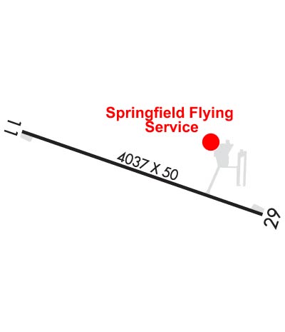
| Lat: N 3713.4 Long: W 09314.9 Elev: 1375 Var: -01 Longest Runway: 4037 | ||
| CTAF: 122.8 | ||
| |||||||||||||||||||||||||||||||
| |||||||||||||||||||||||||||||||
| Rwy | Rwy | |||||||
| 4037x50 | 4037' | 4037x50 | 4037' | |||||
| Runway ID | Single Wheel | Double Wheel | Double Tandem Wheel | Dual Double Wheel |
| 11/29 | 8,000 | N/A | N/A | N/A |
| These numbers are Advisory and are not limits. The Airport Manager should have more accurate Weight Limits | ||||
 Airport Diagram might not be current. | |
| Facility Name: | DOWNTOWN |
| City Name: | SPRINGFIELD |
| County: | GREENE |
| State abbrev: | MO |
| State Name: | MISSOURI |
| Ownership: | PRIVATELY OWNED |
| Use: | OPEN TO THE PUBLIC |
| Owner's Name: | SHERMAN STREET ACQUISITION CO INC |
| Address: | 605 N. SHERMAN ST |
| SPRINGFIELD, MO 65803 | |
| Owner's Phone: | |
| Manager's Name: | LAUREN LEA |
| Address: | 2546 E DIVISION ST |
| SPRINGFIELD, MO 65803 | |
| Phone: | 417-862-2418 |
| FAA Region: | CENTRAL |
| FAA Field Office: | NONE |
| Date | Sunrise | Sunset |
|---|---|---|
| 10/27/25 Monday | 7:32 | 18:21 |
| 10/28/25 Tuesday | 7:33 | 18:20 |
| 10/29/25 Wednesday | 7:34 | 18:19 |
| 10/30/25 Thursday | 7:35 | 18:18 |
| 10/31/25 Friday | 7:36 | 18:17 |
| 11/01/25 Saturday | 7:37 | 18:15 |
| 11/02/25 Sunday | 6:38 | 17:14 |
| 11/03/25 Monday | 6:39 | 17:13 |
| 11/04/25 Tuesday | 6:40 | 17:12 |
| 11/05/25 Wednesday | 6:41 | 17:11 |
| 11/06/25 Thursday | 6:42 | 17:10 |
| 11/07/25 Friday | 6:43 | 17:09 |
| 11/08/25 Saturday | 6:45 | 17:09 |
| 11/09/25 Sunday | 6:46 | 17:08 |
| Airport Attendance Schedule | MON-FRI 0730-1800, SAT 0900-1600 |
| Airport Status | OPERATIONAL (This Status can change at any time - please check NOTAMS) |
| Airport Lighting Schedule | ACTVT NSTD MIRL RWY 11/29 - CTAF-THREE CLICKS. |
| Airport Storage Available | Tie Downs, Hanger |
| Extra Services Available | NONE |
| Wind Indicator | YES - (lighted) |
| Control Tower | NO |
| CTAF Frequency | 122.800 |
| Unicom Frequency | 122.800 |
| Rotating Beacon Color | |
| Segmented Circle | NO |
| Landing Fee | NO |
| Airport Inspected | STATE - performed by STATE AERONAUTICAL PERSONNEL |
| Inspection Date | 09/05/2024 |
| Type of Fuel Available | Grade 100LL, JET A (freeze point -40C) |
| Airframe Repair Service | MAJOR |
| Power Plant Repair Service | MAJOR |
| Latitude | N3713.4 |
| Longitude | W09314.9 (ESTIMATED) |
| Arpt Elevation | 1375ft (ESTIMATED) |
| Magnetic Variation | 01E |
| 0 miles E | of SPRINGFIELD |
| Traffic Pattern Altitude | |
| Sectional Chart | KANSAS CITY |
| Operations (Reported) | Yearly | Avg. Daily |
|---|---|---|
| General Aviation Transient | 0 | 0 |
| General Aviation Local | 0 | 0 |
| Air Taxi | 0 | 0 |
| Commerical | 0 | 0 |
| Commuter | 0 | 0 |
| Military | 0 | 0 |
| Aircraft based on Field | |
|---|---|
| General Aviation Singles | 0 |
| General Aviation Multi | 0 |
| Jet Aircraft | 0 |
| General Aviation Helicopters | 0 |
| Military Aircraft | 0 |
| Gliders | 0 |
| Ultralights | 0 |
| FSS on field | NO |
| FSS tie-in | COLUMBIA |
| FSS Phone | 1-800-WX-BRIEF |
| Who issues Notams | COU |
| Notam D service at airport | YES |
| ARTCC Name | KANSAS CITY |
| Airport Certification | |
| Aircraft Rescue & Firefighting Index | None |
| Airport of Entry | No |
| Custom Landing Rights | No |
| Joint Civil/Military | No |
| Military Landing rights | No |
| 600 FT LGTD TOWER 950 FT N OF RY 29 THLD. |
| NTSD RY SAFETY AREA BYD RY 29 THLD; LARGE SLOPE. |
| PEDESTRIAN GATE CODE IS CTAF FREQ. |
| FOR CD CTC SPRINGFIELD APCH AT 417-868-5620/5619. |
| RWY 11/2 9 NSTD MIRL; 3 THR LGTS EACH RWY, EDGE LGTS SPACED 240 FT APART. |
Airport Communications & Frequencies:
| ||||||||||||||
| Runway: 11 | Runway: 29 | ||
| Mag heading: | 108° | Mag heading: | 288° |
| Rwy Slope: | .50% Up | Rwy Slope: | -.50% Down |
| Approach: | Approach: | ||
| Pattern: | Left Traffic | Pattern: | Left Traffic |
| Markings: | NONPRECISION INSTRUMENT | Markings: | NONPRECISION INSTRUMENT |
| Marking Condition: | FAIR | Marking Condition: | FAIR |
| Arresting Dev: | Arresting Dev: | ||
| Lat & Long: | N3713.5 W09315.3 | Lat. & Long.: | N3713.3 W09314.5 |
| Elev: | 1355.0 ft. MSL | Elev: | 1375.0 ft. MSL |
| TCH: | TCH: | ||
| Visual Glide Path: | Visual Glide Path: | ||
| Displaced Threshold: | No | Displaced Threshold: | No |
| Touchdown Zone: | YES | Touchdown Zone: | YES |
| Touchdown Elev.: | 1370.0 feet | Touchdown Elev.: | 1375.0 feet |
| Visual Glide Slope: | Visual Glide Slope: | ||
| RVR Equipment: | RVR Equipment: | ||
| RVV Equipment: | NO | RVV Equipment: | NO |
| Approach Lights: | Approach Lights: | ||
| REIL: | NO | REIL: | NO |
| Centerline Lights: | NO | Centerline Lights: | NO |
| Touchdown lights: | NO | Touchdown lights: | NO |
| Runway Category: | Runway with a Non-precision Approach | Runway Category: | Runway with a Non-precision Approach |
| Declared Distances: | Declared Distances: | ||
| Obstructions: | TREES | Obstructions: | TREES |
| Marked: | NOT Marked/Lighted | Marked: | NOT Marked/Lighted |
| Clearance slope: | 15:1 | Clearance slope: | 15:1 |
| Obstruction height: | 44 feet AGL | Obstruction height: | 58 feet AGL |
| Dist. from runway: | 890 feet | Dist. from runway: | 1080 feet |
| Centerline offset: | 116 left of centerline | Centerline offset: | 130 feet left of centerline |
| Comments: | Comments: |
Thanks for using FltPlan.com
all rights reserved © 1999-2025 by Flight Plan LLC