
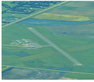
| REDFIELD MUNI REDFIELD SD |
| |
| Lat: N 4451.4 Long: W 09831.9 Elev: 1309 Var: -07 Longest Runway: 3500 | ||
| CTAF: 122.8 | ||
| ||||||||||||||||||||||||||||||||
| ||||||||||||||||||||||||||||||||
| Rwy | Rwy | |||||||
| 3500x75 | 3500' | 3500x75 | 3500' | |||||
| Runway ID | Single Wheel | Double Wheel | Double Tandem Wheel | Dual Double Wheel |
| 17/35 | N/A | N/A | N/A | N/A |
| These numbers are Advisory and are not limits. The Airport Manager should have more accurate Weight Limits | ||||
| FltPlan does not have IFR approach charts available for K1D8. |
| Facility Name: | REDFIELD MUNI |
| City Name: | REDFIELD |
| County: | SPINK |
| State abbrev: | SD |
| State Name: | SOUTH DAKOTA |
| Ownership: | PUBLICLY OWNED |
| Use: | OPEN TO THE PUBLIC |
| Owner's Name: | CITY OF REDFIELD |
| Address: | 626 N. MAIN STREET |
| REDFIELD, SD 57469 | |
| Owner's Phone: | 605-472-4550 |
| Manager's Name: | ADAM HANSEN |
| Address: | 626 N. MAIN STREET, 626 N. MAIN ST |
| REDFIELD, SD 57469 | |
| Phone: | 605-472-4550 |
| FAA Region: | GREAT LAKES |
| FAA Field Office: | DMA |
| Date | Sunrise | Sunset |
|---|---|---|
| 09/24/21 Friday | 7:23 | 19:28 |
| 09/25/21 Saturday | 7:25 | 19:26 |
| 09/26/21 Sunday | 7:26 | 19:24 |
| 09/27/21 Monday | 7:27 | 19:23 |
| 09/28/21 Tuesday | 7:28 | 19:21 |
| 09/29/21 Wednesday | 7:29 | 19:19 |
| 09/30/21 Thursday | 7:31 | 19:17 |
| 10/01/21 Friday | 7:32 | 19:15 |
| 10/02/21 Saturday | 7:33 | 19:13 |
| 10/03/21 Sunday | 7:34 | 19:11 |
| 10/04/21 Monday | 7:36 | 19:09 |
| 10/05/21 Tuesday | 7:37 | 19:08 |
| 10/06/21 Wednesday | 7:38 | 19:06 |
| 10/07/21 Thursday | 7:39 | 19:04 |
| Airport Attendance Schedule | UNATTENDED |
| Airport Status | OPERATIONAL (This Status can change at any time - please check NOTAMS) |
| Airport Lighting Schedule | ACTVT PAPI RWY 17 & 35; MIRL 17/35 - CTAF. |
| Airport Storage Available | Tie Downs |
| Extra Services Available | Crop Dusting, Air Ambulance |
| Wind Indicator | YES - (lighted) |
| Control Tower | NO |
| CTAF Frequency | 122.800 |
| Unicom Frequency | 122.800; UNICOM UNMONITORED. |
| Rotating Beacon Color | CLEAR-GREEN (Light Land Airport) |
| Segmented Circle | YES |
| Landing Fee | NO |
| Airport Inspected | STATE - performed by STATE AERONAUTICAL PERSONNEL |
| Inspection Date | 05/18/2021 |
| Type of Fuel Available | Grade 100LL; -10FUEL AVBL 24 HRS WITH CREDIT CARD. |
| Airframe Repair Service | MINOR |
| Power Plant Repair Service | MINOR |
| Latitude | N4451.4 |
| Longitude | W09831.9 (ESTIMATED) |
| Arpt Elevation | 1308ft (SURVEYED) |
| Magnetic Variation | 07E |
| 1 miles SW | of REDFIELD |
| Traffic Pattern Altitude | |
| Sectional Chart | TWIN CITIES |
| Operations (Reported) | Yearly | Avg. Daily |
|---|---|---|
| General Aviation Transient | 575 | 2 |
| General Aviation Local | 4600 | 13 |
| Air Taxi | 0 | 0 |
| Commerical | 0 | 0 |
| Commuter | 0 | 0 |
| Military | 0 | 0 |
| Aircraft based on Field | |
|---|---|
| General Aviation Singles | 11 |
| General Aviation Multi | 0 |
| Jet Aircraft | 0 |
| General Aviation Helicopters | 0 |
| Military Aircraft | 0 |
| Gliders | 0 |
| Ultralights | 0 |
| FSS on field | NO |
| FSS tie-in | HURON |
| FSS Phone | 1-800-WX-BRIEF |
| Who issues Notams | HON |
| Notam D service at airport | YES |
| ARTCC Name | MINNEAPOLIS |
| Airport Certification | |
| Aircraft Rescue & Firefighting Index | None |
| Airport of Entry | No |
| Custom Landing Rights | No |
| Joint Civil/Military | No |
| Military Landing rights | YES |
| NATIONAL PLAN OF INTEGRATED AIRPORT SYSTEMS (NPIAS) |
| GRANT AGREEMENTS UNDER FAAP/ADAP/AIP |
| ASSURANCES PURSUANT TO TITLE VI, CIVIL RIGHTS ACT OF 1964 |
| ULTRALIGHT ACTIVITY ON AND INVOF ARPT. |
| MIGRATORY BIRDS AND WILDILFE ON AND INVOF ARPT. |
| FOR CD CTC MINNEAPOLIS ARTCC AT 651-463-5588. |
| Runway: 17 | Runway: 35 | ||
| Mag heading: | 167° | Mag heading: | 347° |
| Rwy Slope: | -.01% Down | Rwy Slope: | .01% Up |
| Approach: | Approach: | ||
| Pattern: | Left Traffic | Pattern: | Left Traffic |
| Markings: | NONPRECISION INSTRUMENT | Markings: | NONPRECISION INSTRUMENT |
| Marking Condition: | GOOD | Marking Condition: | GOOD |
| Arresting Dev: | Arresting Dev: | ||
| Lat & Long: | N4451.7 W09831.9 | Lat. & Long.: | N4451.1 W09831.8 |
| Elev: | 1308.5 ft. MSL | Elev: | 1308.0 ft. MSL |
| TCH: | 40 ft. AGL | TCH: | 36 ft. AGL |
| Visual Glide Path: | 3.00 degrees | Visual Glide Path: | 3.00 degrees |
| Displaced Threshold: | No | Displaced Threshold: | No |
| Touchdown Zone: | YES | Touchdown Zone: | YES |
| Touchdown Elev.: | 1308.5 feet | Touchdown Elev.: | 1308.0 feet |
| Visual Glide Slope: | 2-Light PAPI on RIGHT side of Runway | Visual Glide Slope: | 2-Light PAPI on LEFT side of Runway |
| RVR Equipment: | RVR Equipment: | ||
| RVV Equipment: | NO | RVV Equipment: | NO |
| Approach Lights: | Approach Lights: | ||
| REIL: | NO | REIL: | NO |
| Centerline Lights: | NO | Centerline Lights: | NO |
| Touchdown lights: | NO | Touchdown lights: | NO |
| Runway Category: | Runway with a Visual Approach | Runway Category: | Runway with a Visual Approach |
| Declared Distances: | Declared Distances: |
Thanks for using FltPlan.com
all rights reserved © 1999-2021 by Flight Plan LLC