
| REINA BEATRIX INTL (AUA) ARUBA ISLAND |
| |
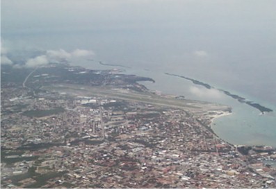
| Lat: N 1230.1 Long: W 07000.9 Elev: 62 Var: +10 Longest Runway: 9278 | ||
| Dept. ATIS: 132.1 Arr. ATIS: 132.1 Ground: 118.0 Tower: 118.0 | ||
| |||||||||||||||||||||||||||||||||||||||||||||||||||||||||||||||||||
| |||||||||||||||||||||||||||||||||||||||||||||||||||||||||||||||||||
| |||||||||||||||||||||||||||||||||||||||||||||||||||||||||||||||||||
 |
| ||||
NOTICE: Information listed below may not be current.
| |||||||
| |||||||
| |||||||
| Rotating Beacon: YES | |||||||
| |||||||
| |||||||
| COMMUNICATION INFORMATION AUTOMATIC TERMINAL INFORMATION SERVICE - ATIS 132.1 GROUND CONTROL - GND 121.9 MISCELLANEOUS - SEARCH AND RESCUE 123.1 RAMP CONTROL - BEATRIX APRON 121.6 TOWER - BEATRIX TWR 120.9 128.85 | |||||||
| COMMUNICATION REMARKS TOWER - APP/TWR combined H24. | |||||||
| INSTRUMENT APPROACHES VORDME RW11 VORDME RW29 ILSDME RW11 | |||||||
| APPROACH MINIMUMS VORDME RW11 CIRCL Approach Minimums Category A: 860' MSL and 1600 METERS Category B: 860' MSL and 2000 METERS Category C: 1140' MSL and 4800 METERS Category D: 1140' MSL and 4800 METERS Category E: NA VORDME RW11 S-11* Approach Minimums Category A: 420' MSL and 1600 METERS Category B: 420' MSL and 1600 METERS Category C: 420' MSL and 1600 METERS Category D: 420' MSL and 1600 METERS Category E: NA VORDME RW29 CIRCL Approach Minimums Category A: 860' MSL and 1600 METERS Category B: 860' MSL and 2000 METERS Category C: 1140' MSL and 4800 METERS Category D: 1140' MSL and 4800 METERS Category E: NA VORDME RW29 S-29 Approach Minimums Category A: 660' MSL and 1600 METERS Category B: 660' MSL and 1600 METERS Category C: 660' MSL and 2800 METERS Category D: 660' MSL and 3200 METERS Category E: NA ILSDME RW11 CIRCL Approach Minimums Category A: 860' MSL and 1600 METERS Category B: 860' MSL and 2000 METERS Category C: 1140' MSL and 4800 METERS Category D: 1140' MSL and 4800 METERS Category E: NA ILSDME RW11 S-ILS Approach Minimums Category A: 209' MSL and 800 METERS Category B: 209' MSL and 800 METERS Category C: 209' MSL and 1200 METERS Category D: 209' MSL and 1200 METERS Category E: NA ILSDME RW11 S-LOC Approach Minimums Category A: 340' MSL and 1200 METERS Category B: 340' MSL and 1200 METERS Category C: 340' MSL and 1200 METERS Category D: 340' MSL and 1200 METERS Category E: NA | |||||||
| APPROACH REMARKS VORDME RW11 - CIRCLING** - **Circling to Rwy 11 not auth at night. VORDME RW11 - S-11*+ - *When ALS inop, increase vis CAT CD to 2 000m. +Procedure not auth at night. VORDME RW29 - CIRCLING* - *Circling to Rwy 11 not auth at night. ILSDME RW11 - S-ILS 11** - **WHEN ALS INOP, INCREASE VIS CAT AB 400 M. ILSDME RW11 - S-LOC 11*** - ***WHEN ALS INOP, INCREASE VIS 400M. | |||||||
| AIRPORT NAVAIDS ABA - ARUBA (VOR-DME) - Bearing: 272° Distance: 4.4 nm BEA - REINA BEATRIX (VOR-DME) - ON FIELD | |||||||
| TERMINAL AREA REMARKS VORDME RW11 WARNING: Intermediate seg leg is less than DOD standards CAT AB 278 , 2.5 minutes. CAT CD 272 , 2 minutes. Minimum holding altitude 2500. Max 220 KIAS. MISSED APPROACH: Climb straight ahead to 2500, then left to BEA VOR/DME and hold . VORDME RW29 CAT AB 093 . CAT CD 088 . Minimum holding alt 2500. Max 220 KIAS. MISSED APPROACH: Climb straight ahead to 2500, then left to BEA VOR and hold. ILSDME RW11 Avoid TNR4 when active. *LOC only (*BEA 0.5 DME (MAP)). Min holding alt 2500. Max 220 KIAS. Glide Slope Angle 2.98 Deg/TCH 51. MISSED APPROACH: Climb straight ahead to 2500, then left to BEA VOR/DME and hold . | |||||||
| AIRPORT REMARKS IFR TAKE-OFF MINIMUMS AND DEPARTURE PROCEDURES Diverse departure not authorized. | |||||||
Thanks for using FltPlan.com
all rights reserved © 1999-2024 by Flight Plan LLC


