Click here for more info on on SMS!

TJVQ

ANTONIO RIVERA RODRIGUEZ (VQS)
ISLA DE VIEQUES
PR
Time Zone: Atlantic
Lat: N 1808.1
Long: W 06529.6
Elev: 49
Var: +13
Longest Runway: 4301
CTAF: 123.0

FBO & Flight Services info for TJVQ

FBOs: Update your Fuel Prices

AIRPORTPh: 787-741-8358
-
Freq: 123.0
Service
Jet
100LL
SAF
MoGas
Fuel Avail: NO FUEL AVAILABLE
Full        Last Update: 04/22/2024 05:24:34

Self        
If you are an FBO, call 1-203-262-1700 to update your info or email: FltPlan.Advertising@garmin.com
Advertise your FBO on FltPlan.com

Runway & Approach Info for TJVQ
Rwy
Length
Land Dist**
Approach*
  Rwy
Length
Land Dist**
Approach*
09
4301x75  3405'          
 
  
27
  4301x75  4301'          
 
 * only ILS, LOC, LDA, and SDF approaches to a specific runway are shown
** For any Declared Landing Distance Available, please see A/FD or Approach plates
Runway Weight Capability (lbs.) Help
Runway IDSingle WheelDouble WheelDouble Tandem WheelDual Double Wheel
09/2720,00040,000N/AN/A
These numbers are Advisory and are not limits.   The Airport Manager should have more accurate Weight Limits
Approach Charts
Approaches    
Current Weather/Notams
Customs Information Send updates to Support@FltPlan.com
Phone 787-741-8366
Fax N/A

Comments Business hours are Monday - Friday 8:00 AM to 5:00 PM
Database effective 05/16/2024
Airport Diagram of TJVQ
Airport Diagram might not be current.

Facility Name: ANTONIO RIVERA RODRIGUEZ
City Name: ISLA DE VIEQUES
County: --PUERTO RICO
State abbrev: PR
State Name: PUERTO RICO
   
Ownership: PUBLICLY OWNED
Use: OPEN TO THE PUBLIC
Owner's Name: PUERTO RICO PORTS AUTH
Address: HC 1 BOX 9421
 VIEQUES, PR 00765-9243
Owner's Phone: 787-729-8715; EXT 5300
  
Manager's Name: RAMN RODRGUEZ VZQUEZ
Address: ANTONIO RIVERA RODRIGUEZ AIRPORT, HC 1 BOX 9421
 VIEQUES, PR 00765-9243
Phone: 787-729-8715; AFTR HRS PH 787-439-5941.
   
FAA Region: SOUTHERN
FAA Field Office: ATL


Sunrise / Sunset times for ANTONIO RIVERA RODRIGUEZ

DateSunriseSunset
04/22/24 Monday6:0018:41
04/23/24 Tuesday6:0018:41
04/24/24 Wednesday5:5918:41
04/25/24 Thursday5:5818:42
04/26/24 Friday5:5818:42
04/27/24 Saturday5:5718:42
04/28/24 Sunday5:5618:43
04/29/24 Monday5:5618:43
04/30/24 Tuesday5:5518:43
05/01/24 Wednesday5:5518:43
05/02/24 Thursday5:5418:44
05/03/24 Friday5:5418:44
05/04/24 Saturday5:5318:44
05/05/24 Sunday5:5318:45

Airport Facilities

Airport Attendance Schedule7 Days A Week 0600-1800
Airport Status OPERATIONAL (This Status can change at any time - please check NOTAMS)
Airport Lighting Schedule
Airport Storage AvailableTie Downs
Extra Services AvailableNONE
Wind IndicatorYES - (lighted)
Control TowerNO
CTAF Frequency123.000
Unicom Frequency123.000; UNICOM MONITORED DURING ATTND. HRS.
Rotating Beacon ColorWG; RTG BCN OTS INDEF.
Segmented CircleYES
Landing FeeYES; LDG FEE FOR ALL ACFT.

Airport Inspection Data

Airport InspectedFEDERAL - performed by PRIVATE CONTRACT PERSONNEL
Inspection Date05/04/2022

Airport Services

Type of Fuel AvailableNone
Airframe Repair ServiceNONE
Power Plant Repair ServiceNONE

Geographic Data

LatitudeN1808.1
LongitudeW06529.6 (ESTIMATED)
Arpt Elevation49ft (SURVEYED)
Magnetic Variation13W
3 miles SWof ISLA DE VIEQUES
Traffic Pattern Altitude
Sectional ChartPUERTO RICO-VIRGIN ISLANDS

Aircraft Data

Operations (Reported)YearlyAvg. Daily
General Aviation Transient 500014
General Aviation Local 500014
Air Taxi 60000164
Commerical 00
Commuter 00
Military 00
Aircraft based on Field
General Aviation Singles 31
General Aviation Multi 2
Jet Aircraft 0
General Aviation Helicopters 0
Military Aircraft 0
Gliders 0
Ultralights 0

FAA Services

FSS on field NO
FSS tie-in SAN JUAN
FSS Phone 1-800-WX-BRIEF
Who issues Notams TJSJ
Notam D service at airport YES
ARTCC Name SAN JUAN

Federal Status

Airport Certification
Aircraft Rescue & Firefighting IndexNone
Airport of EntryNo
Custom Landing RightsYES
Joint Civil/MilitaryNo
Military Landing rightsYES

Federal Agreements

NATIONAL PLAN OF INTEGRATED AIRPORT SYSTEMS (NPIAS)
GRANT AGREEMENTS UNDER FAAP/ADAP/AIP
CONVEYANCE UNDER SCETION 16, FEDERAL AIRPORT ACT OF 1946 OR SECTION 23, AIRPORT AND AIRWAY DEVELOPMENT ACT OF 1970
ASSURANCES PURSUANT TO TITLE VI, CIVIL RIGHTS ACT OF 1964

Remarks

CLSD TO SKED AIR CARRIER OPER WITH MORE THAN 9 PSGR SEATS AND UNSKED AIR CARRIER OPER WITH MORE THAN 30 PSGR SEATS.
PPR FOR OTHER B-III ACFT & MAX WINGSPAN OF 88.75 FT, CTC AMGR.
RISING TERRAIN SOUTH.
FOR CD CTC SAN JUAN CERAP AT 787-253-8664/8665
RWY 9 DAY LANDING LENGTH 4094, NIGHT LANDING 3405.
ACFT NOT VISIBLE FROM OPPOSITE RWY END.
Airport Communications & Frequencies:
CTAF Frequency:
123.000
Unicom Frequency:
123.000; UNICOM MONITORED DURING ATTND. HRS.
Remarks
  • APCH/DEP SVC PRVDD BY SAN JUAN CERAP ON FREQS 128.65/279.6 (EL YUNQUE RCAG).
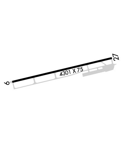
  • Runway Identifications
    Runway Identification: 09/27
    Length: 4301 ft
    Width: 75 ft
    Surface: ASPHALT-GOOD CONDITION
    Edge lights: Medium Intensity

    Treatment: NONE

     Runway: 09   Runway: 27
    Mag heading: 89°Mag heading: 270°
    Rwy Slope: -.54% DownRwy Slope: .54% Up
    Approach: Approach:
    Pattern: Left TrafficPattern: Right Traffic
    Markings: NONPRECISION INSTRUMENTMarkings: BASIC
    Marking Condition: GOODMarking Condition: GOOD
    Arresting Dev: Arresting Dev:
    Lat & Long: N1808.0  W06530.0Lat. & Long.: N1808.2  W06529.3
    Elev: 48.8 ft. MSLElev: 25.6 ft. MSL
    TCH: 46 ft. AGLTCH:
    Visual Glide Path: 3.00 degreesVisual Glide Path:
    Displaced Threshold: 896 feet; DSPLCD THLD MARKED AT 207 FT. NO THLD LIGHTS.Displaced Threshold: No
    Touchdown Zone: YESTouchdown Zone: YES
    Touchdown Elev.: 48.8 feetTouchdown Elev.: 25.6 feet
    Visual Glide Slope: 4-Light PAPI on LEFT side of RunwayVisual Glide Slope:
    RVR Equipment: RVR Equipment:
    RVV Equipment: NORVV Equipment: NO
    Approach Lights: Approach Lights:
    REIL: NOREIL: NO
    Centerline Lights: NOCenterline Lights: NO
    Touchdown lights: NOTouchdown lights: NO
    Runway Category: Runway with a Non-precision Approach having visibility minimums greater than 3/4 mileRunway Category: Runway with a Visual Approach
    Declared Distances: TORA:4301' TODA:4301' ASDA:4301' LDA:3405'Declared Distances: TORA:4301' TODA:4301' ASDA:4301' LDA:3405'
    Obstructions: TREES; ALSO 30 FT. TREES, 201 FT DSTC, 240 FT. L.Obstructions: ROAD
    Marked: NOT Marked/LightedMarked: NOT Marked/Lighted
    Clearance slope: APCH RATIO 0:1 AT DSPLCD THLD OVER 15 FT TREES, 0 FT DSTC, 165 FT L.Clearance slope:
    Obstruction height: 15 feet AGLObstruction height: 15 feet AGL
    Dist. from runway: 201 feetDist. from runway: 201 feet
    Centerline offset: 70 left of centerlineCenterline offset: 200 feet left of centerline
    Comments: 15 FT. TREES, 0-199 FT. DSTC, 130 FT. L.Comments: 15 FT. TREES, 0-199 FT. DSTC, 145 FT. R, 138 FT. R.
    C:1/P: