
| |||||||||||||||||||||||||||||||||||||||||||||||||||||||||||||
| |||||||||||||||||||||||||||||||||||||||||||||||||||||||||||||
| |||||||||||||||||||||||||||||||||||||||||||||||||||||||||||||
| |||||||||||||||||||||||||||||||||||||||||||||||||||||||||||||
| Rwy | Rwy | |||||||
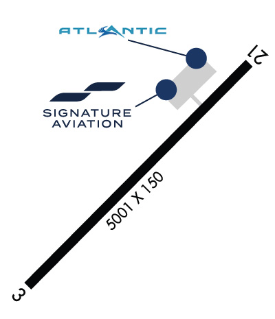
| 5001x150 | 5001' | 111.10 - 033° | 5001x150 | 5001' | ||||
| Runway ID | Single Wheel | Double Wheel | Double Tandem Wheel | Dual Double Wheel |
| 03/21 | 75,000 | 110,000 | 170,000 | N/A |
| These numbers are Advisory and are not limits. The Airport Manager should have more accurate Weight Limits | ||||
 Airport Diagram might not be current. | |
| Facility Name: | LANAI |
| City Name: | LANAI CITY |
| County: | MAUI |
| State abbrev: | HI |
| State Name: | HAWAII |
| Ownership: | PUBLICLY OWNED |
| Use: | OPEN TO THE PUBLIC |
| Owner's Name: | HAWAII ST ARPTS DIV |
| Address: | HONOLULU INTL ARPT |
| HONOLULU, HI 96819 | |
| Owner's Phone: | 808-836-6432 |
| Manager's Name: | MARVIN MONIZ; ARPT OPNS/MAINT MAN/AOM/MR. ALAN FERNANDEZ PHONE 565-7942, CELL PHONE 281-9899. |
| Address: | KAHULUI ARPT |
| KAHULUI, HI 96732 | |
| Phone: | 808-872-3830 |
| FAA Region: | WESTERN-PACIFIC |
| FAA Field Office: | HNL |
| Date | Sunrise | Sunset |
|---|---|---|
| 04/17/24 Wednesday | 6:07 | 18:48 |
| 04/18/24 Thursday | 6:06 | 18:48 |
| 04/19/24 Friday | 6:05 | 18:48 |
| 04/20/24 Saturday | 6:05 | 18:49 |
| 04/21/24 Sunday | 6:04 | 18:49 |
| 04/22/24 Monday | 6:03 | 18:49 |
| 04/23/24 Tuesday | 6:02 | 18:50 |
| 04/24/24 Wednesday | 6:02 | 18:50 |
| 04/25/24 Thursday | 6:01 | 18:51 |
| 04/26/24 Friday | 6:00 | 18:51 |
| 04/27/24 Saturday | 6:00 | 18:51 |
| 04/28/24 Sunday | 5:59 | 18:52 |
| 04/29/24 Monday | 5:58 | 18:52 |
| 04/30/24 Tuesday | 5:58 | 18:52 |
| Airport Attendance Schedule | 7 Days A Week 0600-1800 |
| Airport Status | OPERATIONAL (This Status can change at any time - please check NOTAMS) |
| Airport Lighting Schedule | ACTVT PAPI RWY 3 & 21; MIRL RWY 03/21 - CTAF.; DUSK-DAWN. |
| Airport Storage Available | Tie Downs |
| Extra Services Available | Air Freight, Cargo Handling |
| Wind Indicator | YES - (lighted) |
| Control Tower | NO |
| CTAF Frequency | 122.900 |
| Unicom Frequency | |
| Rotating Beacon Color | WG |
| Segmented Circle | NO |
| Landing Fee | NO |
| Airport Inspected | FEDERAL - performed by FAA AIRPORTS FIELD PERSONNEL |
| Inspection Date | 02/24/2022 |
| Type of Fuel Available | JET A (freeze point -40C); -A JET A FUEL 5000 GAL. POC: MIKE HANOC 808-286-7075 |
| Airframe Repair Service | NONE |
| Power Plant Repair Service | NONE |
| Latitude | N2047.1 |
| Longitude | W15657.1 (ESTIMATED) |
| Arpt Elevation | 1308ft (SURVEYED) |
| Magnetic Variation | 11E |
| 3 miles SW | of LANAI CITY |
| Traffic Pattern Altitude | |
| Sectional Chart | HAWAIIAN ISLANDS |
| Operations (Reported) | Yearly | Avg. Daily |
|---|---|---|
| General Aviation Transient | 150 | 0 |
| General Aviation Local | 400 | 1 |
| Air Taxi | 4118 | 11 |
| Commerical | 1588 | 4 |
| Commuter | 0 | 0 |
| Military | 70 | 0 |
| Aircraft based on Field | |
|---|---|
| General Aviation Singles | 0 |
| General Aviation Multi | 0 |
| Jet Aircraft | 0 |
| General Aviation Helicopters | 0 |
| Military Aircraft | 0 |
| Gliders | 0 |
| Ultralights | 0 |
| FSS on field | NO |
| FSS tie-in | HONOLULU |
| FSS Phone | 1-800-WX-BRIEF |
| Who issues Notams | LNY |
| Notam D service at airport | YES |
| ARTCC Name | HONOLULU CONTROL FACILITY |
| Airport Certification | AIRPORT RECEIVING SCHEDULED AIR CARRIER SERVICE FROM CARRIERS CERTIFICATED BY THE CIVIL AERONAUTICS BOARD; ARPT CLOSED TO AIR CARRIER OPS WITH 10 OR MORE PASSENGER SEATS 1930-0600 EXCEPT PPR, CALL 808-565-7942. |
| Aircraft Rescue & Firefighting Index | AIRPORT HAS A CERTIFICATE UNDER CFR PART 139 |
| Airport of Entry | No |
| Custom Landing Rights | No |
| Joint Civil/Military | No |
| Military Landing rights | YES |
| NATIONAL PLAN OF INTEGRATED AIRPORT SYSTEMS (NPIAS) |
| GRANT AGREEMENTS UNDER FAAP/ADAP/AIP |
| ASSURANCES PURSUANT TO TITLE VI, CIVIL RIGHTS ACT OF 1964 |
| THIS AIRPORT HAS BEEN SURVEYED BY THE NATIONAL GEODETIC SURVEY. |
| SEE AREA NOTICES, TFC ADVYS AT NON-TWR ARPTS. |
| FIXED WING TSNT PRKG NE SIDE OF RAMP IS ASPH. |
| FOR CD IF UNA TO CTC ON FSS FREQ, CTC HONOLULU CONTROL FACILITY AT 808-840-6262. |
| 24 HRS PPR FOR DIVISION 1.1,1.2,1.3 EXPLOSIVES AND 4 HRS PPR FOR HAZARDOUS MATERIAL IN/OUT OF ARPT CTC 808-565-7941/7943. |
| DUE TO RAMP LIMITATIONS ALL ACFT PARKING LIMITED TO ONE HR EXCP VIA PPR CALL 808-565-7942; FAX 808-565-7940 OR 808-872-3880. |
| JET PRKG SW SIDE OF RAMP IS CONC. |
| POSSIBLE SEVERE UPDRAFTS/DOWNDRAFTS FROM 2 MILE FINAL APPROACH TO RUNWAY 3 THRESHHOLD. |
Airport Communications & Frequencies:
| |||||||
| Runway: 03 | Runway: 21 | ||
| Mag heading: | 33° | Mag heading: | 213° |
| Rwy Slope: | .03% Up | Rwy Slope: | -.03% Down |
| Approach: | ILS/DME | Approach: | |
| Pattern: | Left Traffic | Pattern: | Left Traffic |
| Markings: | PRECISION INSTRUMENT | Markings: | NONPRECISION INSTRUMENT |
| Marking Condition: | GOOD | Marking Condition: | GOOD |
| Arresting Dev: | Arresting Dev: | ||
| Lat & Long: | N2046.8 W15657.4 | Lat. & Long.: | N2047.4 W15656.8 |
| Elev: | 1306.6 ft. MSL | Elev: | 1308.1 ft. MSL |
| TCH: | 49 ft. AGL | TCH: | 45 ft. AGL |
| Visual Glide Path: | 3.00 degrees | Visual Glide Path: | 3.76 degrees |
| Displaced Threshold: | No | Displaced Threshold: | No |
| Touchdown Zone: | YES | Touchdown Zone: | YES |
| Touchdown Elev.: | 1306.6 feet | Touchdown Elev.: | 1308.1 feet |
| Visual Glide Slope: | 4-Light PAPI on RIGHT side of Runway | Visual Glide Slope: | 4-Light PAPI on LEFT side of Runway; PAPI UNUSBL BYD 2 NM DUE TO TRRN. |
| RVR Equipment: | RVR Equipment: | ||
| RVV Equipment: | NO | RVV Equipment: | NO |
| Approach Lights: | Approach Lights: | ||
| REIL: | NO | REIL: | NO |
| Centerline Lights: | NO | Centerline Lights: | NO |
| Touchdown lights: | NO | Touchdown lights: | NO |
| Runway Category: | Precision Instrument Runway | Runway Category: | Runway with a Visual Approach |
| Declared Distances: | TORA:5000' TODA:5000' ASDA:5000' LDA:5000' | Declared Distances: | TORA:5000' TODA:5000' ASDA:5000' LDA:5000' |
| Obstructions: | Obstructions: | ANT | |
| Marked: | Marked: | NOT Marked/Lighted | |
| Clearance slope: | 50:1 | Clearance slope: | 40:1 |
| Obstruction height: | Obstruction height: | 20 feet AGL | |
| Dist. from runway: | Dist. from runway: | 1000 feet | |
| Centerline offset: | Centerline offset: | 250 feet right of centerline | |
| Comments: | Comments: |

