
| ||||||||||||||||||||||||||||||||
| ||||||||||||||||||||||||||||||||
| ||||||||||||||||||||||||||||||||
| ||||||||||||||||||||||||||||||||
| Rwy | Rwy | |||||||
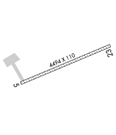
| 4494x110 | 4494' | 4494x110 | 4494' | |||||
| Runway ID | Single Wheel | Double Wheel | Double Tandem Wheel | Dual Double Wheel |
| 06/24 | N/A | N/A | N/A | N/A |
| These numbers are Advisory and are not limits. The Airport Manager should have more accurate Weight Limits | ||||
 Airport Diagram might not be current. | |
| Facility Name: | WAINWRIGHT |
| City Name: | WAINWRIGHT |
| County: | BARROW |
| State abbrev: | AK |
| State Name: | ALASKA |
| Ownership: | PUBLICLY OWNED |
| Use: | OPEN TO THE PUBLIC |
| Owner's Name: | NORTH SLOPE BOROUGH |
| Address: | BOX 69 |
| BARROW, AK 99723 | |
| Owner's Phone: | 907-852-2611 |
| Manager's Name: | GEORGE AHMAOGAK |
| Address: | BOX 69 |
| BARROW, AK 99723 | |
| Phone: | 907-852-0489; X-342 |
| FAA Region: | ALASKA |
| FAA Field Office: | NONE |
| Date | Sunrise | Sunset |
|---|---|---|
| 04/23/24 Tuesday | 5:41 | 23:38 |
| 04/24/24 Wednesday | 5:36 | 23:43 |
| 04/25/24 Thursday | 5:30 | 23:49 |
| 04/26/24 Friday | 5:24 | 23:54 |
| 04/27/24 Saturday | 5:18 | 24:00 |
| 04/28/24 Sunday | 5:12 | 24:06 |
| 04/29/24 Monday | 5:05 | 24:12 |
| 04/30/24 Tuesday | 4:59 | 24:18 |
| 05/01/24 Wednesday | 4:52 | 24:25 |
| 05/02/24 Thursday | 4:46 | 24:32 |
| 05/03/24 Friday | 4:39 | 24:39 |
| 05/04/24 Saturday | 4:31 | 24:46 |
| 05/05/24 Sunday | 4:24 | 24:54 |
| 05/06/24 Monday | 4:16 | 1:02 |
| Airport Attendance Schedule | UNATTENDED |
| Airport Status | OPERATIONAL (This Status can change at any time - please check NOTAMS) |
| Airport Lighting Schedule | ACTVT REIL RWY 06 & 24; PAPI RWY 06 & 24; MIRL RWY 06/24 - CTAF. |
| Airport Storage Available | NONE |
| Extra Services Available | Cargo Handling |
| Wind Indicator | YES - (lighted) |
| Control Tower | NO |
| CTAF Frequency | 122.800 |
| Unicom Frequency | |
| Rotating Beacon Color | WG |
| Segmented Circle | YES |
| Landing Fee | NO |
| Airport Inspected | FEDERAL - performed by PRIVATE CONTRACT PERSONNEL |
| Inspection Date | 06/27/2021 |
| Type of Fuel Available | None |
| Airframe Repair Service | None |
| Power Plant Repair Service | None |
| Latitude | N7038.3 |
| Longitude | W15959.7 (ESTIMATED) |
| Arpt Elevation | 45ft (SURVEYED) |
| Magnetic Variation | 12E |
| 1 miles SE | of WAINWRIGHT |
| Traffic Pattern Altitude | |
| Sectional Chart | CAPE LISBURNE |
| Operations (Reported) | Yearly | Avg. Daily |
|---|---|---|
| General Aviation Transient | 300 | 1 |
| General Aviation Local | 0 | 0 |
| Air Taxi | 800 | 2 |
| Commerical | 0 | 0 |
| Commuter | 0 | 0 |
| Military | 0 | 0 |
| Aircraft based on Field | |
|---|---|
| General Aviation Singles | 0 |
| General Aviation Multi | 0 |
| Jet Aircraft | 0 |
| General Aviation Helicopters | 0 |
| Military Aircraft | 0 |
| Gliders | 0 |
| Ultralights | 0 |
| FSS on field | NO |
| FSS tie-in | BARROW |
| FSS Phone | 852-2511 (Local call) |
| Nearby FSS | FAIRBANKS |
| Phone | 1-800-866-248-6516 |
| Who issues Notams | AWI |
| Notam D service at airport | YES |
| ARTCC Name | ANCHORAGE |
| Airport Certification | |
| Aircraft Rescue & Firefighting Index | None |
| Airport of Entry | No |
| Custom Landing Rights | No |
| Joint Civil/Military | No |
| Military Landing rights | YES |
| NATIONAL PLAN OF INTEGRATED AIRPORT SYSTEMS (NPIAS) |
| ASSURANCES PURSUANT TO TITLE VI, CIVIL RIGHTS ACT OF 1964 |
| GRANT AGREEMENT HAS EXPIRED; HOWEVER, AGREEMENT REMAINS IN EFFECT FOR THIS FACILITY AS LONG AS IT IS PUBLIC USE. |
| RWY COND UNMNT; RCMD VISUAL INSP PRIOR TO USE. |
| BIRDS ON & INVOF ARPT. |
| BARROW FSS - 1-800-779-7709. |
| RAMP & TWY SFC SOFT; RUTS & PONDING PSBL. |
| WX CAMERA AVBL ON INTERNET AT HTTPS://WEATHERCAMS.FAA.GOV |
| RWY 06/2 4 40 FT TWR 500 FT N OF RWY. |
Airport Communications & Frequencies:
| |||||||
| Runway: 06 | Runway: 24 | ||
| Mag heading: | 55° | Mag heading: | 235° |
| Rwy Slope: | -.04% Down | Rwy Slope: | .04% Up |
| Approach: | Approach: | ||
| Pattern: | Left Traffic | Pattern: | Left Traffic |
| Markings: | Markings: | ||
| Marking Condition: | Marking Condition: | ||
| Arresting Dev: | Arresting Dev: | ||
| Lat & Long: | N7038.1 W16000.7 | Lat. & Long.: | N7038.4 W15958.7 |
| Elev: | 41.5 ft. MSL | Elev: | 39.7 ft. MSL |
| TCH: | 31 ft. AGL | TCH: | 30 ft. AGL |
| Visual Glide Path: | 3.00 degrees | Visual Glide Path: | 3.00 degrees |
| Displaced Threshold: | No | Displaced Threshold: | No |
| Touchdown Zone: | YES | Touchdown Zone: | YES |
| Touchdown Elev.: | 45.1 feet | Touchdown Elev.: | 45.1 feet |
| Visual Glide Slope: | 4-Light PAPI on LEFT side of Runway | Visual Glide Slope: | 4-Light PAPI on RIGHT side of Runway |
| RVR Equipment: | RVR Equipment: | ||
| RVV Equipment: | NO | RVV Equipment: | NO |
| Approach Lights: | Approach Lights: | ||
| REIL: | YES | REIL: | YES |
| Centerline Lights: | NO | Centerline Lights: | NO |
| Touchdown lights: | NO | Touchdown lights: | NO |
| Runway Category: | Runway with a Non-precision Approach having visibility minimums greater than 3/4 mile | Runway Category: | Runway with a Non-precision Approach having visibility minimums greater than 3/4 mile |
| Declared Distances: | Declared Distances: | ||
| Obstructions: | ANT | Obstructions: | |
| Marked: | NOT Marked/Lighted | Marked: | |
| Clearance slope: | 30:1 | Clearance slope: | 50:1 |
| Obstruction height: | 75 feet AGL | Obstruction height: | |
| Dist. from runway: | 2320 feet | Dist. from runway: | |
| Centerline offset: | 1118 left of centerline | Centerline offset: | |
| Comments: | Comments: |
