
| ||||||||||||||||||||||||||||||||
| ||||||||||||||||||||||||||||||||
| Rwy | Rwy | |||||||
| 6500x150 | 6500' | 109.50 - 057° | 6500x150 | 6500' | ||||
| Runway ID | Single Wheel | Double Wheel | Double Tandem Wheel | Dual Double Wheel |
| 06/24 | 75,000 | 200,000 | 300,000 | N/A |
| These numbers are Advisory and are not limits. The Airport Manager should have more accurate Weight Limits | ||||
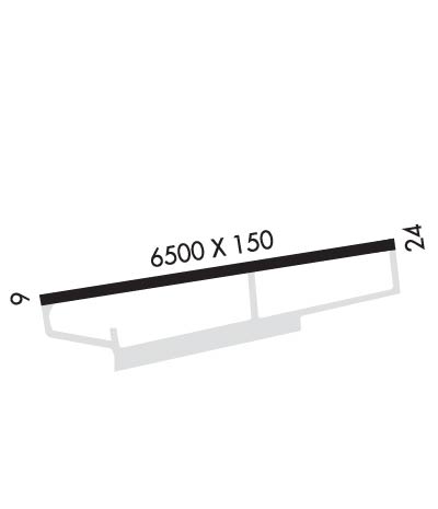 Airport Diagram might not be current. | |
| Facility Name: | VALDEZ PIONEER FLD |
| City Name: | VALDEZ |
| County: | VALDEZ-CORDOVA |
| State abbrev: | AK |
| State Name: | ALASKA |
| Ownership: | PUBLICLY OWNED |
| Use: | OPEN TO THE PUBLIC |
| Owner's Name: | ALASKA DOT&PF NORTHERN REGION |
| Address: | 2301 PEGER ROAD |
| FAIRBANKS, AK 99709 | |
| Owner's Phone: | 907-451-5217 |
| Manager's Name: | TODD BISCHOFF DIMOND |
| Address: | BOX 507 |
| VALDEZ, AK 99686 | |
| Phone: | 907-835-5658 |
| FAA Region: | ALASKA |
| FAA Field Office: | NONE |
| Date | Sunrise | Sunset |
|---|---|---|
| 04/30/24 Tuesday | 5:36 | 21:49 |
| 05/01/24 Wednesday | 5:34 | 21:52 |
| 05/02/24 Thursday | 5:31 | 21:54 |
| 05/03/24 Friday | 5:28 | 21:57 |
| 05/04/24 Saturday | 5:25 | 22:00 |
| 05/05/24 Sunday | 5:22 | 22:02 |
| 05/06/24 Monday | 5:20 | 22:05 |
| 05/07/24 Tuesday | 5:17 | 22:08 |
| 05/08/24 Wednesday | 5:14 | 22:10 |
| 05/09/24 Thursday | 5:11 | 22:13 |
| 05/10/24 Friday | 5:09 | 22:15 |
| 05/11/24 Saturday | 5:06 | 22:18 |
| 05/12/24 Sunday | 5:03 | 22:20 |
| 05/13/24 Monday | 5:01 | 22:23 |
| Airport Attendance Schedule | JAN-DEC MON - FRI 0600-1830, JAN-DEC SAT & SUN 0800-1830 |
| Airport Status | OPERATIONAL (This Status can change at any time - please check NOTAMS) |
| Airport Lighting Schedule | ACTVT MALSR RWY 06; REIL RWY 24; PAPI RWY 06; HIRL RWY 06/24 - CTAF. |
| Airport Storage Available | NONE |
| Extra Services Available | Cargo Handling |
| Wind Indicator | YES - (lighted) |
| Control Tower | NO |
| CTAF Frequency | 122.900 |
| Unicom Frequency | |
| Rotating Beacon Color | WG |
| Segmented Circle | YES |
| Landing Fee | NO |
| Airport Inspected | FEDERAL - performed by FAA AIRPORTS FIELD PERSONNEL |
| Inspection Date | 07/13/2022 |
| Type of Fuel Available | Grade 100LL, JET A (freeze point -40C); -A PPR - 907-834-6933. |
| Airframe Repair Service | MINOR |
| Power Plant Repair Service | MINOR |
| Latitude | N6108.1 |
| Longitude | W14614.7 (ESTIMATED) |
| Arpt Elevation | 128ft (SURVEYED) |
| Magnetic Variation | 19E |
| 3 miles E | of VALDEZ |
| Traffic Pattern Altitude | |
| Sectional Chart | ANCHORAGE |
| Operations (Reported) | Yearly | Avg. Daily |
|---|---|---|
| General Aviation Transient | 3000 | 8 |
| General Aviation Local | 2500 | 7 |
| Air Taxi | 3800 | 10 |
| Commerical | 500 | 1 |
| Commuter | 0 | 0 |
| Military | 500 | 1 |
| Aircraft based on Field | |
|---|---|
| General Aviation Singles | 25 |
| General Aviation Multi | 1 |
| Jet Aircraft | 0 |
| General Aviation Helicopters | 7 |
| Military Aircraft | 0 |
| Gliders | 0 |
| Ultralights | 2 |
| FSS on field | NO |
| FSS tie-in | JUNEAU |
| FSS Phone | 1-800-866-297-2236 |
| Who issues Notams | VDZ |
| Notam D service at airport | YES |
| ARTCC Name | ANCHORAGE |
| Airport Certification | AIRPORT RECEIVING SCHEDULED AIR CARRIER SERVICE FROM CARRIERS CERTIFICATED BY THE CIVIL AERONAUTICS BOARD; CLSD TO ACR OPS MORE THAN 30 PAX SEATS EXC 24 HR PPR IN WRITING - AMGR PO BOX 507 VALDEZ AK 99686; FAX 907-835-5849. |
| Aircraft Rescue & Firefighting Index | AIRPORT HAS A CERTIFICATE UNDER CFR PART 139 |
| Airport of Entry | No |
| Custom Landing Rights | YES |
| Joint Civil/Military | No |
| Military Landing rights | YES |
| NATIONAL PLAN OF INTEGRATED AIRPORT SYSTEMS (NPIAS) |
| GRANT AGREEMENTS UNDER FAAP/ADAP/AIP |
| ASSURANCES PURSUANT TO TITLE VI, CIVIL RIGHTS ACT OF 1964 |
| 1675 X 200 FT SW PTN OF RAMP NOT MNTND NOV 1 - APR 15. |
| MAINT HRS MON-FRI 0600-1830; SAT & SUN 0800-1830. |
| ALERT: DURG STRONG N WIND; MIDFIELD & E END RWY WIND MAY BE MUCH HYR THAN AWOS INDCD. |
| ALERT: SEE SPL NOTICE - PORT VALDEZ AREA & GENOTS - THOMPSON PASS AVALANCHE CTL. |
| POTATO POINT WX CAMERA AVBL ON INTERNET AT HTTPS://WEATHERCAMS.FAA.GOV |
| ARPT SAND LRGR THAN FAA RCMDD/SEE AC150/5200-30. |
| COLD TEMPERATURE AIRPORT. ALTITUDE CORRECTION REQUIRED AT OR BELOW -11C. |
Airport Communications & Frequencies:
| |||||||
| Runway: 06 | Runway: 24 | ||
| Mag heading: | 62° | Mag heading: | 242° |
| Rwy Slope: | 1.09% Up | Rwy Slope: | -1.09% Down |
| Approach: | LDA/DME | Approach: | |
| Pattern: | Right Traffic | Pattern: | Left Traffic |
| Markings: | PRECISION INSTRUMENT | Markings: | NONPRECISION INSTRUMENT |
| Marking Condition: | FAIR | Marking Condition: | FAIR |
| Arresting Dev: | Arresting Dev: | ||
| Lat & Long: | N6108.0 W14615.8 | Lat. & Long.: | N6108.1 W14613.6 |
| Elev: | 57.4 ft. MSL | Elev: | 128.0 ft. MSL |
| TCH: | 29 ft. AGL | TCH: | |
| Visual Glide Path: | 3.00 degrees | Visual Glide Path: | |
| Displaced Threshold: | No | Displaced Threshold: | No |
| Touchdown Zone: | YES | Touchdown Zone: | YES |
| Touchdown Elev.: | 87.2 feet | Touchdown Elev.: | 128.0 feet |
| Visual Glide Slope: | 4-Light PAPI on LEFT side of Runway | Visual Glide Slope: | |
| RVR Equipment: | RVR Equipment: | ||
| RVV Equipment: | NO | RVV Equipment: | NO |
| Approach Lights: | MALSR - 1,400 foot medium intensity approach lighting system with runway alignment indicator lights | Approach Lights: | |
| REIL: | NO | REIL: | YES |
| Centerline Lights: | NO | Centerline Lights: | NO |
| Touchdown lights: | NO | Touchdown lights: | NO |
| Runway Category: | Runway with a Non-precision Approach having visibility minimums greater than 3/4 mile | Runway Category: | Runway with a Non-precision Approach having visibility minimums greater than 3/4 mile |
| Declared Distances: | TORA:6500' TODA:6500' ASDA:6500' LDA:6500' | Declared Distances: | TORA:6500' TODA:6500' ASDA:6500' LDA:6500' |
| Obstructions: | TREES | Obstructions: | TREES |
| Marked: | NOT Marked/Lighted | Marked: | NOT Marked/Lighted |
| Clearance slope: | 34:1 | Clearance slope: | 20:1 |
| Obstruction height: | 55 feet AGL | Obstruction height: | 77 feet AGL |
| Dist. from runway: | 2100 feet | Dist. from runway: | 1580 feet |
| Centerline offset: | Centerline offset: | ||
| Comments: | Comments: |
