
| ||||||||||||||||||||||||||||||||
| ||||||||||||||||||||||||||||||||
| ||||||||||||||||||||||||||||||||
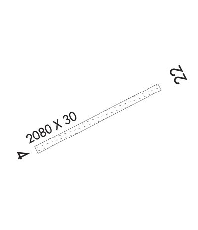
| Rwy | Rwy | |||||||
| 2080x30 | 2080' | 2080x30 | 2080' | |||||
| Runway ID | Single Wheel | Double Wheel | Double Tandem Wheel | Dual Double Wheel |
| 04/22 | N/A | N/A | N/A | N/A |
| These numbers are Advisory and are not limits. The Airport Manager should have more accurate Weight Limits | ||||
| FltPlan does not have IFR approach charts available for PATW. |
 Airport Diagram might not be current. | |
| Facility Name: | CANTWELL |
| City Name: | CANTWELL |
| County: | MATANUSKA-SUSITNA |
| State abbrev: | AK |
| State Name: | ALASKA |
| Ownership: | PRIVATELY OWNED |
| Use: | OPEN TO THE PUBLIC |
| Owner's Name: | BILL SIMMS |
| Address: | 3851 CHINIAK BAY DRIVE |
| ANCHORAGE, AK 99515 | |
| Owner's Phone: | 907-522-3355 |
| Manager's Name: | RAY ATKINS |
| Address: | BOX 22 |
| CANTWELL, AK 99729 | |
| Phone: | 907-768-2143 |
| FAA Region: | ALASKA |
| FAA Field Office: | NONE |
| Date | Sunrise | Sunset |
|---|---|---|
| 04/24/24 Wednesday | 5:53 | 21:56 |
| 04/25/24 Thursday | 5:50 | 21:59 |
| 04/26/24 Friday | 5:46 | 22:02 |
| 04/27/24 Saturday | 5:43 | 22:05 |
| 04/28/24 Sunday | 5:40 | 22:08 |
| 04/29/24 Monday | 5:36 | 22:11 |
| 04/30/24 Tuesday | 5:33 | 22:14 |
| 05/01/24 Wednesday | 5:30 | 22:17 |
| 05/02/24 Thursday | 5:27 | 22:20 |
| 05/03/24 Friday | 5:23 | 22:23 |
| 05/04/24 Saturday | 5:20 | 22:27 |
| 05/05/24 Sunday | 5:17 | 22:30 |
| 05/06/24 Monday | 5:14 | 22:33 |
| 05/07/24 Tuesday | 5:10 | 22:36 |
| Airport Attendance Schedule | UNATTENDED |
| Airport Status | OPERATIONAL (This Status can change at any time - please check NOTAMS) |
| Airport Lighting Schedule | |
| Airport Storage Available | NONE |
| Extra Services Available | Cargo Handling |
| Wind Indicator | YES - (unlit) |
| Control Tower | NO |
| CTAF Frequency | 122.900 |
| Unicom Frequency | |
| Rotating Beacon Color | |
| Segmented Circle | NO |
| Landing Fee |
| Airport Inspected | STATE - performed by STATE AERONAUTICAL PERSONNEL |
| Inspection Date | 08/13/2020 |
| Type of Fuel Available | Grade 100LL; -10 FOR EMERGENCY USE ONLY. |
| Airframe Repair Service | None |
| Power Plant Repair Service | None |
| Latitude | N6323.5 |
| Longitude | W14857.3 (ESTIMATED) |
| Arpt Elevation | 2190ft (ESTIMATED) |
| Magnetic Variation | 27E |
| 0 miles N | of CANTWELL |
| Traffic Pattern Altitude | |
| Sectional Chart | ANCHORAGE |
| Operations (Reported) | Yearly | Avg. Daily |
|---|---|---|
| General Aviation Transient | 1500 | 4 |
| General Aviation Local | 150 | 0 |
| Air Taxi | 200 | 1 |
| Commerical | 0 | 0 |
| Commuter | 0 | 0 |
| Military | 500 | 1 |
| Aircraft based on Field | |
|---|---|
| General Aviation Singles | 3 |
| General Aviation Multi | 0 |
| Jet Aircraft | 0 |
| General Aviation Helicopters | 0 |
| Military Aircraft | 0 |
| Gliders | 0 |
| Ultralights | 0 |
| FSS on field | NO |
| FSS tie-in | KENAI |
| FSS Phone | 1-800-866-864-1737 |
| Who issues Notams | TTW |
| Notam D service at airport | No |
| ARTCC Name | ANCHORAGE |
| Airport Certification | |
| Aircraft Rescue & Firefighting Index | None |
| Airport of Entry | No |
| Custom Landing Rights | No |
| Joint Civil/Military | No |
| Military Landing rights | No |
| RY SUBJECT TO TURBULENT WINDS;HIGH TERRAIN TO THE NE; SW APPROACH FAVORED. |
| ALASKA RAILROAD PARALLELS RY ALONG SOUTH SIDE. |
| ACFT REQUESTED TO TAXI ON RY AND AVOID USE OF SUBDIVISION ROAD PARALLEL TO RY. |
| RY CONDITION MONITORED IREGLY; RCMD VISUAL INSPECTION PRIOR TO LANDING. |
| RY 04 REQUIRES DOGLEG APPROACH DUE TO MOUNTAINOUS TERRAIN. |
| WHEN AVBL WEA RPRTS HRLY ONLY. |
| RY 04 SLOPE AT 2% UPHILL NORTH. |
| WX CAMERA AT SUMMIT APPROX. 10 MI SW AVBL ON INTERNET AT HTTPS://WEATHERCAMS.FAA.GOV |
| RWY 04/2 2 RY 22 LEFT SIDE SLOPES DOWN HILL AND SFC IS UNEVEN. |
| Runway: 04 | Runway: 22 | ||
| Mag heading: | N/A | Mag heading: | N/A |
| Approach: | Approach: | ||
| Pattern: | Right Traffic | Pattern: | Left Traffic |
| Markings: | Markings: | ||
| Marking Condition: | RY EDGES & THLD MARKED WITH ORANGE REFLECTIVE CONES. | Marking Condition: | |
| Arresting Dev: | Arresting Dev: | ||
| Lat & Long: | Lat. & Long.: | ||
| Elev: | N/A | Elev: | N/A |
| TCH: | TCH: | ||
| Visual Glide Path: | Visual Glide Path: | ||
| Displaced Threshold: | No | Displaced Threshold: | No |
| Touchdown Zone: | NO | Touchdown Zone: | NO |
| Touchdown Elev.: | Touchdown Elev.: | ||
| Visual Glide Slope: | Visual Glide Slope: | ||
| RVR Equipment: | RVR Equipment: | ||
| RVV Equipment: | NO | RVV Equipment: | NO |
| Approach Lights: | Approach Lights: | ||
| REIL: | NO | REIL: | NO |
| Centerline Lights: | NO | Centerline Lights: | NO |
| Touchdown lights: | NO | Touchdown lights: | NO |
| Runway Category: | Runway with a Visual Approach | Runway Category: | Runway with a Visual Approach |
| Declared Distances: | Declared Distances: | ||
| Obstructions: | TREES | Obstructions: | ROAD |
| Marked: | NOT Marked/Lighted | Marked: | NOT Marked/Lighted |
| Clearance slope: | Clearance slope: | ||
| Obstruction height: | 25 feet AGL | Obstruction height: | 15 feet AGL |
| Dist. from runway: | 10 feet | Dist. from runway: | 10 feet |
| Centerline offset: | 105 right of centerline | Centerline offset: | 115 feet right of centerline |
| Comments: | Comments: |
