Click here for more info on on SMS!

PASW

SKWENTNA AIRPORT
SKWENTNA
AK
Time Zone: Alaska
Lat: N 6158.0
Long: W 15111.7
Elev: 148
Var: -25
Longest Runway: 3400
CTAF: 122.9

FBO & Flight Services info for PASW

FBOs: Update your Fuel Prices

AIRPORTPh: 907-745-2159
-
-
RUNWAY - GRAVEL
-
-
 
If you are an FBO, call 1-203-262-1700 to update your info or email: FltPlan.Advertising@garmin.com
Advertise your FBO on FltPlan.com

Runway & Approach Info for PASW
Rwy
Length
Land Dist**
Approach*
  Rwy
Length
Land Dist**
Approach*
10
3400x75  3400'          
 
  
28
  3400x75  3400'          
 
 * only ILS, LOC, LDA, and SDF approaches to a specific runway are shown
** For any Declared Landing Distance Available, please see A/FD or Approach plates
Runway Weight Capability (lbs.) Help
Runway IDSingle WheelDouble WheelDouble Tandem WheelDual Double Wheel
10/28N/AN/AN/AN/A
These numbers are Advisory and are not limits.   The Airport Manager should have more accurate Weight Limits
Approach Charts
FltPlan does not have IFR approach charts available for PASW.
Current Weather/Notams
Customs Information Send updates to Support@FltPlan.com
Customs Not Available
Database effective 05/16/2024
Airport Diagram of PASW
Airport Diagram might not be current.

Facility Name: SKWENTNA
City Name: SKWENTNA
County: MATANUSKA-SUSITNA
State abbrev: AK
State Name: ALASKA
   
Ownership: PUBLICLY OWNED
Use: OPEN TO THE PUBLIC
Owner's Name: ALASKA DOT&PF CENTRAL REGION
Address: P.O. BOX 196900
 ANCHORAGE, AK 99519-6900
Owner's Phone: 907-269-0782
  
Manager's Name: KYLER HYLTON
Address: 289 INNER SPRING LOOP
 PALMER, AK 99645
Phone: (907) 745-2159
   
FAA Region: ALASKA
FAA Field Office: NONE


Sunrise / Sunset times for SKWENTNA

DateSunriseSunset
04/25/24 Thursday6:0722:00
04/26/24 Friday6:0422:03
04/27/24 Saturday6:0122:06
04/28/24 Sunday5:5722:08
04/29/24 Monday5:5422:11
04/30/24 Tuesday5:5122:14
05/01/24 Wednesday5:4822:17
05/02/24 Thursday5:4522:19
05/03/24 Friday5:4222:22
05/04/24 Saturday5:3922:25
05/05/24 Sunday5:3622:28
05/06/24 Monday5:3422:31
05/07/24 Tuesday5:3122:33
05/08/24 Wednesday5:2822:36

Airport Facilities

Airport Attendance ScheduleUNATTENDED
Airport Status OPERATIONAL (This Status can change at any time - please check NOTAMS)
Airport Lighting ScheduleACTVT MIRL RWY 10/28; WINDSOCK - CTAF.; ACTVT ROTG BCN - CTAF.
Airport Storage AvailableNONE
Extra Services AvailableCargo Handling
Wind IndicatorYES - (lighted)
Control TowerNO
CTAF Frequency122.900
Unicom Frequency
Rotating Beacon ColorWG
Segmented CircleYES
Landing FeeNO

Airport Inspection Data

Airport InspectedFEDERAL - performed by PRIVATE CONTRACT PERSONNEL
Inspection Date06/11/2021

Airport Services

Type of Fuel AvailableNone
Airframe Repair ServiceNONE
Power Plant Repair ServiceNONE

Geographic Data

LatitudeN6158.0
LongitudeW15111.7 (ESTIMATED)
Arpt Elevation148ft (ESTIMATED)
Magnetic Variation25E
1 miles NEof SKWENTNA
Traffic Pattern Altitude
Sectional ChartANCHORAGE

Aircraft Data

Operations (Reported)YearlyAvg. Daily
General Aviation Transient 25007
General Aviation Local 00
Air Taxi 10003
Commerical 00
Commuter 00
Military 00
Aircraft based on Field
General Aviation Singles 0
General Aviation Multi 0
Jet Aircraft 0
General Aviation Helicopters 0
Military Aircraft 0
Gliders 0
Ultralights 0

FAA Services

FSS on field NO
FSS tie-in KENAI
FSS Phone 1-800-866-864-1737
Who issues Notams SKW
Notam D service at airport YES
ARTCC Name ANCHORAGE

Federal Status

Airport Certification
Aircraft Rescue & Firefighting IndexNone
Airport of EntryNo
Custom Landing RightsNo
Joint Civil/MilitaryNo
Military Landing rightsYES

Federal Agreements

NATIONAL PLAN OF INTEGRATED AIRPORT SYSTEMS (NPIAS)
GRANT AGREEMENTS UNDER FAAP/ADAP/AIP
ASSURANCES PURSUANT TO TITLE VI, CIVIL RIGHTS ACT OF 1964

Remarks

SOFT DURG SPRING THAW; TWO 100 FT TWRS 1.5 NM WEST.
RWY CONDITION UNMONITORED. RECOMMEND VISUAL INSPECTION PRIOR TO LANDING.
WX CAMERA AVBL ON INTERNET AT HTTPS://WEATHERCAMS.FAA.GOV.
ATV ROAD CROSSES RWY 10, 900 FT FM THR.
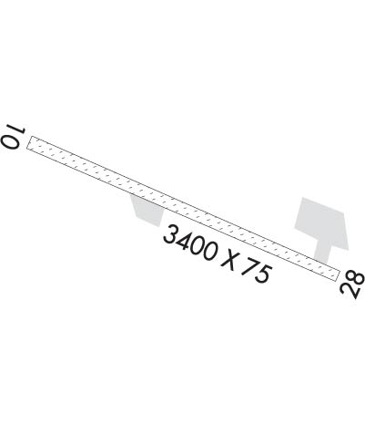
Runway Identifications
Runway Identification: 10/28
Length: 3400 ft
Width: 75 ft
Surface: GRAVEL-GOOD CONDITION
Edge lights: Medium Intensity

Treatment: NONE

 Runway: 10   Runway: 28
Mag heading: 91°Mag heading: 271°
Rwy Slope: .00%Rwy Slope: .00%
Approach: Approach:
Pattern: Left TrafficPattern: Left Traffic
Markings: NONSTANDARDMarkings: NONSTANDARD
Marking Condition: GOOD; NSTD MKGS RWY 10 & 28 MKD WITH REFLECTIVE CONES. THRS MARKED WITH REFLECTIVE PANELS.Marking Condition: GOOD
Arresting Dev: Arresting Dev:
Lat & Long: N6158.1  W15112.3Lat. & Long.: N6157.8  W15111.2
Elev: 148.0 ft. MSLElev: 148.0 ft. MSL
TCH: TCH:
Visual Glide Path: Visual Glide Path:
Displaced Threshold: NoDisplaced Threshold: No
Touchdown Zone: NOTouchdown Zone: NO
Touchdown Elev.: Touchdown Elev.:
Visual Glide Slope: Visual Glide Slope:
RVR Equipment: RVR Equipment:
RVV Equipment: NORVV Equipment: NO
Approach Lights: Approach Lights:
REIL: NOREIL: NO
Centerline Lights: NOCenterline Lights: NO
Touchdown lights: NOTouchdown lights: NO
Runway Category: Runway with a Visual ApproachRunway Category: Runway with a Visual Approach
Declared Distances: Declared Distances:
Obstructions: BRUSH; 200 FT WIDE PATH CUT THROUGH TREES TO APCH.Obstructions: BRUSH
Marked: NOT Marked/LightedMarked: NOT Marked/Lighted
Clearance slope: Clearance slope:
Obstruction height: 9 feet AGLObstruction height: 8 feet AGL
Dist. from runway: 0 feetDist. from runway: 0 feet
Centerline offset: 87 right of centerlineCenterline offset: 89 feet right of centerline
Comments: Comments:
C:/P: