
| ||||||
| ||||||
| ||||||
|
| Rwy | Rwy | |||||||
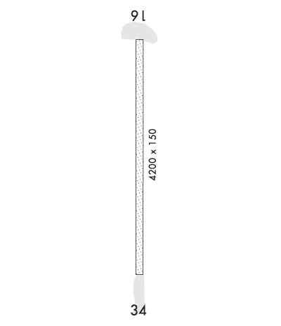
| 4200x150 | 4200' | 4200x150 | 4200' | |||||
| Runway ID | Single Wheel | Double Wheel | Double Tandem Wheel | Dual Double Wheel |
| 16/34 | N/A | N/A | N/A | N/A |
| These numbers are Advisory and are not limits. The Airport Manager should have more accurate Weight Limits | ||||
 Airport Diagram might not be current. | |
| Facility Name: | SPARREVOHN LRRS |
| City Name: | SPARREVOHN |
| County: | KUSKOKWIM |
| State abbrev: | AK |
| State Name: | ALASKA |
| Ownership: | AIR FORCE OWNED |
| Use: | PRIVATE; CLOSED TO THE PUBLIC. OFFICIAL BUSINESS ONLY. |
| Owner's Name: | US AIR FORCE |
| Address: | 611 AIR SUPPORT GROUP, 10471 20TH STREET, SUITE 361 |
| ELMENDORF AFB, AK 99506-2150 | |
| Owner's Phone: | 907-552-3442 |
| Manager's Name: | NICK HILTON; DEPUTY INSTALLATION MANAGER. |
| Address: | 611 AIR SUPPORT SQUADRON, 10471 20TH STREET, SUITE 222 |
| ELMENDORF AFB, AK 99506-2270 | |
| Phone: | 907-552-4400 |
| FAA Region: | ALASKA |
| FAA Field Office: | NONE |
| Date | Sunrise | Sunset |
|---|---|---|
| 04/18/24 Thursday | 6:50 | 21:55 |
| 04/19/24 Friday | 6:47 | 21:57 |
| 04/20/24 Saturday | 6:44 | 22:00 |
| 04/21/24 Sunday | 6:41 | 22:03 |
| 04/22/24 Monday | 6:38 | 22:05 |
| 04/23/24 Tuesday | 6:35 | 22:08 |
| 04/24/24 Wednesday | 6:32 | 22:10 |
| 04/25/24 Thursday | 6:29 | 22:13 |
| 04/26/24 Friday | 6:26 | 22:16 |
| 04/27/24 Saturday | 6:23 | 22:18 |
| 04/28/24 Sunday | 6:20 | 22:21 |
| 04/29/24 Monday | 6:17 | 22:24 |
| 04/30/24 Tuesday | 6:14 | 22:26 |
| 05/01/24 Wednesday | 6:11 | 22:29 |
| Airport Attendance Schedule | MON-FRI 0800-1700 CLSD WKEND & HOLS. |
| Airport Status | OPERATIONAL (This Status can change at any time - please check NOTAMS) |
| Airport Lighting Schedule | |
| Airport Storage Available | NONE |
| Extra Services Available | NONE |
| Wind Indicator | YES - (unlit) |
| Control Tower | NO |
| CTAF Frequency | 126.200 |
| Unicom Frequency | |
| Rotating Beacon Color | |
| Segmented Circle | NO |
| Landing Fee | NO |
| Airport Inspected | No Inspection Data Available performed by the OWNER |
| Inspection Date | 07/17/1978 |
| Type of Fuel Available | None |
| Airframe Repair Service | NONE |
| Power Plant Repair Service | NONE |
| Latitude | N6105.8 |
| Longitude | W15534.5 (ESTIMATED) |
| Arpt Elevation | 1565ft (SURVEYED) |
| Magnetic Variation | 15E |
| 0 miles S | of SPARREVOHN |
| Traffic Pattern Altitude | |
| Sectional Chart | MC GRATH |
| Operations (Reported) | Yearly | Avg. Daily |
|---|---|---|
| General Aviation Transient | 240 | 1 |
| General Aviation Local | 0 | 0 |
| Air Taxi | 0 | 0 |
| Commerical | 0 | 0 |
| Commuter | 0 | 0 |
| Military | 0 | 0 |
| Aircraft based on Field | |
|---|---|
| General Aviation Singles | 0 |
| General Aviation Multi | 0 |
| Jet Aircraft | 0 |
| General Aviation Helicopters | 0 |
| Military Aircraft | 0 |
| Gliders | 0 |
| Ultralights | 0 |
| FSS on field | NO |
| FSS tie-in | KENAI |
| FSS Phone | 1-800-866-864-1737 |
| Who issues Notams | PASV |
| Notam D service at airport | YES |
| ARTCC Name | ANCHORAGE |
| Airport Certification | |
| Aircraft Rescue & Firefighting Index | None |
| Airport of Entry | No |
| Custom Landing Rights | No |
| Joint Civil/Military | No |
| Military Landing rights | No |
| RWY LCTD ON SLOPE OF 3200' MTN; ARPT SURROUNDED BY MTNS. |
| ALL MIL, GOVT AND CIV ACFT OPERATORS SHALL OBTAIN A PPR CTL NR A MIN OF 1-HR PRIOR TO DEP FOR SITE, REQUEST NO EARLIER THAN DAY OF PLANNED TRAVEL, CTC SITE PERSONNEL AT: DSN 317-552-1244/1157 C907-552-1244/1157. |
| PASSENGERS MUST COORDINATE ALL TRAVEL WITH ARS PROGRAM MANAGEMENT (DSN 317-552-4400/9630 OR C907-552-4400/9630) PRIOR TO ANY NON-EMERGENCY TRAVEL TO THE SITE. |
| CALP CTC NRS DSN:317-552-1448/4176 OR C907 552-1448/4176 E-MAIL: AKLANDINGPERMITS@ELMENDORF.AF.MIL. AFI 10-1001 IS NOW LCTD AT: HTTP://WWW.E-PUBLISHING.AF.MIL/SHARED/MEDIA/EPUBS/AFI10-1001.PDF. MAIL CALP APPLICATION TO: ATTN: 11 AF AIRFIELD MANAGER 10471 20TH STREET SUITE 231 ELMENDORF AFB AK 99506. |
| CONTACT 11 AF AIRFIELD MANAGER FOR PERMITS 907-552-1448/4176. |
| WINDS IN EXCESS OF20 KT /RADOME WINDS 25 KT/ MAY PRODUCE SEVER TURBC; RADOME WINDS NOT ALWAYS AVBL. |
| TKOF RWY 16 ONLY; APCH FM S LND RWY 34 ONLY; SUCCESSFUL GO-AROUND IMPROBABLE; DAYLIGHT OPNS ONLY. |
| 60' OVERRUN S END OF RWY 16/34. |
| AFT INITIAL RDO CTC ON FREQ 126.2 OR 121.5 EXPECT A 30 MIN DELAY FOR CURRENT AIRSTRIP COND. |
| RADIO-121.5 (E). |
| USAF INSTALLATION, ALL CIVIL ACFT OPERS REQ CIVIL ACFT LNDG PERMITS PRIOR TO LANDING AT FACILITY. FINES WILL BE LEVIED AGAINST VIOLATORS & REPORTS WILL BE FWDD TO FAA FSDOS IAW 32CFR855 & USAF OPERG INSTRGS. OPERS MUST HAVE ON BOARD A COPY OF CURRENT PERMIT. |
Airport Communications & Frequencies:
| |||||||
| Runway: 16 | Runway: 34 | ||
| Mag heading: | 165° | Mag heading: | 345° |
| Rwy Slope: | -4.76% Down | Rwy Slope: | 4.76% Up |
| Approach: | Approach: | ||
| Pattern: | Left Traffic | Pattern: | Left Traffic |
| Markings: | NONSTANDARD | Markings: | NONSTANDARD |
| Marking Condition: | NSTD MKGS: RYS 16 & 34 MKD WITH 4 FOOT SQ ORANGE MKRS-THLD MKG RIGHT ON RY ENDS. | Marking Condition: | |
| Arresting Dev: | Arresting Dev: | ||
| Lat & Long: | N6106.2 W15534.5 | Lat. & Long.: | N6105.5 W15534.5 |
| Elev: | 1565.0 ft. MSL | Elev: | 1364.9 ft. MSL |
| TCH: | TCH: | 52 ft. AGL | |
| Visual Glide Path: | Visual Glide Path: | 4.00 degrees | |
| Displaced Threshold: | No | Displaced Threshold: | No |
| Touchdown Zone: | YES | Touchdown Zone: | YES |
| Touchdown Elev.: | 1565.0 feet | Touchdown Elev.: | 1476.2 feet |
| Visual Glide Slope: | Visual Glide Slope: | 2-Light PAPI on RIGHT side of Runway | |
| RVR Equipment: | RVR Equipment: | ||
| RVV Equipment: | NO | RVV Equipment: | NO |
| Approach Lights: | Approach Lights: | ||
| REIL: | NO | REIL: | YES |
| Centerline Lights: | NO | Centerline Lights: | NO |
| Touchdown lights: | NO | Touchdown lights: | NO |
| Runway Category: | Runway with a Visual Approach | Runway Category: | Runway with a Visual Approach |
| Declared Distances: | Declared Distances: | ||
| Obstructions: | HILL | Obstructions: | HILL |
| Marked: | NOT Marked/Lighted | Marked: | NOT Marked/Lighted |
| Clearance slope: | 3:1 | Clearance slope: | 10:1 |
| Obstruction height: | Obstruction height: | ||
| Dist. from runway: | 50 feet | Dist. from runway: | 3960 feet |
| Centerline offset: | Centerline offset: | ||
| Comments: | HILL 1413. | Comments: |
