
| ||||||||||||||||||||||||||||||||
| ||||||||||||||||||||||||||||||||
| ||||||||||||||||||||||||||||||||
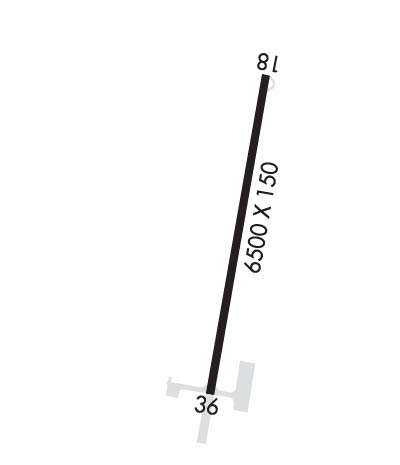
| Rwy | Rwy | |||||||
| 6500x150 | 6500' | 6500x150 | 6500' | 109.90 - 359° | ||||
| Runway ID | Single Wheel | Double Wheel | Double Tandem Wheel | Dual Double Wheel |
| 18/36 | N/A | N/A | N/A | N/A |
| These numbers are Advisory and are not limits. The Airport Manager should have more accurate Weight Limits | ||||
 Airport Diagram might not be current. | |
| Facility Name: | ST PAUL ISLAND |
| City Name: | ST PAUL ISLAND |
| County: | ALEUTIANS WEST |
| State abbrev: | AK |
| State Name: | ALASKA |
| Ownership: | PUBLICLY OWNED |
| Use: | OPEN TO THE PUBLIC |
| Owner's Name: | ALASKA DOT&PF SOUTHCOAST REGION |
| Address: | PO BOX 112506 |
| JUNEAU, AK 99811-2506 | |
| Owner's Phone: | (907) 465-1779 |
| Manager's Name: | DALE RUCKMAN |
| Address: | PO BOX 920525 |
| DUTCH HARBOR, AK 99692 | |
| Phone: | (907) 581-1786; OR 907-546-5000. |
| FAA Region: | ALASKA |
| FAA Field Office: | NONE |
| Date | Sunrise | Sunset |
|---|---|---|
| 04/18/24 Thursday | 8:02 | 22:40 |
| 04/19/24 Friday | 7:59 | 22:42 |
| 04/20/24 Saturday | 7:57 | 22:44 |
| 04/21/24 Sunday | 7:54 | 22:46 |
| 04/22/24 Monday | 7:51 | 22:48 |
| 04/23/24 Tuesday | 7:49 | 22:50 |
| 04/24/24 Wednesday | 7:46 | 22:52 |
| 04/25/24 Thursday | 7:44 | 22:55 |
| 04/26/24 Friday | 7:42 | 22:57 |
| 04/27/24 Saturday | 7:39 | 22:59 |
| 04/28/24 Sunday | 7:37 | 23:01 |
| 04/29/24 Monday | 7:34 | 23:03 |
| 04/30/24 Tuesday | 7:32 | 23:05 |
| 05/01/24 Wednesday | 7:29 | 23:07 |
| Airport Attendance Schedule | UNATTENDED |
| Airport Status | OPERATIONAL (This Status can change at any time - please check NOTAMS) |
| Airport Lighting Schedule | ACTVT MALSF RWY 18 & 36; PAPI RWY 18 & 36; HIRL RWY 18/36- CTAF. |
| Airport Storage Available | NONE |
| Extra Services Available | NONE |
| Wind Indicator | YES - (unlit) |
| Control Tower | NO |
| CTAF Frequency | 122.300 |
| Unicom Frequency | |
| Rotating Beacon Color | WG |
| Segmented Circle | YES |
| Landing Fee | NO |
| Airport Inspected | FEDERAL - performed by PRIVATE CONTRACT PERSONNEL |
| Inspection Date | 08/29/2023 |
| Type of Fuel Available | JET A (freeze point -40C) |
| Airframe Repair Service | NONE |
| Power Plant Repair Service | NONE |
| Latitude | N5710.0 |
| Longitude | W17013.4 (ESTIMATED) |
| Arpt Elevation | 66ft (SURVEYED) |
| Magnetic Variation | 10E |
| 3 miles NE | of ST PAUL ISLAND |
| Traffic Pattern Altitude | |
| Sectional Chart | DUTCH HARBOR |
| Operations (Reported) | Yearly | Avg. Daily |
|---|---|---|
| General Aviation Transient | 0 | 0 |
| General Aviation Local | 0 | 0 |
| Air Taxi | 0 | 0 |
| Commerical | 100 | 0 |
| Commuter | 0 | 0 |
| Military | 100 | 0 |
| Aircraft based on Field | |
|---|---|
| General Aviation Singles | 0 |
| General Aviation Multi | 0 |
| Jet Aircraft | 0 |
| General Aviation Helicopters | 0 |
| Military Aircraft | 0 |
| Gliders | 0 |
| Ultralights | 0 |
| FSS on field | NO |
| FSS tie-in | KENAI |
| FSS Phone | 1-800-866-864-1737 |
| Who issues Notams | SNP |
| Notam D service at airport | YES |
| ARTCC Name | ANCHORAGE |
| Airport Certification | |
| Aircraft Rescue & Firefighting Index | None |
| Airport of Entry | No |
| Custom Landing Rights | No |
| Joint Civil/Military | No |
| Military Landing rights | YES |
| NATIONAL PLAN OF INTEGRATED AIRPORT SYSTEMS (NPIAS) |
| GRANT AGREEMENT HAS EXPIRED; HOWEVER, AGREEMENT REMAINS IN EFFECT FOR THIS FACILITY AS LONG AS IT IS PUBLIC USE. |
| 3 WIND TURBINES APPROX 100 FT TALL 1/4 MILE SOUTHWEST OF RWY 36 APPROACH END. |
| PILOTS ARE REQUESTED TO AVOID FLIGHTS BLW 1000 FT AGL FROM MAY 14 THROUGH SEP 14 IN THOSE AREAS OF ST. PAUL ISLAND WITH ACTIVE BIRD POPULATIONS, AND FLTS BLW 1000 FT AGL FROM SEP 14 THROUGH DEC 14 IN THOSE AREAS OF ST. PAUL ISLAND WITH COASTAL SEAL ROOKERIES. |
| NWS WEATHER BALLOON LAUNCH FACILITY LOCATED ON AIRPORT, SEE INSIDE BACK COVER FOR OPERATION DETAILS. |
| 625 FT LIGHTED TOWER ONE MILE SW. |
| 45 FT TWR 350 FT WEST & 1000 FT NORTH THLD RWY 36 LGTD. |
| WX CAMERA AVBL ON INTERNET AT HTTPS://WEATHERCAMS.FAA.GOV |
| RWY 18/3 6 1000 FT SAFETY AREA ON N AND S END. |
Airport Communications & Frequencies:
| |||||||
| Runway: 18 | Runway: 36 | ||
| Mag heading: | 180° | Mag heading: | 0° |
| Rwy Slope: | -.41% Down | Rwy Slope: | .41% Up |
| Approach: | MLS | Approach: | ILS |
| Pattern: | Left Traffic | Pattern: | Right Traffic |
| Markings: | PRECISION INSTRUMENT | Markings: | PRECISION INSTRUMENT |
| Marking Condition: | GOOD | Marking Condition: | GOOD |
| Arresting Dev: | Arresting Dev: | ||
| Lat & Long: | N5710.5 W17013.2 | Lat. & Long.: | N5709.5 W17013.5 |
| Elev: | 66.2 ft. MSL | Elev: | 39.5 ft. MSL |
| TCH: | 46 ft. AGL | TCH: | 52 ft. AGL |
| Visual Glide Path: | 3.00 degrees | Visual Glide Path: | 3.00 degrees |
| Displaced Threshold: | No | Displaced Threshold: | No |
| Touchdown Zone: | YES | Touchdown Zone: | YES |
| Touchdown Elev.: | 66.4 feet | Touchdown Elev.: | 46.5 feet |
| Visual Glide Slope: | 4-Light PAPI on RIGHT side of Runway | Visual Glide Slope: | 4-Light PAPI on LEFT side of Runway |
| RVR Equipment: | RVR Equipment: | ||
| RVV Equipment: | NO | RVV Equipment: | NO |
| Approach Lights: | MALSF - 1,400 foot medium intensity approach lighting system with sequenced flashers | Approach Lights: | MALSF - 1,400 foot medium intensity approach lighting system with sequenced flashers |
| REIL: | NO | REIL: | NO |
| Centerline Lights: | NO | Centerline Lights: | NO |
| Touchdown lights: | NO | Touchdown lights: | NO |
| Runway Category: | Runway with a Visual Approach | Runway Category: | Precision Instrument Runway |
| Declared Distances: | Declared Distances: | ||
| Obstructions: | ROAD | Obstructions: | FENCE |
| Marked: | NOT Marked/Lighted | Marked: | NOT Marked/Lighted |
| Clearance slope: | Clearance slope: | 32:1 | |
| Obstruction height: | 15 feet AGL | Obstruction height: | 8 feet AGL |
| Dist. from runway: | 200 feet | Dist. from runway: | 460 feet |
| Centerline offset: | Centerline offset: | 520 feet right of centerline | |
| Comments: | 15 FT ROAD, 0 TO 200 FT FROM RWY END BOTH SIDES OF CNTRLN. | Comments: |