
| ||||||||||||||||||||||||||||||||
| ||||||||||||||||||||||||||||||||
| ||||||||||||||||||||||||||||||||
| ||||||||||||||||||||||||||||||||
| Rwy | Rwy | |||||||
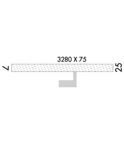
| 3280x75 | 3280' | 3280x75 | 3280' | |||||
| Runway ID | Single Wheel | Double Wheel | Double Tandem Wheel | Dual Double Wheel |
| 07/25 | N/A | N/A | N/A | N/A |
| These numbers are Advisory and are not limits. The Airport Manager should have more accurate Weight Limits | ||||
 Airport Diagram might not be current. | |
| Facility Name: | PILOT POINT |
| City Name: | PILOT POINT |
| County: | LAKE AND PENINSULA |
| State abbrev: | AK |
| State Name: | ALASKA |
| Ownership: | PUBLICLY OWNED |
| Use: | OPEN TO THE PUBLIC |
| Owner's Name: | ALASKA DOT&PF SOUTHCOAST REGION |
| Address: | PO BOX 112500 |
| JUNEAU, AK 99811-2500 | |
| Owner's Phone: | 907-465-4512 |
| Manager's Name: | FLOYD WILSON |
| Address: | PO BOX 65 |
| KING SALMON, AK 99613 | |
| Phone: | 907-246-3325 |
| FAA Region: | ALASKA |
| FAA Field Office: | NONE |
| Date | Sunrise | Sunset |
|---|---|---|
| 04/19/24 Friday | 7:07 | 21:52 |
| 04/20/24 Saturday | 7:05 | 21:55 |
| 04/21/24 Sunday | 7:02 | 21:57 |
| 04/22/24 Monday | 7:00 | 21:59 |
| 04/23/24 Tuesday | 6:57 | 22:01 |
| 04/24/24 Wednesday | 6:54 | 22:03 |
| 04/25/24 Thursday | 6:52 | 22:05 |
| 04/26/24 Friday | 6:49 | 22:08 |
| 04/27/24 Saturday | 6:47 | 22:10 |
| 04/28/24 Sunday | 6:44 | 22:12 |
| 04/29/24 Monday | 6:42 | 22:14 |
| 04/30/24 Tuesday | 6:40 | 22:16 |
| 05/01/24 Wednesday | 6:37 | 22:19 |
| 05/02/24 Thursday | 6:35 | 22:21 |
| Airport Attendance Schedule | UNATTENDED |
| Airport Status | OPERATIONAL (This Status can change at any time - please check NOTAMS) |
| Airport Lighting Schedule | ACTVT PAPI RWY 25; MIRL RWY 07/25 - CTAF. |
| Airport Storage Available | NONE |
| Extra Services Available | NONE |
| Wind Indicator | YES - (lighted) |
| Control Tower | NO |
| CTAF Frequency | 122.900 |
| Unicom Frequency | |
| Rotating Beacon Color | WG |
| Segmented Circle | YES |
| Landing Fee |
| Airport Inspected | FEDERAL - performed by PRIVATE CONTRACT PERSONNEL |
| Inspection Date | 05/23/2021 |
| Type of Fuel Available | None |
| Airframe Repair Service | None |
| Power Plant Repair Service | None |
| Latitude | N5734.8 |
| Longitude | W15734.3 (ESTIMATED) |
| Arpt Elevation | 57ft (SURVEYED) |
| Magnetic Variation | 17E |
| 0 miles NNE | of PILOT POINT |
| Traffic Pattern Altitude | |
| Sectional Chart | KODIAK |
| Operations (Reported) | Yearly | Avg. Daily |
|---|---|---|
| General Aviation Transient | 3000 | 8 |
| General Aviation Local | 500 | 1 |
| Air Taxi | 1800 | 5 |
| Commerical | 0 | 0 |
| Commuter | 0 | 0 |
| Military | 0 | 0 |
| Aircraft based on Field | |
|---|---|
| General Aviation Singles | 3 |
| General Aviation Multi | 0 |
| Jet Aircraft | 0 |
| General Aviation Helicopters | 0 |
| Military Aircraft | 0 |
| Gliders | 0 |
| Ultralights | 0 |
| FSS on field | NO |
| FSS tie-in | KENAI; FOR A TOLL FREE CALL TO KENAI FSS DIAL 1-866-864-1737. |
| FSS Phone | 1-800-866-864-1737 |
| Who issues Notams | PNP |
| Notam D service at airport | YES |
| ARTCC Name | ANCHORAGE |
| Airport Certification | |
| Aircraft Rescue & Firefighting Index | None |
| Airport of Entry | No |
| Custom Landing Rights | No |
| Joint Civil/Military | No |
| Military Landing rights | No |
| NATIONAL PLAN OF INTEGRATED AIRPORT SYSTEMS (NPIAS) |
| GRANT AGREEMENTS UNDER FAAP/ADAP/AIP |
| ASSURANCES PURSUANT TO TITLE VI, CIVIL RIGHTS ACT OF 1964 |
| RWY CONDITIONS NOT MONITORED. RECOMMEND VISUAL INSPECTION PRIOR TO USE. |
| WX CAMERA AVBL ON INTERNET AT HTTPS://WEATHERCAMS.FAA.GOV |
Airport Communications & Frequencies:
| |||||||
| Runway: 07 | Runway: 25 | ||
| Mag heading: | 73° | Mag heading: | 253° |
| Rwy Slope: | .64% Up | Rwy Slope: | -.64% Down |
| Approach: | Approach: | ||
| Pattern: | Left Traffic | Pattern: | Left Traffic |
| Markings: | NONE | Markings: | NONE |
| Marking Condition: | GOOD | Marking Condition: | GOOD |
| Arresting Dev: | Arresting Dev: | ||
| Lat & Long: | N5734.8 W15734.8 | Lat. & Long.: | N5734.8 W15733.8 |
| Elev: | 35.9 ft. MSL | Elev: | 57.0 ft. MSL |
| TCH: | TCH: | 25 ft. AGL | |
| Visual Glide Path: | Visual Glide Path: | 3.00 degrees | |
| Displaced Threshold: | No | Displaced Threshold: | No |
| Touchdown Zone: | YES | Touchdown Zone: | YES |
| Touchdown Elev.: | 57.0 feet | Touchdown Elev.: | 57.0 feet |
| Visual Glide Slope: | Visual Glide Slope: | 4-Light PAPI on LEFT side of Runway | |
| RVR Equipment: | RVR Equipment: | ||
| RVV Equipment: | NO | RVV Equipment: | NO |
| Approach Lights: | Approach Lights: | ||
| REIL: | NO | REIL: | NO |
| Centerline Lights: | NO | Centerline Lights: | NO |
| Touchdown lights: | NO | Touchdown lights: | NO |
| Runway Category: | Runway with a Non-precision Approach | Runway Category: | Runway with a Non-precision Approach |
| Declared Distances: | Declared Distances: |
