
| |||||
|
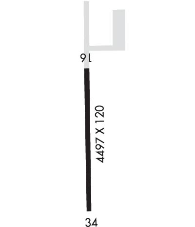
| Rwy | Rwy | |||||||
| 4497x120 | 4497' | 4497x120 | 4497' | |||||
| Runway ID | Single Wheel | Double Wheel | Double Tandem Wheel | Dual Double Wheel |
| 16/34 | 48,000 | 96,000 | 155,000 | N/A |
| These numbers are Advisory and are not limits. The Airport Manager should have more accurate Weight Limits | ||||
| FltPlan does not have IFR approach charts available for PAPC. |
 Airport Diagram might not be current. | |
| Facility Name: | PORT CLARENCE CGS |
| City Name: | PORT CLARENCE |
| County: | NOME |
| State abbrev: | AK |
| State Name: | ALASKA |
| Ownership: | CG |
| Use: | PRIVATE |
| Owner's Name: | US COAST GUARD |
| Address: | USCG LORAN STA PC BOX KPC |
| NOME, AK 99762-8998 | |
| Owner's Phone: | 907-642-3844 |
| Manager's Name: | CMMD OFFICER MATTHEW BOYLE |
| Address: | USCG LORAN STA PC BOX KPC |
| PORT CLARENCE CGS, AK 99762 | |
| Phone: | 907-642-3844; EXTENSION 213. |
| FAA Region: | ALASKA |
| FAA Field Office: | NONE |
| Date | Sunrise | Sunset |
|---|---|---|
| 04/18/24 Thursday | 7:15 | 22:59 |
| 04/19/24 Friday | 7:12 | 23:03 |
| 04/20/24 Saturday | 7:08 | 23:06 |
| 04/21/24 Sunday | 7:04 | 23:09 |
| 04/22/24 Monday | 7:00 | 23:13 |
| 04/23/24 Tuesday | 6:57 | 23:16 |
| 04/24/24 Wednesday | 6:53 | 23:20 |
| 04/25/24 Thursday | 6:49 | 23:23 |
| 04/26/24 Friday | 6:45 | 23:26 |
| 04/27/24 Saturday | 6:42 | 23:30 |
| 04/28/24 Sunday | 6:38 | 23:33 |
| 04/29/24 Monday | 6:34 | 23:37 |
| 04/30/24 Tuesday | 6:31 | 23:40 |
| 05/01/24 Wednesday | 6:27 | 23:44 |
| Airport Attendance Schedule | CONTINUOUS |
| Airport Status | OPERATIONAL (This Status can change at any time - please check NOTAMS) |
| Airport Lighting Schedule | 24 HRS |
| Airport Storage Available | NONE |
| Extra Services Available | NONE |
| Wind Indicator | YES - (unlit) |
| Control Tower | NO |
| CTAF Frequency | 122.800 |
| Unicom Frequency | 122.800 |
| Rotating Beacon Color | |
| Segmented Circle | YES |
| Landing Fee | NO |
| Airport Inspected | 5010-2 PRIVATE USE MAILOUT PROGRAM - performed by the OWNER |
| Inspection Date | 09/09/1992 |
| Type of Fuel Available | None |
| Airframe Repair Service | NONE |
| Power Plant Repair Service | NONE |
| Latitude | N6515.2 |
| Longitude | W16651.5 (ESTIMATED) |
| Arpt Elevation | 10ft (SURVEYED; PER NGA SAC SURVEY.) |
| Magnetic Variation | 16E |
| 1 miles NE | of PORT CLARENCE |
| Traffic Pattern Altitude | |
| Sectional Chart | NOME |
| Operations (Reported) | Yearly | Avg. Daily |
|---|---|---|
| General Aviation Transient | 100 | 0 |
| General Aviation Local | 0 | 0 |
| Air Taxi | 100 | 0 |
| Commerical | 0 | 0 |
| Commuter | 0 | 0 |
| Military | 0 | 0 |
| Aircraft based on Field | |
|---|---|
| General Aviation Singles | 0 |
| General Aviation Multi | 0 |
| Jet Aircraft | 0 |
| General Aviation Helicopters | 0 |
| Military Aircraft | 0 |
| Gliders | 0 |
| Ultralights | 0 |
| FSS on field | NO |
| FSS tie-in | NOME |
| FSS Phone | 1-800-800-478-8400 |
| Nearby FSS | FAIRBANKS |
| Phone | 1-800-866-248-6516 |
| Who issues Notams | |
| Notam D service at airport | No |
| ARTCC Name | ANCHORAGE |
| Airport Certification | |
| Aircraft Rescue & Firefighting Index | None |
| Airport of Entry | No |
| Custom Landing Rights | No |
| Joint Civil/Military | No |
| Military Landing rights | No |
| 1500 FT X 120 FT GRAVEL OVERRUN N END. |
| N-S PREVAILING WINDS. |
| AVBL PPR ONLY. CTC CMDR AT 907-642-3844 OR ON 122.8. |
| MIRL MKD BY 36 INCH BY ONE & HALF INCH DIAMETER YELLOW PLASTIC TUBES IN WINTER CONDS. |
| Runway: 16 | Runway: 34 | ||
| Mag heading: | 164° | Mag heading: | 344° |
| Rwy Slope: | -.11% Down | Rwy Slope: | .11% Up |
| Approach: | Approach: | ||
| Pattern: | Left Traffic | Pattern: | Right Traffic |
| Markings: | BASIC | Markings: | BASIC |
| Marking Condition: | Marking Condition: | ||
| Arresting Dev: | Arresting Dev: | ||
| Lat & Long: | N6515.6 W16651.5 | Lat. & Long.: | N6514.8 W16651.5 |
| Elev: | 8.0 ft. MSL | Elev: | 3.0 ft. MSL |
| TCH: | TCH: | ||
| Visual Glide Path: | Visual Glide Path: | 3.00 degrees | |
| Displaced Threshold: | No | Displaced Threshold: | No |
| Touchdown Zone: | YES | Touchdown Zone: | YES |
| Touchdown Elev.: | 10.0 feet | Touchdown Elev.: | 10.0 feet |
| Visual Glide Slope: | Visual Glide Slope: | 2-Box VASI on LEFT side of Runway | |
| RVR Equipment: | RVR Equipment: | ||
| RVV Equipment: | NO | RVV Equipment: | NO |
| Approach Lights: | Approach Lights: | ||
| REIL: | NO | REIL: | YES |
| Centerline Lights: | NO | Centerline Lights: | NO |
| Touchdown lights: | NO | Touchdown lights: | NO |
| Runway Category: | Runway with a Visual Approach | Runway Category: | Runway with a Visual Approach |
| Declared Distances: | Declared Distances: |
