
| ||||||||||||||||||||||||||||||||
| ||||||||||||||||||||||||||||||||
| ||||||||||||||||||||||||||||||||
| ||||||||||||||||||||||||||||||||
| Rwy | Rwy | |||||||
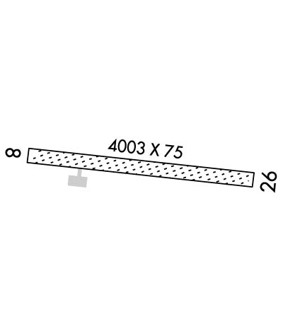
| 4003x75 | 4003' | 4003x75 | 4003' | |||||
| Runway ID | Single Wheel | Double Wheel | Double Tandem Wheel | Dual Double Wheel |
| 08/26 | N/A | N/A | N/A | N/A |
| These numbers are Advisory and are not limits. The Airport Manager should have more accurate Weight Limits | ||||
 Airport Diagram might not be current. | |
| Facility Name: | NELSON LAGOON |
| City Name: | NELSON LAGOON |
| County: | ALEUTIANS EAST |
| State abbrev: | AK |
| State Name: | ALASKA |
| Ownership: | PUBLICLY OWNED |
| Use: | OPEN TO THE PUBLIC |
| Owner's Name: | ALASKA DOT&PF SOUTHCOAST REGION |
| Address: | P.O. BOX 112506 |
| JUNEAU, AK 99811-2506 | |
| Owner's Phone: | (907) 465-1779 |
| Manager's Name: | HAROLD "HAP" KREMER |
| Address: | BOX 97 |
| COLD BAY, AK 99571 | |
| Phone: | (907) 532-2579 |
| FAA Region: | ALASKA |
| FAA Field Office: | NONE |
| Date | Sunrise | Sunset |
|---|---|---|
| 04/19/24 Friday | 7:26 | 22:02 |
| 04/20/24 Saturday | 7:24 | 22:04 |
| 04/21/24 Sunday | 7:22 | 22:06 |
| 04/22/24 Monday | 7:19 | 22:08 |
| 04/23/24 Tuesday | 7:17 | 22:10 |
| 04/24/24 Wednesday | 7:14 | 22:12 |
| 04/25/24 Thursday | 7:12 | 22:14 |
| 04/26/24 Friday | 7:10 | 22:16 |
| 04/27/24 Saturday | 7:07 | 22:18 |
| 04/28/24 Sunday | 7:05 | 22:20 |
| 04/29/24 Monday | 7:03 | 22:22 |
| 04/30/24 Tuesday | 7:00 | 22:24 |
| 05/01/24 Wednesday | 6:58 | 22:26 |
| 05/02/24 Thursday | 6:56 | 22:28 |
| Airport Attendance Schedule | UNATTENDED |
| Airport Status | OPERATIONAL (This Status can change at any time - please check NOTAMS) |
| Airport Lighting Schedule | ACTVT MIRL RY 08/26 - CTAF. |
| Airport Storage Available | Tie Downs |
| Extra Services Available | NONE |
| Wind Indicator | YES - (lighted) |
| Control Tower | NO |
| CTAF Frequency | 122.900 |
| Unicom Frequency | |
| Rotating Beacon Color | WG |
| Segmented Circle | YES |
| Landing Fee | NO |
| Airport Inspected | STATE - performed by STATE AERONAUTICAL PERSONNEL |
| Inspection Date | 08/13/2020 |
| Type of Fuel Available | Grade 100LL |
| Airframe Repair Service | NONE |
| Power Plant Repair Service | NONE |
| Latitude | N5600.5 |
| Longitude | W16109.6 (ESTIMATED) |
| Arpt Elevation | 14ft (SURVEYED) |
| Magnetic Variation | 11E |
| 2 miles E | of NELSON LAGOON |
| Traffic Pattern Altitude | |
| Sectional Chart | KODIAK |
| Operations (Reported) | Yearly | Avg. Daily |
|---|---|---|
| General Aviation Transient | 12 | 0 |
| General Aviation Local | 84 | 0 |
| Air Taxi | 206 | 1 |
| Commerical | 0 | 0 |
| Commuter | 0 | 0 |
| Military | 0 | 0 |
| Aircraft based on Field | |
|---|---|
| General Aviation Singles | 0 |
| General Aviation Multi | 1 |
| Jet Aircraft | 0 |
| General Aviation Helicopters | 0 |
| Military Aircraft | 0 |
| Gliders | 0 |
| Ultralights | 0 |
| FSS on field | NO |
| FSS tie-in | COLD BAY |
| FSS Phone | 1-800-800-478-7250 |
| Nearby FSS | KENAI |
| Phone | 1-800-866-864-1737 |
| Who issues Notams | OUL |
| Notam D service at airport | YES |
| ARTCC Name | ANCHORAGE |
| Airport Certification | |
| Aircraft Rescue & Firefighting Index | None |
| Airport of Entry | No |
| Custom Landing Rights | No |
| Joint Civil/Military | No |
| Military Landing rights | YES |
| NATIONAL PLAN OF INTEGRATED AIRPORT SYSTEMS (NPIAS) |
| GRANT AGREEMENTS UNDER FAAP/ADAP/AIP |
| ASSURANCES PURSUANT TO TITLE VI, CIVIL RIGHTS ACT OF 1964 |
| LARGE SEA BIRDS ALONG BEACH ADJACENT TO RY. |
| RY CONDITION NOT MONITORED; RECOMMEND VISUAL INSPECTION PRIOR TO USING. |
| WX CAMERA AVBL ON INTERNET AT HTTPS://WEATHERCAMS.FAA.GOV |
| RWY 08/2 6 FIRST 300 FT RWY 08 SOFT IN MIDDLE. |
Airport Communications & Frequencies:
| |||||||
| Runway: 08 | Runway: 26 | ||
| Mag heading: | 85° | Mag heading: | 265° |
| Rwy Slope: | -.10% Down | Rwy Slope: | .10% Up |
| Approach: | Approach: | ||
| Pattern: | Left Traffic | Pattern: | Left Traffic |
| Markings: | NONSTANDARD | Markings: | NONSTANDARD |
| Marking Condition: | FAIR | Marking Condition: | FAIR |
| Arresting Dev: | Arresting Dev: | ||
| Lat & Long: | N5600.5 W16110.2 | Lat. & Long.: | N5600.4 W16109.0 |
| Elev: | 14.0 ft. MSL | Elev: | 10.0 ft. MSL |
| TCH: | TCH: | ||
| Visual Glide Path: | Visual Glide Path: | ||
| Displaced Threshold: | No | Displaced Threshold: | No |
| Touchdown Zone: | YES | Touchdown Zone: | YES |
| Touchdown Elev.: | 14.0 feet | Touchdown Elev.: | 10.2 feet |
| Visual Glide Slope: | Visual Glide Slope: | ||
| RVR Equipment: | RVR Equipment: | ||
| RVV Equipment: | NO | RVV Equipment: | NO |
| Approach Lights: | Approach Lights: | ||
| REIL: | NO | REIL: | NO |
| Centerline Lights: | NO | Centerline Lights: | NO |
| Touchdown lights: | NO | Touchdown lights: | NO |
| Runway Category: | Runway with a Non-precision Approach | Runway Category: | Runway with a Non-precision Approach |
| Declared Distances: | Declared Distances: | ||
| Obstructions: | BRUSH | Obstructions: | BRUSH |
| Marked: | NOT Marked/Lighted | Marked: | NOT Marked/Lighted |
| Clearance slope: | Clearance slope: | ||
| Obstruction height: | 5 feet AGL | Obstruction height: | 6 feet AGL |
| Dist. from runway: | 0 feet | Dist. from runway: | 0 feet |
| Centerline offset: | 100B | Centerline offset: | 100B |
| Comments: | Comments: |
