
| ||||||||||||||||||||||||||||||||
| ||||||||||||||||||||||||||||||||
| ||||||||||||||||||||||||||||||||
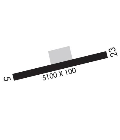
| Rwy | Rwy | |||||||
| 5100x100 | 5100' | 5100x100 | 5100' | |||||
| Runway ID | Single Wheel | Double Wheel | Double Tandem Wheel | Dual Double Wheel |
| 05/23 | N/A | N/A | N/A | N/A |
| These numbers are Advisory and are not limits. The Airport Manager should have more accurate Weight Limits | ||||
 Airport Diagram might not be current. | |
| Facility Name: | NORTHWAY |
| City Name: | NORTHWAY |
| County: | SOUTHEAST FAIRBANKS |
| State abbrev: | AK |
| State Name: | ALASKA |
| Ownership: | PUBLICLY OWNED |
| Use: | OPEN TO THE PUBLIC |
| Owner's Name: | ALASKA DOT&PF NORTHERN REGION |
| Address: | 2301 PEGER RD. |
| FAIRBANKS, AK 99709 | |
| Owner's Phone: | 907-451-2200 |
| Manager's Name: | SAM JENNINGS |
| Address: | BOX 356 |
| TOK, AK 99780 | |
| Phone: | 907-883-5128 |
| FAA Region: | ALASKA |
| FAA Field Office: | NONE |
| Date | Sunrise | Sunset |
|---|---|---|
| 04/25/24 Thursday | 5:24 | 21:28 |
| 04/26/24 Friday | 5:21 | 21:31 |
| 04/27/24 Saturday | 5:18 | 21:34 |
| 04/28/24 Sunday | 5:14 | 21:37 |
| 04/29/24 Monday | 5:11 | 21:40 |
| 04/30/24 Tuesday | 5:08 | 21:43 |
| 05/01/24 Wednesday | 5:05 | 21:46 |
| 05/02/24 Thursday | 5:02 | 21:49 |
| 05/03/24 Friday | 4:58 | 21:52 |
| 05/04/24 Saturday | 4:55 | 21:55 |
| 05/05/24 Sunday | 4:52 | 21:58 |
| 05/06/24 Monday | 4:49 | 22:01 |
| 05/07/24 Tuesday | 4:46 | 22:04 |
| 05/08/24 Wednesday | 4:43 | 22:07 |
| Airport Attendance Schedule | UNATTENDED |
| Airport Status | OPERATIONAL (This Status can change at any time - please check NOTAMS) |
| Airport Lighting Schedule | ACTVT REIL RWY 23; PAPI RWY 05 & 23; MIRL RWY 05/23 - CTAF. |
| Airport Storage Available | Hanger |
| Extra Services Available | Cargo Handling |
| Wind Indicator | YES - (lighted) |
| Control Tower | NO |
| CTAF Frequency | 123.600 |
| Unicom Frequency | |
| Rotating Beacon Color | WG |
| Segmented Circle | YES |
| Landing Fee | NO |
| Airport Inspected | FEDERAL - performed by STATE AERONAUTICAL PERSONNEL |
| Inspection Date | 08/14/2020 |
| Type of Fuel Available | None |
| Airframe Repair Service | None |
| Power Plant Repair Service | None |
| Latitude | N6257.7 |
| Longitude | W14155.7 (ESTIMATED) |
| Arpt Elevation | 1720ft (SURVEYED) |
| Magnetic Variation | 24E |
| 0 miles S | of NORTHWAY |
| Traffic Pattern Altitude | |
| Sectional Chart | ANCHORAGE |
| Operations (Reported) | Yearly | Avg. Daily |
|---|---|---|
| General Aviation Transient | 8000 | 22 |
| General Aviation Local | 3500 | 10 |
| Air Taxi | 4000 | 11 |
| Commerical | 0 | 0 |
| Commuter | 0 | 0 |
| Military | 300 | 1 |
| Aircraft based on Field | |
|---|---|
| General Aviation Singles | 0 |
| General Aviation Multi | 0 |
| Jet Aircraft | 0 |
| General Aviation Helicopters | 0 |
| Military Aircraft | 0 |
| Gliders | 0 |
| Ultralights | 0 |
| FSS on field | YES |
| FSS tie-in | NORTHWAY |
| FSS Phone | 1-800-800-478-6611 |
| Nearby FSS | FAIRBANKS |
| Phone | 1-800-866-248-6516 |
| Who issues Notams | ORT |
| Notam D service at airport | YES |
| ARTCC Name | ANCHORAGE |
| Airport Certification | |
| Aircraft Rescue & Firefighting Index | None |
| Airport of Entry | No |
| Custom Landing Rights | YES |
| Joint Civil/Military | No |
| Military Landing rights | No |
| NATIONAL PLAN OF INTEGRATED AIRPORT SYSTEMS (NPIAS) |
| GRANT AGREEMENTS UNDER FAAP/ADAP/AIP |
| ASSURANCES PURSUANT TO TITLE VI, CIVIL RIGHTS ACT OF 1964 |
| WINTER SN REMOVAL OPS - CTAF. |
| NORTHWAY ARPT WX CAMERA AND KNOB RIDGE WX CAMERA AVBL ON INTERNET AT HTTPS://WEATHERCAMS.FAA.GOV/. |
| FSS ON ARPT 15 JUN-30 SEP. |
| FOREIGN ARR ORT/PAOR OR YARGER LAKE +2 HR PPR; NMLLY 1800Z-0000Z - U.S. CUSTOMS 907-774-2242/2252. |
| ELEC FILED EAPIS MANIFEST REQ PRIOR TO DEP. |
| COLD TEMPERATURE AIRPORT. ALTITUDE CORRECTION REQUIRED AT OR BELOW -38C. |
| FLOATPLANE CUST SVC AVBL YARGER LAKE 8 NM E. |
| SUAIS - 125.3/126.3 OR 800-758-8723. |
| RWY COND UNMN; RCMD VISUAL INSP PRIOR TO LNDG. |
| RWY 05/2 3 FQT VRB STRONG CROSSWIND. |
| RWY 23 SKI STRIP PARL & ADJ THR NW SIDE. |
Airport Communications & Frequencies:
| |||||||
| Runway: 05 | Runway: 23 | ||
| Mag heading: | 52° | Mag heading: | 232° |
| Rwy Slope: | -.03% Down | Rwy Slope: | .03% Up |
| Approach: | Approach: | ||
| Pattern: | Left Traffic | Pattern: | Left Traffic |
| Markings: | NONPRECISION INSTRUMENT | Markings: | NONPRECISION INSTRUMENT |
| Marking Condition: | GOOD | Marking Condition: | GOOD |
| Arresting Dev: | Arresting Dev: | ||
| Lat & Long: | N6257.6 W14156.6 | Lat. & Long.: | N6257.8 W14154.8 |
| Elev: | 1720.1 ft. MSL | Elev: | 1718.7 ft. MSL |
| TCH: | 39 ft. AGL | TCH: | 36 ft. AGL |
| Visual Glide Path: | 3.00 degrees | Visual Glide Path: | 3.00 degrees |
| Displaced Threshold: | No | Displaced Threshold: | No |
| Touchdown Zone: | YES | Touchdown Zone: | YES |
| Touchdown Elev.: | 1720.1 feet | Touchdown Elev.: | 1718.8 feet |
| Visual Glide Slope: | 4-Light PAPI on LEFT side of Runway | Visual Glide Slope: | 4-Light PAPI on LEFT side of Runway |
| RVR Equipment: | RVR Equipment: | ||
| RVV Equipment: | NO | RVV Equipment: | NO |
| Approach Lights: | Approach Lights: | ||
| REIL: | NO | REIL: | YES |
| Centerline Lights: | NO | Centerline Lights: | NO |
| Touchdown lights: | NO | Touchdown lights: | NO |
| Runway Category: | Runway with a Non-precision Approach having visibility minimums greater than 3/4 mile | Runway Category: | Runway with a Non-precision Approach having visibility minimums greater than 3/4 mile |
| Declared Distances: | Declared Distances: | ||
| Obstructions: | TREES | Obstructions: | TREES |
| Marked: | NOT Marked/Lighted | Marked: | NOT Marked/Lighted |
| Clearance slope: | 30:1 | Clearance slope: | 16:1 |
| Obstruction height: | 61 feet AGL | Obstruction height: | 60 feet AGL |
| Dist. from runway: | 2029 feet | Dist. from runway: | 1195 feet |
| Centerline offset: | B | Centerline offset: | 425 feet left of centerline |
| Comments: | Comments: |
