
| ||||||||||||||||||||||||||||||||
| ||||||||||||||||||||||||||||||||
| ||||||||||||||||||||||||||||||||
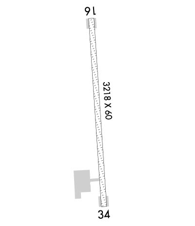
| Rwy | Rwy | |||||||
| 3200x75 | 3200' | 3200x75 | 3200' | |||||
| Runway ID | Single Wheel | Double Wheel | Double Tandem Wheel | Dual Double Wheel |
| 16/34 | N/A | N/A | N/A | N/A |
| These numbers are Advisory and are not limits. The Airport Manager should have more accurate Weight Limits | ||||
 Airport Diagram might not be current. | |
| Facility Name: | TOKSOOK BAY |
| City Name: | TOKSOOK BAY |
| County: | BETHEL |
| State abbrev: | AK |
| State Name: | ALASKA |
| Ownership: | PUBLICLY OWNED |
| Use: | OPEN TO THE PUBLIC |
| Owner's Name: | ALASKA DOT&PF CENTRAL REGION |
| Address: | PO BOX 196900 |
| ANCHORAGE, AK 99519-6900 | |
| Owner's Phone: | (907) 269-0749 |
| Manager's Name: | JOSEPH LARAUX |
| Address: | PO BOX 505 |
| BETHEL, AK 99559 | |
| Phone: | (907) 543-2498 |
| FAA Region: | ALASKA |
| FAA Field Office: | NONE |
| Date | Sunrise | Sunset |
|---|---|---|
| 04/25/24 Thursday | 7:09 | 22:48 |
| 04/26/24 Friday | 7:06 | 22:51 |
| 04/27/24 Saturday | 7:03 | 22:54 |
| 04/28/24 Sunday | 7:01 | 22:56 |
| 04/29/24 Monday | 6:58 | 22:59 |
| 04/30/24 Tuesday | 6:55 | 23:01 |
| 05/01/24 Wednesday | 6:52 | 23:04 |
| 05/02/24 Thursday | 6:49 | 23:06 |
| 05/03/24 Friday | 6:47 | 23:09 |
| 05/04/24 Saturday | 6:44 | 23:11 |
| 05/05/24 Sunday | 6:41 | 23:14 |
| 05/06/24 Monday | 6:39 | 23:16 |
| 05/07/24 Tuesday | 6:36 | 23:19 |
| 05/08/24 Wednesday | 6:33 | 23:22 |
| Airport Attendance Schedule | UNATTENDED |
| Airport Status | OPERATIONAL (This Status can change at any time - please check NOTAMS) |
| Airport Lighting Schedule | ACTVT REIL RWY 16 & 34; PAPI RWY 16 & 34; MIRL RWY 16/34 - CTAF.; ACTVT ROTG BCN - CTAF. |
| Airport Storage Available | NONE |
| Extra Services Available | NONE |
| Wind Indicator | YES - (lighted) |
| Control Tower | NO |
| CTAF Frequency | 122.900 |
| Unicom Frequency | |
| Rotating Beacon Color | WG |
| Segmented Circle | YES |
| Landing Fee | NO |
| Airport Inspected | STATE - performed by PRIVATE CONTRACT PERSONNEL |
| Inspection Date | 06/07/2023 |
| Type of Fuel Available | None |
| Airframe Repair Service | NONE |
| Power Plant Repair Service | NONE |
| Latitude | N6032.5 |
| Longitude | W16505.2 (ESTIMATED) |
| Arpt Elevation | 71ft (SURVEYED) |
| Magnetic Variation | 12E |
| 1 miles NE | of TOKSOOK BAY |
| Traffic Pattern Altitude | |
| Sectional Chart | BETHEL |
| Operations (Reported) | Yearly | Avg. Daily |
|---|---|---|
| General Aviation Transient | 0 | 0 |
| General Aviation Local | 0 | 0 |
| Air Taxi | 4596 | 13 |
| Commerical | 0 | 0 |
| Commuter | 0 | 0 |
| Military | 0 | 0 |
| Aircraft based on Field | |
|---|---|
| General Aviation Singles | 0 |
| General Aviation Multi | 0 |
| Jet Aircraft | 0 |
| General Aviation Helicopters | 0 |
| Military Aircraft | 0 |
| Gliders | 0 |
| Ultralights | 0 |
| FSS on field | NO |
| FSS tie-in | KENAI |
| FSS Phone | 1-800-866-864-1737 |
| Who issues Notams | OOK |
| Notam D service at airport | YES |
| ARTCC Name | ANCHORAGE |
| Airport Certification | |
| Aircraft Rescue & Firefighting Index | None |
| Airport of Entry | No |
| Custom Landing Rights | No |
| Joint Civil/Military | No |
| Military Landing rights | YES |
| NATIONAL PLAN OF INTEGRATED AIRPORT SYSTEMS (NPIAS) |
| RWY COND UNMNT; RCMND VISUAL INSP PRIOR TO USE. |
| EXP RANDOM TURBULENT WINDS. |
| WX CAMERA AVBL ON INTERNET AT HTTPS://WEATHERCAMS.FAA.GOV |
| BIRDS ON & INVOF ARPT. VEHICLE & ATV TFC ON RWY & RAMP. |
Airport Communications & Frequencies:
| |||||||
| Runway: 16 | Runway: 34 | ||
| Mag heading: | 165° | Mag heading: | 345° |
| Rwy Slope: | -.68% Down | Rwy Slope: | .68% Up |
| Approach: | Approach: | ||
| Pattern: | Left Traffic | Pattern: | Left Traffic |
| Markings: | NONE | Markings: | NONE |
| Marking Condition: | GOOD | Marking Condition: | GOOD |
| Arresting Dev: | Arresting Dev: | ||
| Lat & Long: | N6032.7 W16505.3 | Lat. & Long.: | N6032.2 W16505.2 |
| Elev: | 71.0 ft. MSL | Elev: | 49.2 ft. MSL |
| TCH: | 37 ft. AGL | TCH: | 30 ft. AGL |
| Visual Glide Path: | 4.00 degrees | Visual Glide Path: | 3.00 degrees |
| Displaced Threshold: | No | Displaced Threshold: | No |
| Touchdown Zone: | YES | Touchdown Zone: | YES |
| Touchdown Elev.: | 72.2 feet | Touchdown Elev.: | 70.9 feet |
| Visual Glide Slope: | 4-Light PAPI on LEFT side of Runway; UNUSBL BYD 9 DEG LEFT OF CNTRLN. | Visual Glide Slope: | 4-Light PAPI on RIGHT side of Runway |
| RVR Equipment: | RVR Equipment: | ||
| RVV Equipment: | NO | RVV Equipment: | NO |
| Approach Lights: | Approach Lights: | ||
| REIL: | YES | REIL: | YES |
| Centerline Lights: | NO | Centerline Lights: | NO |
| Touchdown lights: | NO | Touchdown lights: | NO |
| Runway Category: | Runway with a Visual Approach | Runway Category: | Runway with a Non-precision Approach |
| Declared Distances: | Declared Distances: |
