
| ||||||||||||||||||||||||||||||||
| ||||||||||||||||||||||||||||||||
| ||||||||||||||||||||||||||||||||
| Rwy | Rwy | |||||||
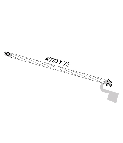
| 4020x75 | 4020' | 4020x75 | 4020' | |||||
| Runway ID | Single Wheel | Double Wheel | Double Tandem Wheel | Dual Double Wheel |
| 09/27 | N/A | N/A | N/A | N/A |
| These numbers are Advisory and are not limits. The Airport Manager should have more accurate Weight Limits | ||||
 Airport Diagram might not be current. | |
| Facility Name: | KOBUK |
| City Name: | KOBUK |
| County: | NORTHWEST ARCTIC; NORTHWEST ARCTIC BOROUGH |
| State abbrev: | AK |
| State Name: | ALASKA |
| Ownership: | PUBLICLY OWNED |
| Use: | OPEN TO THE PUBLIC |
| Owner's Name: | ALASKA DOT&PF NORTHERN REGION |
| Address: | 2301 PEGER ROAD |
| FAIRBANKS, AK 99709 | |
| Owner's Phone: | 907-451-2200 |
| Manager's Name: | ALVIN WERNEKE |
| Address: | BOX 55 |
| KOTZUBUE, AK 99752 | |
| Phone: | 907-442-3147 |
| FAA Region: | ALASKA |
| FAA Field Office: | NONE |
| Date | Sunrise | Sunset |
|---|---|---|
| 04/25/24 Thursday | 5:57 | 22:56 |
| 04/26/24 Friday | 5:53 | 23:00 |
| 04/27/24 Saturday | 5:48 | 23:04 |
| 04/28/24 Sunday | 5:44 | 23:08 |
| 04/29/24 Monday | 5:40 | 23:12 |
| 04/30/24 Tuesday | 5:36 | 23:16 |
| 05/01/24 Wednesday | 5:31 | 23:20 |
| 05/02/24 Thursday | 5:27 | 23:24 |
| 05/03/24 Friday | 5:23 | 23:28 |
| 05/04/24 Saturday | 5:19 | 23:32 |
| 05/05/24 Sunday | 5:14 | 23:36 |
| 05/06/24 Monday | 5:10 | 23:40 |
| 05/07/24 Tuesday | 5:06 | 23:45 |
| 05/08/24 Wednesday | 5:01 | 23:49 |
| Airport Attendance Schedule | UNATTENDED |
| Airport Status | OPERATIONAL (This Status can change at any time - please check NOTAMS) |
| Airport Lighting Schedule | ACTVT MIRL RY 09/27 - CTAF. |
| Airport Storage Available | NONE |
| Extra Services Available | NONE |
| Wind Indicator | YES - (lighted) |
| Control Tower | NO |
| CTAF Frequency | 122.700 |
| Unicom Frequency | |
| Rotating Beacon Color | WG |
| Segmented Circle | YES |
| Landing Fee | NO |
| Airport Inspected | CONTRACTOR - performed by PRIVATE CONTRACT PERSONNEL |
| Inspection Date | 07/22/2023 |
| Type of Fuel Available | None |
| Airframe Repair Service | NONE |
| Power Plant Repair Service | NONE |
| Latitude | N6654.7 |
| Longitude | W15653.8 (ESTIMATED) |
| Arpt Elevation | 142ft (SURVEYED) |
| Magnetic Variation | 19E |
| 0 miles N | of KOBUK |
| Traffic Pattern Altitude | |
| Sectional Chart | FAIRBANKS |
| Operations (Reported) | Yearly | Avg. Daily |
|---|---|---|
| General Aviation Transient | 0 | 0 |
| General Aviation Local | 0 | 0 |
| Air Taxi | 500 | 1 |
| Commerical | 0 | 0 |
| Commuter | 0 | 0 |
| Military | 0 | 0 |
| Aircraft based on Field | |
|---|---|
| General Aviation Singles | 0 |
| General Aviation Multi | 0 |
| Jet Aircraft | 0 |
| General Aviation Helicopters | 0 |
| Military Aircraft | 0 |
| Gliders | 0 |
| Ultralights | 0 |
| FSS on field | NO |
| FSS tie-in | KOTZEBUE |
| FSS Phone | 1-800-800-478-7460 |
| Nearby FSS | FAIRBANKS |
| Phone | 1-800-866-248-6516 |
| Who issues Notams | OTZ |
| Notam D service at airport | YES |
| ARTCC Name | ANCHORAGE |
| Airport Certification | |
| Aircraft Rescue & Firefighting Index | None |
| Airport of Entry | No |
| Custom Landing Rights | No |
| Joint Civil/Military | No |
| Military Landing rights | YES |
| NATIONAL PLAN OF INTEGRATED AIRPORT SYSTEMS (NPIAS) |
| RY CONDITION NOT MONITORED; RECOMMEND VISUAL INSPECTION PRIOR TO LANDING. |
| FLOAT PLANE OPERATION ON LAKE. |
| PARALLEL PLINE NORTH OF RY. |
| WX CAMERA AVBL ON INTERNET AT HTTPS://WEATHERCAMS.FAA.GOV |
| COLD TEMPERATURE AIRPORT. ALTITUDE CORRECTION REQUIRED AT OR BELOW -38C. |
| RWY 09/2 7 DIP ON RY 09 ABEAM SLOUGH. |
Airport Communications & Frequencies:
| |||||||
| Runway: 09 | Runway: 27 | ||
| Mag heading: | 87° | Mag heading: | 267° |
| Rwy Slope: | -.05% Down | Rwy Slope: | .05% Up |
| Approach: | Approach: | ||
| Pattern: | Left Traffic | Pattern: | Left Traffic |
| Markings: | Markings: | ||
| Marking Condition: | Marking Condition: | ||
| Arresting Dev: | Arresting Dev: | ||
| Lat & Long: | N6654.8 W15654.6 | Lat. & Long.: | N6654.6 W15653.0 |
| Elev: | 140.0 ft. MSL | Elev: | 137.8 ft. MSL |
| TCH: | TCH: | ||
| Visual Glide Path: | Visual Glide Path: | ||
| Displaced Threshold: | No | Displaced Threshold: | No |
| Touchdown Zone: | YES | Touchdown Zone: | YES |
| Touchdown Elev.: | 142.2 feet | Touchdown Elev.: | 142.2 feet |
| Visual Glide Slope: | Visual Glide Slope: | ||
| RVR Equipment: | RVR Equipment: | ||
| RVV Equipment: | NO | RVV Equipment: | NO |
| Approach Lights: | Approach Lights: | ||
| REIL: | NO | REIL: | NO |
| Centerline Lights: | NO | Centerline Lights: | NO |
| Touchdown lights: | NO | Touchdown lights: | NO |
| Runway Category: | Runway with a Non-precision Approach having visibility minimums greater than 3/4 mile | Runway Category: | Runway with a Non-precision Approach having visibility minimums greater than 3/4 mile |
| Declared Distances: | Declared Distances: | ||
| Obstructions: | BRUSH | Obstructions: | BRUSH |
| Marked: | NOT Marked/Lighted | Marked: | NOT Marked/Lighted |
| Clearance slope: | Clearance slope: | ||
| Obstruction height: | 6 feet AGL | Obstruction height: | 25 feet AGL |
| Dist. from runway: | 0 feet | Dist. from runway: | 0 feet |
| Centerline offset: | 126 right of centerline | Centerline offset: | 126 feet right of centerline |
| Comments: | Comments: |
