Click here for more info on on SMS!

PANU

NULATO (NUL)
NULATO
AK
Time Zone: Alaska
Lat: N 6443.8
Long: W 15804.5
Elev: 406
Var: -13
Longest Runway: 4011G
CTAF: 122.9

FBO & Flight Services info for PANU

FBOs: Update your Fuel Prices

AIRPORT (UNATNDD)Ph: 907-451-5280
-
-
Service
Jet
100LL
SAF
MoGas
Fuel Avail: NO FUEL AVAILABLE
Full        Last Update: 04/25/2024 05:27:34

Self        
RUNWAY - GRAVEL
-
-
 
If you are an FBO, call 1-203-262-1700 to update your info or email: FltPlan.Advertising@garmin.com
Advertise your FBO on FltPlan.com

Runway & Approach Info for PANU
Rwy
Length
Land Dist**
Approach*
  Rwy
Length
Land Dist**
Approach*
03
4011x100  4011'          
 
  
21
  4011x100  4011'          
 
 * only ILS, LOC, LDA, and SDF approaches to a specific runway are shown
** For any Declared Landing Distance Available, please see A/FD or Approach plates
Runway Weight Capability (lbs.) Help
Runway IDSingle WheelDouble WheelDouble Tandem WheelDual Double Wheel
03/21N/AN/AN/AN/A
These numbers are Advisory and are not limits.   The Airport Manager should have more accurate Weight Limits
Approach Charts
Approaches    
Current Weather/Notams
Customs Information Send updates to Support@FltPlan.com
Customs Not Available
Database effective 05/16/2024
Airport Diagram of PANU
Airport Diagram might not be current.

Facility Name: NULATO
City Name: NULATO
County: YUKON-KOYUKUK
State abbrev: AK
State Name: ALASKA
   
Ownership: PUBLICLY OWNED
Use: OPEN TO THE PUBLIC
Owner's Name: ALASKA DOT&PF NORTHERN REGION
Address: 2301 PEGER RD
 FAIRBANKS, AK 99709
Owner's Phone: (907) 451-5280
  
Manager's Name: JASON LUDINGTON
Address: 2301 PEGER ROAD
 FAIRBANKS, AK 99709
Phone: (907) 451-5280
   
FAA Region: ALASKA
FAA Field Office: NONE


Sunrise / Sunset times for NULATO

DateSunriseSunset
04/24/24 Wednesday6:2122:41
04/25/24 Thursday6:1822:44
04/26/24 Friday6:1422:47
04/27/24 Saturday6:1122:51
04/28/24 Sunday6:0722:54
04/29/24 Monday6:0322:57
04/30/24 Tuesday6:0023:01
05/01/24 Wednesday5:5623:04
05/02/24 Thursday5:5323:08
05/03/24 Friday5:4923:11
05/04/24 Saturday5:4523:14
05/05/24 Sunday5:4223:18
05/06/24 Monday5:3823:21
05/07/24 Tuesday5:3523:25

Airport Facilities

Airport Attendance ScheduleUNATTENDED
Airport Status OPERATIONAL (This Status can change at any time - please check NOTAMS)
Airport Lighting ScheduleACTVT MIRL RY 03/21 - CTAF.
Airport Storage AvailableTie Downs
Extra Services AvailableNONE
Wind IndicatorYES - (lighted)
Control TowerNO
CTAF Frequency122.900
Unicom Frequency
Rotating Beacon ColorWG
Segmented CircleYES
Landing FeeNO

Airport Inspection Data

Airport InspectedFEDERAL - performed by PRIVATE CONTRACT PERSONNEL
Inspection Date08/03/2023

Airport Services

Type of Fuel AvailableNone
Airframe Repair ServiceNONE
Power Plant Repair ServiceNONE

Geographic Data

LatitudeN6443.8
LongitudeW15804.5 (ESTIMATED)
Arpt Elevation405ft (SURVEYED)
Magnetic Variation13E
1 miles NEof NULATO
Traffic Pattern Altitude
Sectional ChartNOME

Aircraft Data

Operations (Reported)YearlyAvg. Daily
General Aviation Transient 00
General Aviation Local 00
Air Taxi 7002
Commerical 00
Commuter 00
Military 00
Aircraft based on Field
General Aviation Singles 0
General Aviation Multi 0
Jet Aircraft 0
General Aviation Helicopters 0
Military Aircraft 0
Gliders 0
Ultralights 0

FAA Services

FSS on field NO
FSS tie-in FAIRBANKS
FSS Phone 1-800-866-248-6516
Who issues Notams FAI
Notam D service at airport YES
ARTCC Name ANCHORAGE

Federal Status

Airport Certification
Aircraft Rescue & Firefighting IndexNone
Airport of EntryNo
Custom Landing RightsNo
Joint Civil/MilitaryNo
Military Landing rightsYES

Federal Agreements

NATIONAL PLAN OF INTEGRATED AIRPORT SYSTEMS (NPIAS)

Remarks

RWY CONDITION NOT MONITORED; RECOMMEND VISUAL INSPECTION PRIOR TO LANDING.
SNOW REMOVAL OPERATIONS DURING WINTER--MONITOR CTAF.
WX CAMERA AVBL ON INTERNET AT HTTPS://WEATHERCAMS.FAA.GOV.
Airport Communications & Frequencies:
CTAF Frequency:
122.900
Remarks
  • APCH/DEP SVC PRVDD BY ANCHORAGE ARTCC ON FREQS 127.0/290.2 (GALENA RCAG).
  • COMMUNICATIONS PRVDD BY FAIRBANKS FSS ON FREQ 122.2 (GALENA RCO).
  • Runway Identifications
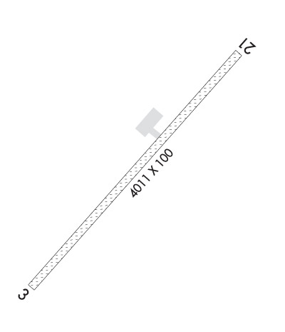
    Runway Identification: 03/21
    Length: 4011 ft
    Width: 100 ft
    Surface: GRAVEL-GOOD CONDITION
    Edge lights: Medium Intensity

    Treatment: NONE

     Runway: 03   Runway: 21
    Mag heading: 29°Mag heading: 209°
    Rwy Slope: 1.07% UpRwy Slope: -1.07% Down
    Approach: Approach:
    Pattern: Left TrafficPattern: Left Traffic
    Markings: Markings:
    Marking Condition: Marking Condition:
    Arresting Dev: Arresting Dev:
    Lat & Long: N6443.5  W15805.0Lat. & Long.: N6444.0  W15803.9
    Elev: 362.8 ft. MSLElev: 405.9 ft. MSL
    TCH: TCH:
    Visual Glide Path: Visual Glide Path:
    Displaced Threshold: NoDisplaced Threshold: No
    Touchdown Zone: YESTouchdown Zone: YES
    Touchdown Elev.: 397.9 feetTouchdown Elev.: 405.9 feet
    Visual Glide Slope: Visual Glide Slope:
    RVR Equipment: RVR Equipment:
    RVV Equipment: NORVV Equipment: NO
    Approach Lights: Approach Lights:
    REIL: NOREIL: NO
    Centerline Lights: NOCenterline Lights: NO
    Touchdown lights: NOTouchdown lights: NO
    Runway Category: Runway with a Non-precision ApproachRunway Category: Runway with a Non-precision Approach
    Declared Distances: Declared Distances:
    Obstructions: BRUSHObstructions: BRUSH
    Marked: NOT Marked/LightedMarked: NOT Marked/Lighted
    Clearance slope: Clearance slope:
    Obstruction height: 6 feet AGLObstruction height: 6 feet AGL
    Dist. from runway: 0 feetDist. from runway: 0 feet
    Centerline offset: 95 right of centerlineCenterline offset: 210 feet left of centerline
    Comments: Comments:
    C:1/P: