Click here for more info on on SMS!

PALR

CHANDALAR LAKE (WCR)
CHANDALAR LAKE
AK
Time Zone: Alaska
Lat: N 6730.3
Long: W 14829.0
Elev: 1920
Var: -22
Longest Runway: 3000G
CTAF: 122.9

FBO & Flight Services info for PALR

FBOs: Update your Fuel Prices

AIRPORT UNATTENDPh: 907-451-2207
-
Freq: 122.9
Service
Jet
100LL
SAF
MoGas
Fuel Avail: NO FUEL AVAILABLE
Full        Last Update: 04/22/2024 05:24:34

Self        
RUNWAY - GRAVEL
-
-
 
If you are an FBO, call 1-203-262-1700 to update your info or email: FltPlan.Advertising@garmin.com
Advertise your FBO on FltPlan.com

Runway & Approach Info for PALR
Rwy
Length
Land Dist**
Approach*
  Rwy
Length
Land Dist**
Approach*
03
3000x60  3000'          
 
  
21
  3000x60  3000'          
 
 * only ILS, LOC, LDA, and SDF approaches to a specific runway are shown
** For any Declared Landing Distance Available, please see A/FD or Approach plates
Runway Weight Capability (lbs.) Help
Runway IDSingle WheelDouble WheelDouble Tandem WheelDual Double Wheel
03/21N/AN/AN/AN/A
These numbers are Advisory and are not limits.   The Airport Manager should have more accurate Weight Limits
Approach Charts
FltPlan does not have IFR approach charts available for PALR.
Current Weather/Notams
Customs Information Send updates to Support@FltPlan.com
Customs Not Available
Database effective 05/16/2024
Airport Diagram of PALR
Airport Diagram might not be current.

Facility Name: CHANDALAR LAKE
City Name: CHANDALAR LAKE
County: YUKON-KOYUKUK
State abbrev: AK
State Name: ALASKA
   
Ownership: PUBLICLY OWNED
Use: OPEN TO THE PUBLIC
Owner's Name: ALASKA DOT&PF NORTHERN REGION
Address: 2301 PEGER RD
 FAIRBANKS, AK 99709
Owner's Phone: 907-451-2200
  
Manager's Name: JEFF RUSSELL
Address: 2301 PEGER RD
 FAIRBANKS, AK 99709
Phone: 907-452-2207
   
FAA Region: ALASKA
FAA Field Office: NONE


Sunrise / Sunset times for CHANDALAR LAKE

DateSunriseSunset
04/22/24 Monday5:3122:15
04/23/24 Tuesday5:2722:19
04/24/24 Wednesday5:2322:23
04/25/24 Thursday5:1822:27
04/26/24 Friday5:1422:32
04/27/24 Saturday5:0922:36
04/28/24 Sunday5:0522:40
04/29/24 Monday5:0122:44
04/30/24 Tuesday4:5622:48
05/01/24 Wednesday4:5222:52
05/02/24 Thursday4:4722:57
05/03/24 Friday4:4323:01
05/04/24 Saturday4:3823:06
05/05/24 Sunday4:3323:10

Airport Facilities

Airport Attendance ScheduleUNATTENDED
Airport Status OPERATIONAL (This Status can change at any time - please check NOTAMS)
Airport Lighting Schedule
Airport Storage AvailableTie Downs
Extra Services AvailableNONE
Wind IndicatorYES - (unlit)
Control TowerNO
CTAF Frequency122.900
Unicom Frequency
Rotating Beacon Color
Segmented CircleYES
Landing Fee

Airport Inspection Data

Airport InspectedCONTRACTOR - performed by PRIVATE CONTRACT PERSONNEL
Inspection Date07/06/2023

Airport Services

Type of Fuel AvailableNone
Airframe Repair ServiceNone
Power Plant Repair ServiceNone

Geographic Data

LatitudeN6730.3
LongitudeW14829.0 (ESTIMATED)
Arpt Elevation1920ft (ESTIMATED)
Magnetic Variation22E
0 miles Nof CHANDALAR LAKE
Traffic Pattern Altitude
Sectional ChartFAIRBANKS

Aircraft Data

Operations (Reported)YearlyAvg. Daily
General Aviation Transient 00
General Aviation Local 1000
Air Taxi 1000
Commerical 00
Commuter 00
Military 00
Aircraft based on Field
General Aviation Singles 0
General Aviation Multi 0
Jet Aircraft 0
General Aviation Helicopters 0
Military Aircraft 0
Gliders 0
Ultralights 0

FAA Services

FSS on field NO
FSS tie-in FAIRBANKS
FSS Phone 1-800-866-248-6516
Who issues Notams WCR
Notam D service at airport YES
ARTCC Name ANCHORAGE

Federal Status

Airport Certification
Aircraft Rescue & Firefighting IndexNone
Airport of EntryNo
Custom Landing RightsNo
Joint Civil/MilitaryNo
Military Landing rightsYES

Federal Agreements

NATIONAL PLAN OF INTEGRATED AIRPORT SYSTEMS (NPIAS)

Remarks

UNATTENDED. NO WINTER MAINT, SKI EQUIPPED AIRCRAFT ONLY. RWY NOT MAINTAINED AND CONDITION NOT MONITORED, RECOMMEND VISUAL INSPECTION PRIOR TO LANDING
RWY 03/2 1 SLOPES DOWN HILL 4% FROM N TO S.
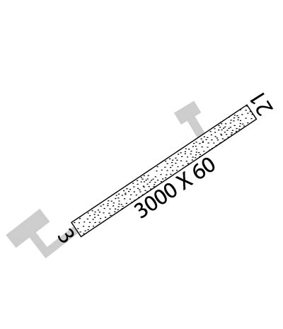
Runway Identifications
Runway Identification: 03/21
Length: 3000 ft
Width: 60 ft
Surface: NATURAL SOIL-GOOD CONDITION
Edge lights:

Treatment: NONE

 Runway: 03   Runway: 21
Mag heading: 35°Mag heading: 215°
Rwy Slope: .00%Rwy Slope: .00%
Approach: Approach:
Pattern: Left TrafficPattern: Left Traffic
Markings: NONSTANDARDMarkings: NONSTANDARD
Marking Condition: RYS 04 & 22 NSTD MKGS; THLDS MKD WITH REFLECTIVE BOARDS, NO EDGE MKRS.Marking Condition:
Arresting Dev: Arresting Dev:
Lat & Long: N6730.1  W14829.5Lat. & Long.: N6730.4  W14828.5
Elev: 1920.0 ft. MSLElev: 1920.0 ft. MSL
TCH: TCH:
Visual Glide Path: Visual Glide Path:
Displaced Threshold: NoDisplaced Threshold: No
Touchdown Zone: YESTouchdown Zone: YES
Touchdown Elev.: 1920.0 feetTouchdown Elev.: 1920.0 feet
Visual Glide Slope: Visual Glide Slope:
RVR Equipment: RVR Equipment:
RVV Equipment: NORVV Equipment: NO
Approach Lights: Approach Lights:
REIL: NOREIL: NO
Centerline Lights: NOCenterline Lights: NO
Touchdown lights: NOTouchdown lights: NO
Runway Category: Runway with a Visual ApproachRunway Category: Runway with a Visual Approach
Declared Distances: Declared Distances:
Obstructions: BRUSHObstructions: BRUSH
Marked: NOT Marked/LightedMarked: NOT Marked/Lighted
Clearance slope: Clearance slope:
Obstruction height: 8 feet AGLObstruction height: 5 feet AGL
Dist. from runway: 0 feetDist. from runway: 0 feet
Centerline offset: 75 right of centerlineCenterline offset: 60 feet right of centerline
Comments: Comments:
C:/P: