Click here for more info on on SMS!

PAKH

AKHIOK (AKK)
AKHIOK
AK
Time Zone: Alaska
Lat: N 5656.3
Long: W 15411.0
Elev: 44
Var: -18
Longest Runway: 3120
AWOS: 118.32
CTAF: 122.8

FBO & Flight Services info for PAKH

FBOs: Update your Fuel Prices

AIRPORTPh: 907-487-4952
-
Freq: 122.8
Service
Jet
100LL
SAF
MoGas
Fuel Avail: NO FUEL AVAILABLE
Full        Last Update: 04/25/2024 05:27:34

Self        
RUNWAY - GRAVEL
-
-
 
If you are an FBO, call 1-203-262-1700 to update your info or email: FltPlan.Advertising@garmin.com
Advertise your FBO on FltPlan.com

Runway & Approach Info for PAKH
Rwy
Length
Land Dist**
Approach*
  Rwy
Length
Land Dist**
Approach*
04
3120x50  3120'          
 
  
22
  3120x50  3120'          
 
 * only ILS, LOC, LDA, and SDF approaches to a specific runway are shown
** For any Declared Landing Distance Available, please see A/FD or Approach plates
Runway Weight Capability (lbs.) Help
Runway IDSingle WheelDouble WheelDouble Tandem WheelDual Double Wheel
04/22N/AN/AN/AN/A
These numbers are Advisory and are not limits.   The Airport Manager should have more accurate Weight Limits
Approach Charts
Approaches    
Current Weather/Notams
Customs Information Send updates to Support@FltPlan.com
Customs Not Available
Database effective 05/16/2024
Airport Diagram of PAKH
Airport Diagram might not be current.

Facility Name: AKHIOK
City Name: AKHIOK
County: KODIAK ISLAND
State abbrev: AK
State Name: ALASKA
   
Ownership: PUBLICLY OWNED
Use: OPEN TO THE PUBLIC
Owner's Name: ALASKA DOT&PF SOUTHCOAST REGION
Address: PO BOX 112506
 JUNEAU, AK 99811-6900
Owner's Phone: 907-269-0760; 907-269-0760
  
Manager's Name: PHIL SMITH
Address: 1500 ANTON LARSON RD.
 KODIAK, AK 99615
Phone: 907-487-4952
   
FAA Region: ALASKA
FAA Field Office: NONE


Sunrise / Sunset times for AKHIOK

DateSunriseSunset
04/24/24 Wednesday6:4321:47
04/25/24 Thursday6:4121:49
04/26/24 Friday6:3821:52
04/27/24 Saturday6:3621:54
04/28/24 Sunday6:3421:56
04/29/24 Monday6:3121:58
04/30/24 Tuesday6:2922:00
05/01/24 Wednesday6:2622:02
05/02/24 Thursday6:2422:04
05/03/24 Friday6:2222:06
05/04/24 Saturday6:2022:08
05/05/24 Sunday6:1722:10
05/06/24 Monday6:1522:13
05/07/24 Tuesday6:1322:15

Airport Facilities

Airport Attendance ScheduleUNATTENDED
Airport Status OPERATIONAL (This Status can change at any time - please check NOTAMS)
Airport Lighting Schedule
Airport Storage AvailableNONE
Extra Services AvailableNONE
Wind IndicatorYES - (unlit)
Control TowerNO
CTAF Frequency122.800
Unicom Frequency122.800
Rotating Beacon Color
Segmented CircleNO
Landing FeeNO

Airport Inspection Data

Airport InspectedCONTRACTOR - performed by PRIVATE CONTRACT PERSONNEL
Inspection Date06/22/2022

Airport Services

Type of Fuel AvailableNone
Airframe Repair ServiceNONE
Power Plant Repair ServiceNONE

Geographic Data

LatitudeN5656.3
LongitudeW15411.0 (ESTIMATED)
Arpt Elevation44ft (SURVEYED)
Magnetic Variation18E
1 miles SSWof AKHIOK
Traffic Pattern Altitude
Sectional ChartKODIAK

Aircraft Data

Operations (Reported)YearlyAvg. Daily
General Aviation Transient 1000
General Aviation Local 00
Air Taxi 15004
Commerical 00
Commuter 00
Military 00
Aircraft based on Field
General Aviation Singles 0
General Aviation Multi 0
Jet Aircraft 0
General Aviation Helicopters 0
Military Aircraft 0
Gliders 0
Ultralights 0

FAA Services

FSS on field NO
FSS tie-in KENAI
FSS Phone 1-800-866-864-1737
Who issues Notams AKK
Notam D service at airport YES
ARTCC Name ANCHORAGE

Federal Status

Airport Certification
Aircraft Rescue & Firefighting IndexNone
Airport of EntryNo
Custom Landing RightsNo
Joint Civil/MilitaryNo
Military Landing rightsYES

Federal Agreements

NATIONAL PLAN OF INTEGRATED AIRPORT SYSTEMS (NPIAS)
GRANT AGREEMENTS UNDER FAAP/ADAP/AIP
ASSURANCES PURSUANT TO TITLE VI, CIVIL RIGHTS ACT OF 1964

Remarks

RY CONDITION NOT MONITORED; RECOMMEND VISUAL INSPECTION PRIOR TO LANDING.
WX CAMERA AVBL ON INTERNET AT HTTPS://WEATHERCAMS.FAA.GOV
BIRDS INVOF ARPT.
RWY 04/2 2 RY 4/22 NE 1/3 HAS WATER PUDDLES TO 2 IN DEEP.
Airport Communications & Frequencies:
CTAF Frequency:
122.800
Unicom Frequency:
122.800
Remarks
  • APCH/DEP SVC PRVDD BY ANCHORAGE ARTCC (ZAN) ON 125.1/281.4 (KODIAK RCAG).
  • COMMUNICATIONS PRVDD BY KENAI FSS ON FREQ 122.6 (AKHIOK RCO).
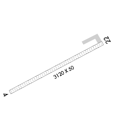
  • Runway Identifications
    Runway Identification: 04/22
    Length: 3120 ft
    Width: 50 ft
    Surface: GRAVEL-FAIR CONDITION
    Edge lights:

    Treatment: NONE

     Runway: 04   Runway: 22
    Mag heading: 44°Mag heading: 224°
    Rwy Slope: -.16% DownRwy Slope: .16% Up
    Approach: Approach:
    Pattern: Right TrafficPattern: Left Traffic
    Markings: NONSTANDARDMarkings: NONSTANDARD
    Marking Condition: GOOD; RWY 04 /22 MKD WITH ORANGE CONES & THLDS MKD WITH PLASTIC REFLECTIVE MKRS THAT ARE DIFFICULT TO SEE ON FINAL APCH.Marking Condition: GOOD
    Arresting Dev: Arresting Dev:
    Lat & Long: N5656.2  W15411.4Lat. & Long.: N5656.4  W15410.6
    Elev: 44.1 ft. MSLElev: 39.1 ft. MSL
    TCH: TCH:
    Visual Glide Path: Visual Glide Path:
    Displaced Threshold: NoDisplaced Threshold: No
    Touchdown Zone: YESTouchdown Zone: YES
    Touchdown Elev.: 44.4 feetTouchdown Elev.: 44.4 feet
    Visual Glide Slope: Visual Glide Slope:
    RVR Equipment: RVR Equipment:
    RVV Equipment: NORVV Equipment: NO
    Approach Lights: Approach Lights:
    REIL: NOREIL: NO
    Centerline Lights: NOCenterline Lights: NO
    Touchdown lights: NOTouchdown lights: NO
    Runway Category: Runway with a Non-precision ApproachRunway Category: Runway with a Non-precision Approach
    Declared Distances: Declared Distances:
    Obstructions: ROADObstructions: BRUSH
    Marked: NOT Marked/LightedMarked: NOT Marked/Lighted
    Clearance slope: 30:1Clearance slope:
    Obstruction height: 15 feet AGLObstruction height: 8 feet AGL
    Dist. from runway: 450 feetDist. from runway: 0 feet
    Centerline offset: 170 right of centerlineCenterline offset: 45 feet right of centerline
    Comments: Comments:
    C:/P: