Click here for more info on on SMS!

PAJZ

KOLIGANEK (JZZ)
KOLIGANEK
AK
Time Zone: Alaska
Lat: N 5943.6
Long: W 15715.6
Elev: 272
Var: -13
Longest Runway: 3300
AWOS: 118.52
CTAF: 122.9

FBO & Flight Services info for PAJZ

FBOs: Update your Fuel Prices

AIRPORT - UNATTNDPh: 907-842-5511
-
Freq: 122.9
Service
Jet
100LL
SAF
MoGas
Fuel Avail: NO FUEL AVAILABLE
Full        Last Update: 04/19/2024 00:01:47

Self        
RUNWAY - GRAVEL
-
-
 
AWOSPh: 907-596-3302
-
Freq: 118.52  
If you are an FBO, call 1-203-262-1700 to update your info or email: FltPlan.Advertising@garmin.com
Advertise your FBO on FltPlan.com

Runway & Approach Info for PAJZ
Rwy
Length
Land Dist**
Approach*
  Rwy
Length
Land Dist**
Approach*
09
3300x75  3300'          
 
  
27
  3300x75  3300'          
 
 * only ILS, LOC, LDA, and SDF approaches to a specific runway are shown
** For any Declared Landing Distance Available, please see A/FD or Approach plates
Runway Weight Capability (lbs.) Help
Runway IDSingle WheelDouble WheelDouble Tandem WheelDual Double Wheel
09/27N/AN/AN/AN/A
These numbers are Advisory and are not limits.   The Airport Manager should have more accurate Weight Limits
Approach Charts
Approaches    
Current Weather/Notams
Customs Information Send updates to Support@FltPlan.com
Customs Not Available
Database effective 04/18/2024
Airport Diagram of PAJZ
Airport Diagram might not be current.

Facility Name: KOLIGANEK
City Name: KOLIGANEK
County: DILLINGHAM
State abbrev: AK
State Name: ALASKA
   
Ownership: PUBLICLY OWNED
Use: OPEN TO THE PUBLIC
Owner's Name: ALASKA DOT&PF CENTRAL REGION
Address: PO BOX 196900
 ANCHORAGE, AK 99519-6900
Owner's Phone: 907-269-0749
  
Manager's Name: JON TAYLOR
Address: BOX 250
 DILLINGHAM, AK 99576
Phone: 907-842-5511
   
FAA Region: ALASKA
FAA Field Office: NONE


Sunrise / Sunset times for KOLIGANEK

DateSunriseSunset
04/18/24 Thursday7:0221:56
04/19/24 Friday6:5921:59
04/20/24 Saturday6:5622:01
04/21/24 Sunday6:5322:03
04/22/24 Monday6:5022:06
04/23/24 Tuesday6:4722:08
04/24/24 Wednesday6:4522:11
04/25/24 Thursday6:4222:13
04/26/24 Friday6:3922:16
04/27/24 Saturday6:3622:18
04/28/24 Sunday6:3322:21
04/29/24 Monday6:3122:23
04/30/24 Tuesday6:2822:26
05/01/24 Wednesday6:2522:28

Airport Facilities

Airport Attendance ScheduleUNATTENDED
Airport Status OPERATIONAL (This Status can change at any time - please check NOTAMS)
Airport Lighting ScheduleACTVT MIRL RWY 09/27; PAPI RWY 09 & 27 - CTAF.; ACTVT ROTG BCN - CTAF.
Airport Storage AvailableTie Downs
Extra Services AvailableNONE
Wind IndicatorYES - (unlit)
Control TowerNO
CTAF Frequency122.900
Unicom Frequency
Rotating Beacon ColorWG
Segmented CircleYES
Landing Fee

Airport Inspection Data

Airport Inspected5010-1 PUBLIC USE MAILOUT PROGRAM - performed by PRIVATE CONTRACT PERSONNEL
Inspection Date05/22/2021

Airport Services

Type of Fuel AvailableNone
Airframe Repair ServiceNone
Power Plant Repair ServiceNone

Geographic Data

LatitudeN5943.6
LongitudeW15715.6 (ESTIMATED)
Arpt Elevation271ft (SURVEYED)
Magnetic Variation13E
1 miles Eof KOLIGANEK
Traffic Pattern Altitude
Sectional ChartKODIAK

Aircraft Data

Operations (Reported)YearlyAvg. Daily
General Aviation Transient 00
General Aviation Local 00
Air Taxi 12723
Commerical 00
Commuter 00
Military 00
Aircraft based on Field
General Aviation Singles 0
General Aviation Multi 0
Jet Aircraft 0
General Aviation Helicopters 0
Military Aircraft 0
Gliders 0
Ultralights 0

FAA Services

FSS on field NO
FSS tie-in DILLINGHAM
FSS Phone 842-5275 (Local call)
Nearby FSS KENAI
Phone 1-800-866-864-1737
Who issues Notams JZZ
Notam D service at airport YES
ARTCC Name ANCHORAGE

Federal Status

Airport Certification
Aircraft Rescue & Firefighting IndexNone
Airport of EntryNo
Custom Landing RightsNo
Joint Civil/MilitaryNo
Military Landing rightsNo

Federal Agreements

NATIONAL PLAN OF INTEGRATED AIRPORT SYSTEMS (NPIAS)
GRANT AGREEMENTS UNDER FAAP/ADAP/AIP
ASSURANCES PURSUANT TO TITLE VI, CIVIL RIGHTS ACT OF 1964

Remarks

RWY COND UNMNT; RCMD VISUAL INSP PRIOR TO USE.
WX CAMERA AVBL ON INTERNET AT HTTPS://WEATHERCAMS.FAA.GOV
RWY 09/2 7 SLOPES DOWN TOWARD W END.
RWY 09/2 7 HEAVES & HUMPS; RWY SLOUGHING OFF INTO TUNDRA.
Airport Communications & Frequencies:
CTAF Frequency:
122.900
Remarks
  • APCH/DEP SVC PRVDD BY ANCHORAGE ARTCC ON FREQS 132.75/282.35 (DILLINGHAM RCAG).
  • COMMUNICATIONS PRVDD BY DILLINGHAM FSS ON FREQ 122.55 0745-2345 (KEMUK MOUNTAIN RCO) OTHER TIMES CTC KENAI FSS.
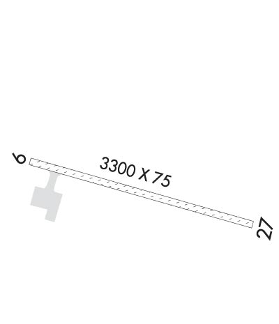
  • Runway Identifications
    Runway Identification: 09/27
    Length: 3300 ft
    Width: 75 ft
    Surface: GRAVEL-GOOD CONDITION
    Edge lights: Medium Intensity

    Treatment: NONE

     Runway: 09   Runway: 27
    Mag heading: 93°Mag heading: 273°
    Rwy Slope: 1.04% UpRwy Slope: -1.04% Down
    Approach: Approach:
    Pattern: Left TrafficPattern: Left Traffic
    Markings: NONSTANDARDMarkings: NONSTANDARD
    Marking Condition: GOOD; THR MKD WITH LGTS.Marking Condition: GOOD; THR MKD WITH LGTS
    Arresting Dev: Arresting Dev:
    Lat & Long: N5943.7  W15716.1Lat. & Long.: N5943.5  W15715.1
    Elev: 237.4 ft. MSLElev: 271.8 ft. MSL
    TCH: 39 ft. AGLTCH: 27 ft. AGL
    Visual Glide Path: 3.50 degreesVisual Glide Path: 3.50 degrees
    Displaced Threshold: NoDisplaced Threshold: No
    Touchdown Zone: YESTouchdown Zone: YES
    Touchdown Elev.: 268.9 feetTouchdown Elev.: 271.8 feet
    Visual Glide Slope: 4-Light PAPI on RIGHT side of RunwayVisual Glide Slope: 4-Light PAPI on LEFT side of Runway
    RVR Equipment: RVR Equipment:
    RVV Equipment: NORVV Equipment: NO
    Approach Lights: Approach Lights:
    REIL: NOREIL: NO
    Centerline Lights: NOCenterline Lights: NO
    Touchdown lights: NOTouchdown lights: NO
    Runway Category: Runway with a Non-precision ApproachRunway Category: Runway with a Non-precision Approach
    Declared Distances: TORA:3300' TODA:3300' ASDA:3300' LDA:3300'Declared Distances: TORA:3300' TODA:3300' ASDA:3300' LDA:3300'
    Obstructions: BRUSHObstructions: BRUSH
    Marked: NOT Marked/LightedMarked: NOT Marked/Lighted
    Clearance slope: 1:1Clearance slope:
    Obstruction height: 4 feet AGLObstruction height: 6 feet AGL
    Dist. from runway: 5 feetDist. from runway: 0 feet
    Centerline offset: 217 right of centerlineCenterline offset: 115 feet right of centerline
    Comments: Comments:
    C:/P: