
| ||||||||||||||||||||||||||||||||
| ||||||||||||||||||||||||||||||||
| ||||||||||||||||||||||||||||||||
| ||||||||||||||||||||||||||||||||
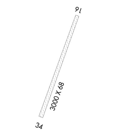
| Rwy | Rwy | |||||||
| 3000x68 | 3000' | 3000x68 | 3000' | |||||
| Runway ID | Single Wheel | Double Wheel | Double Tandem Wheel | Dual Double Wheel |
| 16/34 | N/A | N/A | N/A | N/A |
| These numbers are Advisory and are not limits. The Airport Manager should have more accurate Weight Limits | ||||
| FltPlan does not have IFR approach charts available for PAIN. |
 Airport Diagram might not be current. | |
| Facility Name: | MC KINLEY NTL PARK |
| City Name: | MCKINLEY PARK |
| County: | YUKON-KOYUKUK |
| State abbrev: | AK |
| State Name: | ALASKA |
| Ownership: | PUBLICLY OWNED |
| Use: | OPEN TO THE PUBLIC |
| Owner's Name: | NPS DENALI NATL PARK |
| Address: | PO BOX 9 |
| DENALI NATL PARK, AK 99755 | |
| Owner's Phone: | 907-683-2294 |
| Manager's Name: | SUPERINTENDENT, DENALI NAT. PARK |
| Address: | PO BOX 9 |
| DENALI NATL PARK, AK 99755 | |
| Phone: | 907-683-9581 |
| FAA Region: | ALASKA |
| FAA Field Office: | NONE |
| Date | Sunrise | Sunset |
|---|---|---|
| 04/24/24 Wednesday | 5:51 | 21:58 |
| 04/25/24 Thursday | 5:48 | 22:01 |
| 04/26/24 Friday | 5:44 | 22:04 |
| 04/27/24 Saturday | 5:41 | 22:07 |
| 04/28/24 Sunday | 5:37 | 22:10 |
| 04/29/24 Monday | 5:34 | 22:13 |
| 04/30/24 Tuesday | 5:31 | 22:17 |
| 05/01/24 Wednesday | 5:27 | 22:20 |
| 05/02/24 Thursday | 5:24 | 22:23 |
| 05/03/24 Friday | 5:21 | 22:26 |
| 05/04/24 Saturday | 5:17 | 22:29 |
| 05/05/24 Sunday | 5:14 | 22:32 |
| 05/06/24 Monday | 5:11 | 22:35 |
| 05/07/24 Tuesday | 5:07 | 22:39 |
| Airport Attendance Schedule | UNATTENDED |
| Airport Status | OPERATIONAL (This Status can change at any time - please check NOTAMS) |
| Airport Lighting Schedule | |
| Airport Storage Available | Tie Downs |
| Extra Services Available | Charter |
| Wind Indicator | YES - (unlit) |
| Control Tower | NO |
| CTAF Frequency | 122.900 |
| Unicom Frequency | |
| Rotating Beacon Color | |
| Segmented Circle | NO |
| Landing Fee | NO |
| Airport Inspected | STATE - performed by STATE AERONAUTICAL PERSONNEL |
| Inspection Date | 08/13/2020 |
| Type of Fuel Available | None |
| Airframe Repair Service | NONE |
| Power Plant Repair Service | NONE |
| Latitude | N6344.0 |
| Longitude | W14854.6 (ESTIMATED) |
| Arpt Elevation | 1720ft (ESTIMATED) |
| Magnetic Variation | 27E |
| 2 miles NE | of MCKINLEY PARK |
| Traffic Pattern Altitude | |
| Sectional Chart | ANCHORAGE |
| Operations (Reported) | Yearly | Avg. Daily |
|---|---|---|
| General Aviation Transient | 1700 | 5 |
| General Aviation Local | 500 | 1 |
| Air Taxi | 1000 | 3 |
| Commerical | 0 | 0 |
| Commuter | 0 | 0 |
| Military | 0 | 0 |
| Aircraft based on Field | |
|---|---|
| General Aviation Singles | 4 |
| General Aviation Multi | 2 |
| Jet Aircraft | 0 |
| General Aviation Helicopters | 1 |
| Military Aircraft | 0 |
| Gliders | 0 |
| Ultralights | 0 |
| FSS on field | NO |
| FSS tie-in | FAIRBANKS |
| FSS Phone | 1-800-866-248-6516 |
| Who issues Notams | INR |
| Notam D service at airport | YES |
| ARTCC Name | ANCHORAGE |
| Airport Certification | |
| Aircraft Rescue & Firefighting Index | None |
| Airport of Entry | No |
| Custom Landing Rights | No |
| Joint Civil/Military | No |
| Military Landing rights | YES |
| NO OVERRUN AT EITHER RWY END. |
| WX CAMERA AVBL ON INTERNET AT HTTPS://WEATHERCAMS.FAA.GOV |
| PVT ROTORWING USE PROHIBITED, EXCP IN CASE OF EMERGS. |
| CANYON S & W OF ARPT SUBJECT TO STRONG DOWNDRAFTS. |
| COMMERCIAL OR BUSINESS USE OF THIS AIRSTRIP IS PROHIBITED EXCEPT UNDER PERMIT WITH THE NATIONAL PARK SERVICE. |
| RWY-34 MTN LCTD AT 10,500 FT FROM RY END. |
| FREQUENT PEDESTRIAN & WILDLIFE TFC ON RY. |
| ALL TRAFFIC PATTERNS TO EAST SIDE DUE TO TERRAIN CLEARANCE. |
| FREQS 122.725 NORTH/ 123.65 SOUTH IS DESIGNATED FOR INTER ACFT COMMUNICATION IN DENALI NATIONAL PARK. |
| RWY 16/3 4 ACFT PARKING ALONG SIDES OF RY 16/34 HAS REDUCED USABLE WIDTH TO 68 FT. |
| RWY 16/3 4 GRASS ENCROACHMENT ON BOTH SIDES OF RY. |
| Runway: 16 | Runway: 34 | ||
| Mag heading: | N/A | Mag heading: | N/A |
| Approach: | Approach: | ||
| Pattern: | Left Traffic | Pattern: | Right Traffic |
| Markings: | Markings: | ||
| Marking Condition: | RY 16/34 MARKED WITH DAMAGED AND FADED CONES. | Marking Condition: | |
| Arresting Dev: | Arresting Dev: | ||
| Lat & Long: | Lat. & Long.: | ||
| Elev: | N/A | Elev: | N/A |
| TCH: | TCH: | ||
| Visual Glide Path: | Visual Glide Path: | ||
| Displaced Threshold: | No | Displaced Threshold: | No |
| Touchdown Zone: | NO | Touchdown Zone: | NO |
| Touchdown Elev.: | Touchdown Elev.: | ||
| Visual Glide Slope: | Visual Glide Slope: | ||
| RVR Equipment: | RVR Equipment: | ||
| RVV Equipment: | NO | RVV Equipment: | NO |
| Approach Lights: | Approach Lights: | ||
| REIL: | NO | REIL: | NO |
| Centerline Lights: | NO | Centerline Lights: | NO |
| Touchdown lights: | NO | Touchdown lights: | NO |
| Runway Category: | Runway with a Visual Approach | Runway Category: | Runway with a Visual Approach |
| Declared Distances: | Declared Distances: | ||
| Obstructions: | TREES | Obstructions: | TREES |
| Marked: | NOT Marked/Lighted | Marked: | NOT Marked/Lighted |
| Clearance slope: | Clearance slope: | ||
| Obstruction height: | 18 feet AGL | Obstruction height: | 40 feet AGL |
| Dist. from runway: | 0 feet | Dist. from runway: | 0 feet |
| Centerline offset: | 80 right of centerline | Centerline offset: | 74 feet left of centerline |
| Comments: | Comments: |
