
| ||||||||||||||||||||||||||||||||
| ||||||||||||||||||||||||||||||||
| Rwy | Rwy | |||||||
| 2910x60 | 2910' | 2910x60 | 2910' | |||||
| Runway ID | Single Wheel | Double Wheel | Double Tandem Wheel | Dual Double Wheel |
| 15/33 | N/A | N/A | N/A | N/A |
| These numbers are Advisory and are not limits. The Airport Manager should have more accurate Weight Limits | ||||
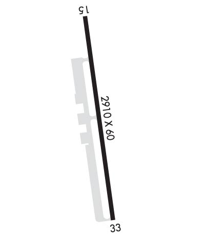 Airport Diagram might not be current. | |
| Facility Name: | HEALY RIVER |
| City Name: | HEALY |
| County: | DENALI |
| State abbrev: | AK |
| State Name: | ALASKA |
| Ownership: | PUBLICLY OWNED |
| Use: | OPEN TO THE PUBLIC |
| Owner's Name: | ALASKA DOT&PF NORTHERN REGION |
| Address: | 2301 PEGER ROAD |
| FAIRBANKS, AK 99709 | |
| Owner's Phone: | 907-451-2200 |
| Manager's Name: | JASON LUDINGTON |
| Address: | 2301 PEGER ROAD |
| FAIRBANKS, AK 99709 | |
| Phone: | 907-451-5280 |
| FAA Region: | ALASKA |
| FAA Field Office: | NONE |
| Date | Sunrise | Sunset |
|---|---|---|
| 04/23/24 Tuesday | 5:54 | 21:56 |
| 04/24/24 Wednesday | 5:50 | 21:59 |
| 04/25/24 Thursday | 5:47 | 22:02 |
| 04/26/24 Friday | 5:44 | 22:05 |
| 04/27/24 Saturday | 5:40 | 22:08 |
| 04/28/24 Sunday | 5:37 | 22:11 |
| 04/29/24 Monday | 5:33 | 22:15 |
| 04/30/24 Tuesday | 5:30 | 22:18 |
| 05/01/24 Wednesday | 5:26 | 22:21 |
| 05/02/24 Thursday | 5:23 | 22:24 |
| 05/03/24 Friday | 5:20 | 22:27 |
| 05/04/24 Saturday | 5:16 | 22:30 |
| 05/05/24 Sunday | 5:13 | 22:34 |
| 05/06/24 Monday | 5:10 | 22:37 |
| Airport Attendance Schedule | UNATTENDED |
| Airport Status | OPERATIONAL (This Status can change at any time - please check NOTAMS) |
| Airport Lighting Schedule | ACTVT MIRL RY 15/33 - CTAF. |
| Airport Storage Available | Tie Downs |
| Extra Services Available | Charter |
| Wind Indicator | YES - (lighted) |
| Control Tower | NO |
| CTAF Frequency | 122.900 |
| Unicom Frequency | |
| Rotating Beacon Color | WG |
| Segmented Circle | YES; SEGMENTED CIRCLE 400 FT FM RY33 THLD 200 FT L OF CNTRLN. |
| Landing Fee | NO |
| Airport Inspected | STATE - performed by STATE AERONAUTICAL PERSONNEL |
| Inspection Date | 08/13/2020 |
| Type of Fuel Available | Grade 100LL, JET A (freeze point -40C); -A FULL SERVICE AV GAS AND JET A AVAILABLE DURING NORMAL BUSINESS HOURS MAY TO SEPTEMBER AND BY CALL OUT YEAR ROUND AND AFTER HOURS. CALL OUT FEE MAY APPLY, CALL: 907-683-2359. |
| Airframe Repair Service | None |
| Power Plant Repair Service | None |
| Latitude | N6352.1 |
| Longitude | W14858.1 (ESTIMATED) |
| Arpt Elevation | 1275ft (SURVEYED) |
| Magnetic Variation | 16E |
| 0 miles N | of HEALY |
| Traffic Pattern Altitude | |
| Sectional Chart | ANCHORAGE |
| Operations (Reported) | Yearly | Avg. Daily |
|---|---|---|
| General Aviation Transient | 500 | 1 |
| General Aviation Local | 300 | 1 |
| Air Taxi | 500 | 1 |
| Commerical | 0 | 0 |
| Commuter | 0 | 0 |
| Military | 0 | 0 |
| Aircraft based on Field | |
|---|---|
| General Aviation Singles | 7 |
| General Aviation Multi | 2 |
| Jet Aircraft | 0 |
| General Aviation Helicopters | 0 |
| Military Aircraft | 0 |
| Gliders | 0 |
| Ultralights | 0 |
| FSS on field | NO |
| FSS tie-in | FAIRBANKS |
| FSS Phone | 1-800-866-248-6516 |
| Who issues Notams | FAI |
| Notam D service at airport | YES |
| ARTCC Name | ANCHORAGE |
| Airport Certification | |
| Aircraft Rescue & Firefighting Index | None |
| Airport of Entry | No |
| Custom Landing Rights | No |
| Joint Civil/Military | No |
| Military Landing rights | YES |
| NATIONAL PLAN OF INTEGRATED AIRPORT SYSTEMS (NPIAS) |
| GRANT AGREEMENTS UNDER FAAP/ADAP/AIP |
| ASSURANCES PURSUANT TO TITLE VI, CIVIL RIGHTS ACT OF 1964 |
| TURBULENT WINDS INVOF ARPT. |
| RWY CONDITION NOT MONITORED; RECOMMEND VISUAL INSPECTION PRIOR TO LANDING. |
| ARPT 2 SM SW OF USIBELLI MINE. |
| RR TRACKS 700 FT FM THLD 20 FT ABOVE RWY ELEVATION. |
| COLD TEMPERATURE AIRPORT. ALTITUDE CORRECTION REQUIRED AT OR BELOW -11C. |
| RWY 15/3 3 NUMEROUS CRACKS IN ASPH WITH WEEDS & GRASS GROWING THRU SFC UP TO 12 IN TALL. |
Airport Communications & Frequencies:
| |||||||
| Runway: 15 | Runway: 33 | ||
| Mag heading: | N/A | Mag heading: | N/A |
| Rwy Slope: | .64% Up | Rwy Slope: | -.64% Down |
| Approach: | Approach: | ||
| Pattern: | Right Traffic | Pattern: | Left Traffic |
| Markings: | NONSTANDARD | Markings: | NONSTANDARD |
| Marking Condition: | GOOD; RY 15/33 NSTD MKGS: THLD MKD BY PANELS, CONES & LIGHTS. | Marking Condition: | GOOD |
| Arresting Dev: | Arresting Dev: | ||
| Lat & Long: | N6352.3 W14858.2 | Lat. & Long.: | N6351.8 W14858.1 |
| Elev: | 1256.4 ft. MSL | Elev: | 1275.0 ft. MSL |
| TCH: | TCH: | ||
| Visual Glide Path: | Visual Glide Path: | ||
| Displaced Threshold: | No | Displaced Threshold: | No |
| Touchdown Zone: | YES | Touchdown Zone: | YES |
| Touchdown Elev.: | 1275.0 feet | Touchdown Elev.: | 1275.0 feet |
| Visual Glide Slope: | Visual Glide Slope: | ||
| RVR Equipment: | RVR Equipment: | ||
| RVV Equipment: | NO | RVV Equipment: | NO |
| Approach Lights: | Approach Lights: | ||
| REIL: | NO | REIL: | NO |
| Centerline Lights: | NO | Centerline Lights: | NO |
| Touchdown lights: | NO | Touchdown lights: | NO |
| Runway Category: | Runway with a Visual Approach | Runway Category: | Runway with a Visual Approach |
| Declared Distances: | Declared Distances: | ||
| Obstructions: | TREES | Obstructions: | TREES |
| Marked: | NOT Marked/Lighted | Marked: | NOT Marked/Lighted |
| Clearance slope: | Clearance slope: | ||
| Obstruction height: | 25 feet AGL | Obstruction height: | 8 feet AGL |
| Dist. from runway: | 200 feet | Dist. from runway: | 200 feet |
| Centerline offset: | 75 left of centerline | Centerline offset: | 115 feet right of centerline |
| Comments: | Comments: |
