
| ||||||||||||||||||||||||||||||||||||||||||||
| ||||||||||||||||||||||||||||||||||||||||||||
| ||||||||||||||||||||||||||||||||||||||||||||
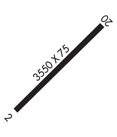
| Rwy | Rwy | |||||||
| 3550x75 | 3550' | 3550x75 | 3550' | |||||
| Runway ID | Single Wheel | Double Wheel | Double Tandem Wheel | Dual Double Wheel |
| 02/20 | N/A | N/A | N/A | N/A |
| These numbers are Advisory and are not limits. The Airport Manager should have more accurate Weight Limits | ||||
| FltPlan does not have IFR approach charts available for PAGY. |
 Airport Diagram might not be current. | |
| Facility Name: | SKAGWAY |
| City Name: | SKAGWAY |
| County: | SKAGWAY-HOONAH-ANGOON |
| State abbrev: | AK |
| State Name: | ALASKA |
| Ownership: | PUBLICLY OWNED |
| Use: | OPEN TO THE PUBLIC |
| Owner's Name: | ALASKA DOT&PF SOUTHCOAST REGION |
| Address: | P.O. BOX 112506 |
| JUNEAU, AK 99811-2506 | |
| Owner's Phone: | (907) 983-2323 |
| Manager's Name: | SHAUN MCKNIGHT |
| Address: | BOX 356 |
| SKAGWAY, AK 99840 | |
| Phone: | 907-983-2323 |
| FAA Region: | ALASKA |
| FAA Field Office: | NONE |
| Date | Sunrise | Sunset |
|---|---|---|
| 04/24/24 Wednesday | 5:18 | 20:42 |
| 04/25/24 Thursday | 5:15 | 20:44 |
| 04/26/24 Friday | 5:13 | 20:47 |
| 04/27/24 Saturday | 5:10 | 20:49 |
| 04/28/24 Sunday | 5:07 | 20:51 |
| 04/29/24 Monday | 5:04 | 20:54 |
| 04/30/24 Tuesday | 5:02 | 20:56 |
| 05/01/24 Wednesday | 4:59 | 20:59 |
| 05/02/24 Thursday | 4:57 | 21:01 |
| 05/03/24 Friday | 4:54 | 21:03 |
| 05/04/24 Saturday | 4:51 | 21:06 |
| 05/05/24 Sunday | 4:49 | 21:08 |
| 05/06/24 Monday | 4:46 | 21:11 |
| 05/07/24 Tuesday | 4:44 | 21:13 |
| Airport Attendance Schedule | UNATTENDED |
| Airport Status | OPERATIONAL (This Status can change at any time - please check NOTAMS) |
| Airport Lighting Schedule | ACTVT REIL RWY 02 & 20; MIRL RWY 02/20 - CTAF. |
| Airport Storage Available | Tie Downs |
| Extra Services Available | Charter |
| Wind Indicator | YES - (lighted) |
| Control Tower | NO |
| CTAF Frequency | 122.900 |
| Unicom Frequency | |
| Rotating Beacon Color | |
| Segmented Circle | NO |
| Landing Fee | NO |
| Airport Inspected | STATE - performed by PRIVATE CONTRACT PERSONNEL |
| Inspection Date | 09/20/2023 |
| Type of Fuel Available | Grade 100LL; -10FUEL MON-FRI 0800-1700 - 907-983-2259; AFT HR - 907-612-0049. |
| Airframe Repair Service | None |
| Power Plant Repair Service | None |
| Latitude | N5927.6 |
| Longitude | W13519.0 (ESTIMATED) |
| Arpt Elevation | 44ft (SURVEYED) |
| Magnetic Variation | 29E |
| 0 miles NW | of SKAGWAY |
| Traffic Pattern Altitude | |
| Sectional Chart | JUNEAU |
| Operations (Reported) | Yearly | Avg. Daily |
|---|---|---|
| General Aviation Transient | 0 | 0 |
| General Aviation Local | 500 | 1 |
| Air Taxi | 3800 | 10 |
| Commerical | 0 | 0 |
| Commuter | 0 | 0 |
| Military | 0 | 0 |
| Aircraft based on Field | |
|---|---|
| General Aviation Singles | 12 |
| General Aviation Multi | 0 |
| Jet Aircraft | 0 |
| General Aviation Helicopters | 7 |
| Military Aircraft | 0 |
| Gliders | 0 |
| Ultralights | 0 |
| FSS on field | NO |
| FSS tie-in | JUNEAU |
| FSS Phone | 1-800-866-297-2236 |
| Who issues Notams | SGY |
| Notam D service at airport | YES |
| ARTCC Name | ANCHORAGE |
| Airport Certification | |
| Aircraft Rescue & Firefighting Index | None |
| Airport of Entry | No |
| Custom Landing Rights | YES |
| Joint Civil/Military | No |
| Military Landing rights | YES |
| NATIONAL PLAN OF INTEGRATED AIRPORT SYSTEMS (NPIAS) |
| GRANT AGREEMENT HAS EXPIRED; HOWEVER, AGREEMENT REMAINS IN EFFECT FOR THIS FACILITY AS LONG AS IT IS PUBLIC USE. |
| ACFT OVR 12500 LB GWT NA EXC PPR IN WRITING - AMGR. |
| PAJA TO RWY, TWY & PRKG APRON NA. |
| RCMD DALGT OPS ONLY. |
| ARPT COND UNMNT; MAINT IREG; RCMND VISUAL INSP PRIOR TO USE. |
| ACR OPS OVER 30 PAX SEATS NA. |
| WX CAMERA AVBL ON INTERNET AT HTTPS://WEATHERCAMS.FAA.GOV |
| BIRDS & BEARS INVOF ARPT. |
| JUNEAU FSS FONE IN FUEL AREA. |
| LIGHT ACFT & HEL TFC JUNE 1 - SEP 15 - INFO AMGR. |
| RWY 02 ALERT: SEE GENOT FOR RWY 02 DEP INFO & ENR CTAF FREQS. DEP REQ HIGH PER CLIMB DUE TO TRRN. DEP MAY DOGLEG EAST BFR TURN CROSSWIND TO INCR ALT; MNTN RWY HDG AT LEAST 1/2 MI BFR DOGLEG TO AVOID SCHOOL & PLAYGROUND. |
| RWY 20 APCH IN NRW CANYON; TURB & HIGH OBSTNS. SCHOOL & PLAYGROUND INVOF APCH END. |
| Runway: 02 | Runway: 20 | ||
| Mag heading: | N/A | Mag heading: | N/A |
| Rwy Slope: | .82% Up | Rwy Slope: | -.82% Down |
| Approach: | Approach: | ||
| Pattern: | Left Traffic | Pattern: | Right Traffic |
| Markings: | BASIC | Markings: | BASIC |
| Marking Condition: | FAIR | Marking Condition: | FAIR |
| Arresting Dev: | Arresting Dev: | ||
| Lat & Long: | N5927.4 W13519.4 | Lat. & Long.: | N5927.8 W13518.6 |
| Elev: | 30.0 ft. MSL | Elev: | 59.0 ft. MSL |
| TCH: | TCH: | ||
| Visual Glide Path: | Visual Glide Path: | ||
| Displaced Threshold: | No | Displaced Threshold: | No |
| Touchdown Zone: | NO | Touchdown Zone: | NO |
| Touchdown Elev.: | Touchdown Elev.: | ||
| Visual Glide Slope: | Visual Glide Slope: | ||
| RVR Equipment: | RVR Equipment: | ||
| RVV Equipment: | NO | RVV Equipment: | NO |
| Approach Lights: | Approach Lights: | ||
| REIL: | YES; NSTD OMNIDIRECTIONAL. | REIL: | YES; NSTD OMNIDIRECTIONAL. |
| Centerline Lights: | NO | Centerline Lights: | NO |
| Touchdown lights: | NO | Touchdown lights: | NO |
| Runway Category: | Runway with a Visual Approach | Runway Category: | Runway with a Visual Approach |
| Declared Distances: | Declared Distances: | ||
| Obstructions: | TREES | Obstructions: | TREES |
| Marked: | NOT Marked/Lighted | Marked: | NOT Marked/Lighted |
| Clearance slope: | 4:1 | Clearance slope: | 4:1 |
| Obstruction height: | 96 feet AGL | Obstruction height: | 80 feet AGL |
| Dist. from runway: | 620 feet | Dist. from runway: | 551 feet |
| Centerline offset: | 220 left of centerline | Centerline offset: | 200 feet right of centerline |
| Comments: | Comments: |