
| ||||||||||||||||||||||||||||||||
| ||||||||||||||||||||||||||||||||
| Rwy | Rwy | |||||||
| 2450x70 | 2450' | 2450x70 | 2450' | |||||
| Runway ID | Single Wheel | Double Wheel | Double Tandem Wheel | Dual Double Wheel |
| 07/25 | N/A | N/A | N/A | N/A |
| These numbers are Advisory and are not limits. The Airport Manager should have more accurate Weight Limits | ||||
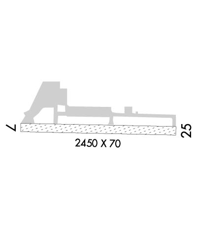 Airport Diagram might not be current. | |
| Facility Name: | BIG LAKE |
| City Name: | BIG LAKE |
| County: | MATANUSKA-SUSITNA |
| State abbrev: | AK |
| State Name: | ALASKA |
| Ownership: | PUBLICLY OWNED |
| Use: | OPEN TO THE PUBLIC |
| Owner's Name: | ALASKA DOT&PF CENTRAL REGION |
| Address: | PO BOX 196900 |
| ANCHORAGE, AK 99519-6900 | |
| Owner's Phone: | 907-269-0770 |
| Manager's Name: | KYLER HYLTON |
| Address: | 289 INNER SPRING LOOP, DOT&PF CENTRAL REGION |
| PALMER, AK 99645 | |
| Phone: | 907-745-2159 |
| FAA Region: | ALASKA |
| FAA Field Office: | NONE |
| Date | Sunrise | Sunset |
|---|---|---|
| 04/23/24 Tuesday | 6:09 | 21:47 |
| 04/24/24 Wednesday | 6:06 | 21:49 |
| 04/25/24 Thursday | 6:03 | 21:52 |
| 04/26/24 Friday | 6:00 | 21:55 |
| 04/27/24 Saturday | 5:57 | 21:58 |
| 04/28/24 Sunday | 5:54 | 22:00 |
| 04/29/24 Monday | 5:51 | 22:03 |
| 04/30/24 Tuesday | 5:48 | 22:06 |
| 05/01/24 Wednesday | 5:45 | 22:08 |
| 05/02/24 Thursday | 5:43 | 22:11 |
| 05/03/24 Friday | 5:40 | 22:14 |
| 05/04/24 Saturday | 5:37 | 22:17 |
| 05/05/24 Sunday | 5:34 | 22:19 |
| 05/06/24 Monday | 5:31 | 22:22 |
| Airport Attendance Schedule | UNATTENDED |
| Airport Status | OPERATIONAL (This Status can change at any time - please check NOTAMS) |
| Airport Lighting Schedule | ACTVT MIRL RY 07/25 - 122.8 |
| Airport Storage Available | Tie Downs |
| Extra Services Available | NONE |
| Wind Indicator | YES - (lighted) |
| Control Tower | NO |
| CTAF Frequency | 122.800 |
| Unicom Frequency | |
| Rotating Beacon Color | WG |
| Segmented Circle | YES |
| Landing Fee |
| Airport Inspected | FEDERAL - performed by PRIVATE CONTRACT PERSONNEL |
| Inspection Date | 09/15/2020 |
| Type of Fuel Available | None |
| Airframe Repair Service | MAJOR |
| Power Plant Repair Service | MAJOR |
| Latitude | N6132.1 |
| Longitude | W14948.8 (ESTIMATED) |
| Arpt Elevation | 162ft (SURVEYED) |
| Magnetic Variation | 15E |
| 1 miles SE | of BIG LAKE |
| Traffic Pattern Altitude | |
| Sectional Chart | ANCHORAGE |
| Operations (Reported) | Yearly | Avg. Daily |
|---|---|---|
| General Aviation Transient | 8000 | 22 |
| General Aviation Local | 1500 | 4 |
| Air Taxi | 0 | 0 |
| Commerical | 0 | 0 |
| Commuter | 0 | 0 |
| Military | 0 | 0 |
| Aircraft based on Field | |
|---|---|
| General Aviation Singles | 66 |
| General Aviation Multi | 2 |
| Jet Aircraft | 0 |
| General Aviation Helicopters | 2 |
| Military Aircraft | 0 |
| Gliders | 0 |
| Ultralights | 0 |
| FSS on field | NO |
| FSS tie-in | KENAI |
| FSS Phone | 1-800-866-864-1737 |
| Who issues Notams | ENA |
| Notam D service at airport | YES |
| ARTCC Name | ANCHORAGE |
| Airport Certification | |
| Aircraft Rescue & Firefighting Index | None |
| Airport of Entry | No |
| Custom Landing Rights | No |
| Joint Civil/Military | No |
| Military Landing rights | No |
| NATIONAL PLAN OF INTEGRATED AIRPORT SYSTEMS (NPIAS) |
| LOW FLYING ACFT INVOF APCH TO BIG LAKE VOR. |
| ARPT HAS DESIGNATED TRANSIENT ACFT PARKING AVBL. TRANSIENT ACFT PARKING IS DESIGNATED WITH GREEN CONES. |
| BE ALERT: FROST HEAVE ON RY APRXLY 2200 FT. |
| RY COND NOT MONITORED; RECOMMEND VISUAL INSPECTION PRIOR TO USE. |
| UPDRAFT OFF OF RISING HILL ON APCH TO RY 25. |
| RY 07+15' ROAD PARALLEL TO RY END. |
| 190 FT AGL LIGHTED TWR 2 NM NE OF ARPT. |
| BE ALERT: OCCASIONAL ULTRA LIGHT TRAFFIC. |
Airport Communications & Frequencies:
|
| Runway: 07 | Runway: 25 | ||
| Mag heading: | 75° | Mag heading: | 255° |
| Rwy Slope: | -.11% Down | Rwy Slope: | .11% Up |
| Approach: | Approach: | ||
| Pattern: | Left Traffic | Pattern: | Left Traffic |
| Markings: | NONSTANDARD | Markings: | NONSTANDARD |
| Marking Condition: | GOOD | Marking Condition: | GOOD |
| Arresting Dev: | Arresting Dev: | ||
| Lat & Long: | N6132.1 W14949.2 | Lat. & Long.: | N6132.1 W14948.3 |
| Elev: | 161.0 ft. MSL | Elev: | 158.3 ft. MSL |
| TCH: | TCH: | ||
| Visual Glide Path: | Visual Glide Path: | ||
| Displaced Threshold: | No | Displaced Threshold: | No |
| Touchdown Zone: | YES | Touchdown Zone: | YES |
| Touchdown Elev.: | 162.4 feet | Touchdown Elev.: | 162.4 feet |
| Visual Glide Slope: | Visual Glide Slope: | ||
| RVR Equipment: | RVR Equipment: | ||
| RVV Equipment: | NO | RVV Equipment: | NO |
| Approach Lights: | Approach Lights: | ||
| REIL: | NO | REIL: | NO |
| Centerline Lights: | NO | Centerline Lights: | NO |
| Touchdown lights: | NO | Touchdown lights: | NO |
| Runway Category: | Runway with a Non-precision Approach | Runway Category: | Runway with a Non-precision Approach |
| Declared Distances: | Declared Distances: | ||
| Obstructions: | TREES | Obstructions: | TREES |
| Marked: | NOT Marked/Lighted | Marked: | NOT Marked/Lighted |
| Clearance slope: | Clearance slope: | ||
| Obstruction height: | 60 feet AGL | Obstruction height: | 50 feet AGL |
| Dist. from runway: | 0 feet | Dist. from runway: | 0 feet |
| Centerline offset: | 200 right of centerline | Centerline offset: | 207 feet left of centerline |
| Comments: | Comments: |
