Click here for more info on on SMS!

PAGK

GULKANA
GULKANA
AK
Time Zone: Alaska
Lat: N 6209.3
Long: W 14527.3
Elev: 1586
Var: -17
Longest Runway: 5001
AWOS: 134.85
CTAF: 122.9

FBO & Flight Services info for PAGK

FBOs: Update your Fuel Prices

GULKANA FUELPh: 907-822-4331
-
-
Service
Jet
100LL
SAF
MoGas
Fuel Avail: SS Available 24 hrs; w/ Credit Card Avgas, Jet-A, Heating Oil SS $2.71/gal.
Full        Last Update: 03/21/2024 13:42

Self6.849.62    
 Address: MILE 118 RICHARDSON HWY   GLENNALLEN, AK 99588
AWOSPh: 907-822-3707
-
Freq: 134.85  
If you are an FBO, call 1-203-262-1700 to update your info or email: FltPlan.Advertising@garmin.com
Advertise your FBO on FltPlan.com

Runway & Approach Info for PAGK
Rwy
Length
Land Dist**
Approach*
  Rwy
Length
Land Dist**
Approach*
15L
5001x100  5001'          
 
  
33R
  5001x100  5001'          
 
15R
2300x60  2300'          
 
  
33L
  2300x60  2300'          
 
 * only ILS, LOC, LDA, and SDF approaches to a specific runway are shown
** For any Declared Landing Distance Available, please see A/FD or Approach plates
Runway Weight Capability (lbs.) Help
Runway IDSingle WheelDouble WheelDouble Tandem WheelDual Double Wheel
15L/33RN/AN/AN/AN/A
15R/33LN/AN/AN/AN/A
These numbers are Advisory and are not limits.   The Airport Manager should have more accurate Weight Limits
Approach Charts
Approaches    
Current Weather/Notams
Customs Information Send updates to Support@FltPlan.com
Customs Not Available
Database effective 04/18/2024
Airport Diagram of PAGK
Airport Diagram might not be current.

Facility Name: GULKANA
City Name: GULKANA
County: VALDEZ-CORDOVA
State abbrev: AK
State Name: ALASKA
   
Ownership: PUBLICLY OWNED
Use: OPEN TO THE PUBLIC
Owner's Name: ALASKA DOT&PF NORTHERN REGION
Address: , 2301 PEGER RD
 FAIRBANKS, AK 99701
Owner's Phone: 907-451-2200
  
Manager's Name: CHAD HELLER
Address: BOX 7
 GLENNALLEN, AK 99588
Phone: 907-822-3222
   
FAA Region: ALASKA
FAA Field Office: NONE


Sunrise / Sunset times for GULKANA

DateSunriseSunset
04/19/24 Friday6:0221:21
04/20/24 Saturday5:5921:24
04/21/24 Sunday5:5521:27
04/22/24 Monday5:5221:30
04/23/24 Tuesday5:4921:32
04/24/24 Wednesday5:4621:35
04/25/24 Thursday5:4321:38
04/26/24 Friday5:4021:41
04/27/24 Saturday5:3721:44
04/28/24 Sunday5:3321:46
04/29/24 Monday5:3021:49
04/30/24 Tuesday5:2721:52
05/01/24 Wednesday5:2421:55
05/02/24 Thursday5:2121:58

Airport Facilities

Airport Attendance ScheduleJUN-SEP MON-FRI 0900-1700, OCT-MAY MON-FRI 1000-1500
Airport Status OPERATIONAL (This Status can change at any time - please check NOTAMS)
Airport Lighting ScheduleACTVT VASI RWY 15L & 33R; MIRL RWY 15L/33R - CTAF.
Airport Storage AvailableTie Downs
Extra Services AvailableCargo Handling
Wind IndicatorYES - (lighted)
Control TowerNO
CTAF Frequency122.900
Unicom Frequency
Rotating Beacon ColorWG
Segmented CircleYES
Landing FeeNO

Airport Inspection Data

Airport InspectedFEDERAL - performed by STATE AERONAUTICAL PERSONNEL
Inspection Date08/08/2020

Airport Services

Type of Fuel AvailableGrade 100LL, JET A (freeze point -40C); -10FUEL AVBL 24 HRS WITH CREDIT CARD OR CALL 907-822-4331.
Airframe Repair ServiceMINOR
Power Plant Repair ServiceMINOR

Geographic Data

LatitudeN6209.3
LongitudeW14527.3 (ESTIMATED)
Arpt Elevation1586ft (SURVEYED)
Magnetic Variation17E
4 miles NE; LCTD 4 SM NE OF GLENNALLEN.of GULKANA
Traffic Pattern Altitude
Sectional ChartANCHORAGE

Aircraft Data

Operations (Reported)YearlyAvg. Daily
General Aviation Transient 18555
General Aviation Local 15764
Air Taxi 5401
Commerical 9963
Commuter 00
Military 1550
Aircraft based on Field
General Aviation Singles 21
General Aviation Multi 0
Jet Aircraft 0
General Aviation Helicopters 0
Military Aircraft 0
Gliders 0
Ultralights 0

FAA Services

FSS on field NO
FSS tie-in KENAI
FSS Phone 1-800-866-864-1737
Who issues Notams GKN
Notam D service at airport YES
ARTCC Name ANCHORAGE

Federal Status

Airport Certification
Aircraft Rescue & Firefighting IndexNone
Airport of EntryNo
Custom Landing RightsNo
Joint Civil/MilitaryNo
Military Landing rightsYES

Federal Agreements

NATIONAL PLAN OF INTEGRATED AIRPORT SYSTEMS (NPIAS)
GRANT AGREEMENTS UNDER FAAP/ADAP/AIP
SURPLUS PROPERTY AGREEMENT UNDER PUBLIC LAW 289
ASSURANCES PURSUANT TO TITLE VI, CIVIL RIGHTS ACT OF 1964

Remarks

MIGRATORY BIRDS ON & INVOF ARPT DURING SPRING.
SUAIS 125.3/126.3 (1-800-758-8723).
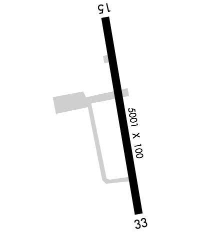
RWY 15R/33L IS MAINTAINED AS SKI STRIP IN WINTER AND GRVL STRIP THE REMAINDER OF THE YEAR. VISUAL INSPECTION REQD BEFORE LNDG. BEACON TWR AND OTHER OBSTACLES ON N APCH END.
MOOSE & CARIBOU ON & AROUND ARPT.
PERSONNEL AND EQUIPMENT MAY BE WORKING ON RWY AT ANY TIME.
RWY CONDITION NOT MONITORED; RECOMMEND VISUAL INSPECTION PRIOR TO LANDING.
WX CAMERA AVBL ON INTERNET AT HTTPS://WEATHERCAMS.FAA.GOV
Airport Communications & Frequencies:
CTAF Frequency:
122.900
Remarks
  • APCH/DEP SVC PRVDD BY ANCHORAGE ARTCC ON FREQS 119.5/317.5 (GULKANA RCAG).
  • Runway Identifications
    Runway Identification: 15L/33R
    Length: 5001 ft
    Width: 100 ft
    Surface: ASPHALT-GOOD CONDITION
    Edge lights: Medium Intensity

    Treatment: NONE

     Runway: 15L   Runway: 33R
    Mag heading: 154°Mag heading: 334°
    Rwy Slope: -.80% DownRwy Slope: .80% Up
    Approach: Approach:
    Pattern: Left TrafficPattern: Left Traffic
    Markings: NONPRECISION INSTRUMENTMarkings: NONPRECISION INSTRUMENT
    Marking Condition: GOODMarking Condition: GOOD
    Arresting Dev: Arresting Dev:
    Lat & Long: N6209.7  W14527.4Lat. & Long.: N6208.9  W14527.1
    Elev: 1586.1 ft. MSLElev: 1546.0 ft. MSL
    TCH: 49 ft. AGLTCH: 29 ft. AGL
    Visual Glide Path: 3.00 degreesVisual Glide Path: 3.00 degrees
    Displaced Threshold: NoDisplaced Threshold: No
    Touchdown Zone: YESTouchdown Zone: YES
    Touchdown Elev.: 1586.1 feetTouchdown Elev.: 1572.8 feet
    Visual Glide Slope: 4-BOX VASI ON LEFT SIDE OF RUNWAYVisual Glide Slope: 4-BOX VASI ON RIGHT SIDE OF RUNWAY
    RVR Equipment: RVR Equipment:
    RVV Equipment: NORVV Equipment: NO
    Approach Lights: Approach Lights:
    REIL: NOREIL: NO
    Centerline Lights: NOCenterline Lights: NO
    Touchdown lights: NOTouchdown lights: NO
    Runway Category: Runway with a Non-precision Approach having visibility minimums greater than 3/4 mileRunway Category: Runway with a Non-precision Approach having visibility minimums greater than 3/4 mile
    Declared Distances: Declared Distances:
    Obstructions: TREESObstructions: TREES
    Marked: NOT Marked/LightedMarked: NOT Marked/Lighted
    Clearance slope: 35:1Clearance slope: 30:1
    Obstruction height: 37 feet AGLObstruction height: 57 feet AGL
    Dist. from runway: 1500 feetDist. from runway: 1914 feet
    Centerline offset: 171 left of centerlineCenterline offset: B
    Comments: Comments: BRUSH 6 FT HIGH, 190 FT OFF RUNWAY END, 90 FT RIGHT.
    Runway Identification: 15R/33L
    Length: 2300 ft
    Width: 60 ft
    Surface: -GOOD CONDITION
    Edge lights:

    Treatment: NONE

     Runway: 15R   Runway: 33L
    Mag heading: 154°Mag heading: 334°
    Rwy Slope: -.89% DownRwy Slope: .89% Up
    Approach: Approach:
    Pattern: Left TrafficPattern: Left Traffic
    Markings: NONEMarkings: NONE
    Marking Condition: GOODMarking Condition: GOOD
    Arresting Dev: Arresting Dev:
    Lat & Long: N6209.4  W14527.5Lat. & Long.: N6209.0  W14527.4
    Elev: 1567.9 ft. MSLElev: 1547.4 ft. MSL
    TCH: TCH:
    Visual Glide Path: Visual Glide Path:
    Displaced Threshold: NoDisplaced Threshold: No
    Touchdown Zone: YESTouchdown Zone: YES
    Touchdown Elev.: 1566.9 feetTouchdown Elev.: 1566.9 feet
    Visual Glide Slope: Visual Glide Slope:
    RVR Equipment: RVR Equipment:
    RVV Equipment: NORVV Equipment: NO
    Approach Lights: Approach Lights:
    REIL: NOREIL: NO
    Centerline Lights: NOCenterline Lights: NO
    Touchdown lights: NOTouchdown lights: NO
    Runway Category: Runway with a Visual ApproachRunway Category: Runway with a Visual Approach
    Declared Distances: Declared Distances:
    Obstructions: TOWERObstructions: TREES
    Marked: LIGHTEDMarked: NOT Marked/Lighted
    Clearance slope: 15:1Clearance slope: 19:1
    Obstruction height: 56 feet AGLObstruction height: 63 feet AGL
    Dist. from runway: 880 feetDist. from runway: 1213 feet
    Centerline offset: 45 right of centerlineCenterline offset: 69 feet right of centerline
    Comments: Comments:
    C:1/P: