
| ||||||||||||||||||||||||||||||||
| ||||||||||||||||||||||||||||||||
| ||||||||||||||||||||||||||||||||
| ||||||||||||||||||||||||||||||||
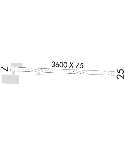
| Rwy | Rwy | |||||||
| 3600x75 | 3600' | 3600x75 | 3600' | |||||
| Runway ID | Single Wheel | Double Wheel | Double Tandem Wheel | Dual Double Wheel |
| 07/25 | N/A | N/A | N/A | N/A |
| These numbers are Advisory and are not limits. The Airport Manager should have more accurate Weight Limits | ||||
 Airport Diagram might not be current. | |
| Facility Name: | EAGLE |
| City Name: | EAGLE |
| County: | SOUTHEAST FAIRBANKS |
| State abbrev: | AK |
| State Name: | ALASKA |
| Ownership: | PUBLICLY OWNED |
| Use: | OPEN TO THE PUBLIC |
| Owner's Name: | ALASKA DOT&PF NORTHERN REGION |
| Address: | 2301 PEGER RD |
| FAIRBANKS, AK 99709 | |
| Owner's Phone: | 907-451-2200 |
| Manager's Name: | SAM JENNINGS |
| Address: | P O BOX 356 |
| TOK, AK 99780 | |
| Phone: | 907-883-5128 |
| FAA Region: | ALASKA |
| FAA Field Office: | NONE |
| Date | Sunrise | Sunset |
|---|---|---|
| 04/23/24 Tuesday | 5:17 | 21:30 |
| 04/24/24 Wednesday | 5:14 | 21:33 |
| 04/25/24 Thursday | 5:10 | 21:37 |
| 04/26/24 Friday | 5:06 | 21:40 |
| 04/27/24 Saturday | 5:03 | 21:43 |
| 04/28/24 Sunday | 4:59 | 21:47 |
| 04/29/24 Monday | 4:55 | 21:50 |
| 04/30/24 Tuesday | 4:52 | 21:53 |
| 05/01/24 Wednesday | 4:48 | 21:57 |
| 05/02/24 Thursday | 4:45 | 22:00 |
| 05/03/24 Friday | 4:41 | 22:04 |
| 05/04/24 Saturday | 4:37 | 22:07 |
| 05/05/24 Sunday | 4:34 | 22:10 |
| 05/06/24 Monday | 4:30 | 22:14 |
| Airport Attendance Schedule | UNATTENDED |
| Airport Status | OPERATIONAL (This Status can change at any time - please check NOTAMS) |
| Airport Lighting Schedule | ACTVT MIRL RY 07/25 & VASI RY 07 - CTAF.; ACTVT ROTG BCN - CTAF. |
| Airport Storage Available | Tie Downs |
| Extra Services Available | NONE |
| Wind Indicator | YES - (lighted) |
| Control Tower | NO |
| CTAF Frequency | 122.800 |
| Unicom Frequency | 122.800 |
| Rotating Beacon Color | WG |
| Segmented Circle | YES |
| Landing Fee | NO |
| Airport Inspected | CONTRACTOR - performed by PRIVATE CONTRACT PERSONNEL |
| Inspection Date | 06/09/2022 |
| Type of Fuel Available | None |
| Airframe Repair Service | NONE |
| Power Plant Repair Service | NONE |
| Latitude | N6446.7 |
| Longitude | W14109.0 (ESTIMATED) |
| Arpt Elevation | 907ft (SURVEYED) |
| Magnetic Variation | 21E |
| 2 miles E | of EAGLE |
| Traffic Pattern Altitude | |
| Sectional Chart | DAWSON |
| Operations (Reported) | Yearly | Avg. Daily |
|---|---|---|
| General Aviation Transient | 1200 | 3 |
| General Aviation Local | 800 | 2 |
| Air Taxi | 400 | 1 |
| Commerical | 0 | 0 |
| Commuter | 0 | 0 |
| Military | 0 | 0 |
| Aircraft based on Field | |
|---|---|
| General Aviation Singles | 1 |
| General Aviation Multi | 0 |
| Jet Aircraft | 0 |
| General Aviation Helicopters | 0 |
| Military Aircraft | 0 |
| Gliders | 0 |
| Ultralights | 0 |
| FSS on field | NO |
| FSS tie-in | NORTHWAY |
| FSS Phone | 1-800-800-478-6611 |
| Nearby FSS | FAIRBANKS |
| Phone | 1-800-866-248-6516 |
| Who issues Notams | EAA |
| Notam D service at airport | YES |
| ARTCC Name | ANCHORAGE |
| Airport Certification | |
| Aircraft Rescue & Firefighting Index | None |
| Airport of Entry | No |
| Custom Landing Rights | No; CUSTOMS UNAVBL CONTACT 907-774-2252 FOR INFO. |
| Joint Civil/Military | No |
| Military Landing rights | YES |
| NATIONAL PLAN OF INTEGRATED AIRPORT SYSTEMS (NPIAS) |
| GRANT AGREEMENTS UNDER FAAP/ADAP/AIP |
| ASSURANCES PURSUANT TO TITLE VI, CIVIL RIGHTS ACT OF 1964 |
| RY CONDITION NOT MONITORED; RECOMMEND VISUAL INSPECTION PRIOR TO LANDING. |
| SUAIS - 125.3/126.3(1-800-758-8723). |
| WX CAMERA AVBL ON INTERNET AT HTTPS://WEATHERCAMS.FAA.GOV |
| HEL OPN FR SOUTH RAMP DURG SUMMER MONTHS. |
| 100LL AND JET A FUEL AVBL BY CALLING 907-547-2220. |
| COLD TEMPERATURE AIRPORT. ALTITUDE CORRECTION REQUIRED AT OR BELOW -13C. |
Airport Communications & Frequencies:
| |||||||||
| Runway: 07 | Runway: 25 | ||
| Mag heading: | 71° | Mag heading: | 251° |
| Rwy Slope: | .18% Up | Rwy Slope: | -.18% Down |
| Approach: | Approach: | ||
| Pattern: | Left Traffic | Pattern: | Left Traffic |
| Markings: | Markings: | ||
| Marking Condition: | RYS 07 & 25 MKD WITH REFLECTIVE THLD PANELS & CONES. | Marking Condition: | |
| Arresting Dev: | Arresting Dev: | ||
| Lat & Long: | N6446.7 W14109.7 | Lat. & Long.: | N6446.7 W14108.3 |
| Elev: | 900.7 ft. MSL | Elev: | 907.2 ft. MSL |
| TCH: | 39 ft. AGL | TCH: | |
| Visual Glide Path: | 3.75 degrees | Visual Glide Path: | |
| Displaced Threshold: | No | Displaced Threshold: | No |
| Touchdown Zone: | YES | Touchdown Zone: | YES |
| Touchdown Elev.: | 904.5 feet | Touchdown Elev.: | 907.2 feet |
| Visual Glide Slope: | 4-BOX VASI ON LEFT SIDE OF RUNWAY | Visual Glide Slope: | |
| RVR Equipment: | RVR Equipment: | ||
| RVV Equipment: | NO | RVV Equipment: | NO |
| Approach Lights: | Approach Lights: | ||
| REIL: | NO | REIL: | NO |
| Centerline Lights: | NO | Centerline Lights: | NO |
| Touchdown lights: | NO | Touchdown lights: | NO |
| Runway Category: | Runway with a Visual Approach | Runway Category: | Runway with a Visual Approach |
| Declared Distances: | Declared Distances: | ||
| Obstructions: | HILL | Obstructions: | TREES |
| Marked: | NOT Marked/Lighted | Marked: | NOT Marked/Lighted |
| Clearance slope: | 1:1 | Clearance slope: | 13:1 |
| Obstruction height: | 4 feet AGL | Obstruction height: | 90 feet AGL |
| Dist. from runway: | 0 feet | Dist. from runway: | 1239 feet |
| Centerline offset: | 110 right of centerline | Centerline offset: | 218 feet left of centerline |
| Comments: | Comments: |