
| ||||||
| ||||||
| ||||||
|
| Rwy | Rwy | |||||||
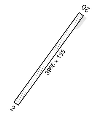
| 3955x135 | 3955' | 3955x135 | 3955' | |||||
| Runway ID | Single Wheel | Double Wheel | Double Tandem Wheel | Dual Double Wheel |
| 02/20 | N/A | N/A | N/A | N/A |
| These numbers are Advisory and are not limits. The Airport Manager should have more accurate Weight Limits | ||||
 Airport Diagram might not be current. | |
| Facility Name: | CAPE ROMANZOF LRRS |
| City Name: | CAPE ROMANZOF |
| County: | KUSILVAK |
| State abbrev: | AK |
| State Name: | ALASKA |
| Ownership: | AIR FORCE OWNED |
| Use: | PRIVATE; OFFL BUS ONLY; CLSD TO PUBLIC. |
| Owner's Name: | U.S. AIR FORCE |
| Address: | 611TH AIR SUPPORT GROUP, 10471 20TH STREET, SUITE 361 |
| ELMENDORF AFB, AK 99506-2270 | |
| Owner's Phone: | 907-552-3442 |
| Manager's Name: | NICK HILTON |
| Address: | 611TH AIR SUPPORT SQUADRON, 10471 20TH STREET, SUITE 222 |
| ELMENDORF AFB, AK 99506-2270 | |
| Phone: | 907-552-4400 |
| FAA Region: | ALASKA |
| FAA Field Office: | NONE |
| Date | Sunrise | Sunset |
|---|---|---|
| 04/25/24 Thursday | 7:07 | 22:58 |
| 04/26/24 Friday | 7:04 | 23:01 |
| 04/27/24 Saturday | 7:01 | 23:04 |
| 04/28/24 Sunday | 6:58 | 23:07 |
| 04/29/24 Monday | 6:55 | 23:09 |
| 04/30/24 Tuesday | 6:52 | 23:12 |
| 05/01/24 Wednesday | 6:49 | 23:15 |
| 05/02/24 Thursday | 6:46 | 23:18 |
| 05/03/24 Friday | 6:43 | 23:20 |
| 05/04/24 Saturday | 6:40 | 23:23 |
| 05/05/24 Sunday | 6:37 | 23:26 |
| 05/06/24 Monday | 6:34 | 23:29 |
| 05/07/24 Tuesday | 6:31 | 23:31 |
| 05/08/24 Wednesday | 6:28 | 23:34 |
| Airport Attendance Schedule | MON-FRI 1700-0200Z++; CLSD WKENDS & FED HOL. |
| Airport Status | OPERATIONAL (This Status can change at any time - please check NOTAMS) |
| Airport Lighting Schedule | ON CONSLY. |
| Airport Storage Available | NONE |
| Extra Services Available | NONE |
| Wind Indicator | YES - (unlit) |
| Control Tower | NO |
| CTAF Frequency | 126.200 |
| Unicom Frequency | |
| Rotating Beacon Color | |
| Segmented Circle | YES |
| Landing Fee | NO |
| Airport Inspected | No Inspection Data Available performed by the OWNER |
| Inspection Date | 08/30/1976 |
| Type of Fuel Available | None |
| Airframe Repair Service | None |
| Power Plant Repair Service | None |
| Latitude | N6146.9 |
| Longitude | W16602.4 (ESTIMATED) |
| Arpt Elevation | 467ft (SURVEYED) |
| Magnetic Variation | 08E |
| 6 miles SE | of CAPE ROMANZOF |
| Traffic Pattern Altitude | |
| Sectional Chart | BETHEL |
| Operations (Reported) | Yearly | Avg. Daily |
|---|---|---|
| General Aviation Transient | 0 | 0 |
| General Aviation Local | 0 | 0 |
| Air Taxi | 0 | 0 |
| Commerical | 0 | 0 |
| Commuter | 0 | 0 |
| Military | 0 | 0 |
| Aircraft based on Field | |
|---|---|
| General Aviation Singles | 0 |
| General Aviation Multi | 0 |
| Jet Aircraft | 0 |
| General Aviation Helicopters | 0 |
| Military Aircraft | 0 |
| Gliders | 0 |
| Ultralights | 0 |
| FSS on field | NO |
| FSS tie-in | KENAI |
| FSS Phone | 1-800-866-864-1737 |
| Who issues Notams | PACZ |
| Notam D service at airport | YES |
| ARTCC Name | ANCHORAGE |
| Airport Certification | |
| Aircraft Rescue & Firefighting Index | None |
| Airport of Entry | No |
| Custom Landing Rights | No |
| Joint Civil/Military | No |
| Military Landing rights | No |
| MIL, GOV & CIVIL PPR 24 HR BFR SKED ARR & NO LATER THAN 1 HR PRIOR TO DEP - D317-552-9419/9370, C907-552-9419/9370. |
| PAX MUST COORD PRIOR TO NON EMERG TVL TO SITE - ARS PROGRAM MGMT D317-552-4400/9630 OR C907-552-4400/9630. |
| CTN: SHARP DROPOFF W SIDE OF RWY; RSTR 180 DEG TURNS TO N END APRON AREA. |
| WX MEASURING EQUIP APCH END RWY 02 R SIDE. MKRS 250 FT APART FULL LEN. |
| CTN: WINDS FM 070-150 MAY BE STRONGER THAN RPRTD. WIND OVR 20 KTS PSBL SVR TURB. |
| DALGT OPS ONLY. |
| AFT CTC ON 126.2 OR 121.5 EXP 30 MIN DELAY FOR FICON. |
| USAF APRT: CIV OPRS MUST HAVE CIV ACFT LNDG PERMIT CALP BFR 30 DAY PPR IS ISSUED. NON CALP OPS FINED & RPTD PER USAF OPERG INSTRN. CALP APPLICATION - 611 ASUS/LRAM D317-552-1448/4176/C907-552-1448/4176, AKLANDINGPERMITS@US.AF.MIL OR MAIL TO 11 AF AMGR 10471 20TH ST SUITE 231, JBER AK 99506. |
| ALERT: IN ADDITION TO WILDLIFE RISK ANALYSIS HAZARD NMRS GULLS INVOF ARPT IN JUNE; GEESE & SWANS AUG-SEP; DURG HERRING FISHERY ACT NMRS GULLS ON BEACH BLW APCH TO RWY. DILIGENCE RCMND. |
| RWY 02/2 0 RWY ON SIDE OF 2100 FT MT; APCH FM SW; LND RWY 02 & TKOF RWY 20; HIGH TRRN BOTH SIDES & N RWY END. SUCCESSFUL GO AROUND IMPROBABLE. |
Airport Communications & Frequencies:
| |||||||
| Runway: 02 | Runway: 20 | ||
| Mag heading: | 21° | Mag heading: | 201° |
| Rwy Slope: | 2.35% Up | Rwy Slope: | -2.35% Down |
| Approach: | Approach: | ||
| Pattern: | Left Traffic | Pattern: | Left Traffic |
| Markings: | NONSTANDARD | Markings: | NONSTANDARD |
| Marking Condition: | FAIR | Marking Condition: | FAIR |
| Arresting Dev: | Arresting Dev: | ||
| Lat & Long: | N6146.6 W16602.7 | Lat. & Long.: | N6147.1 W16602.0 |
| Elev: | 374.0 ft. MSL | Elev: | 467.0 ft. MSL |
| TCH: | 44 ft. AGL | TCH: | |
| Visual Glide Path: | 3.00 degrees | Visual Glide Path: | |
| Displaced Threshold: | No | Displaced Threshold: | No |
| Touchdown Zone: | YES | Touchdown Zone: | YES |
| Touchdown Elev.: | 444.0 feet | Touchdown Elev.: | 467.0 feet |
| Visual Glide Slope: | 2-Light PAPI on RIGHT side of Runway | Visual Glide Slope: | |
| RVR Equipment: | RVR Equipment: | ||
| RVV Equipment: | NO | RVV Equipment: | NO |
| Approach Lights: | Approach Lights: | ||
| REIL: | YES | REIL: | NO |
| Centerline Lights: | NO | Centerline Lights: | NO |
| Touchdown lights: | NO | Touchdown lights: | NO |
| Runway Category: | Runway with a Visual Approach | Runway Category: | Runway with a Visual Approach |
| Declared Distances: | Declared Distances: | ||
| Obstructions: | Obstructions: | RIDGE | |
| Marked: | Marked: | NOT Marked/Lighted | |
| Clearance slope: | 50:1 | Clearance slope: | 12:1 |
| Obstruction height: | Obstruction height: | ||
| Dist. from runway: | Dist. from runway: | 5280 feet | |
| Centerline offset: | Centerline offset: | ||
| Comments: | Comments: |
