
| ||||||||||||||||||||||||||||||||
| ||||||||||||||||||||||||||||||||
| ||||||||||||||||||||||||||||||||
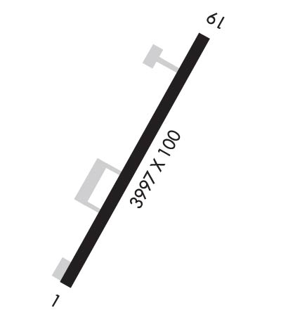
| Rwy | Rwy | |||||||
| 3997x100 | 3997' | 3997x100 | 3997' | |||||
| Runway ID | Single Wheel | Double Wheel | Double Tandem Wheel | Dual Double Wheel |
| 01/19 | N/A | N/A | N/A | N/A |
| These numbers are Advisory and are not limits. The Airport Manager should have more accurate Weight Limits | ||||
| FltPlan does not have IFR approach charts available for PACL. |
 Airport Diagram might not be current. | |
| Facility Name: | CLEAR |
| City Name: | CLEAR |
| County: | DENALI |
| State abbrev: | AK |
| State Name: | ALASKA |
| Ownership: | PUBLICLY OWNED |
| Use: | OPEN TO THE PUBLIC |
| Owner's Name: | ALASKA DOT&PF NORTHERN REGION |
| Address: | 2301 PEGER RD |
| FAIRBANKS, AK 99709 | |
| Owner's Phone: | 907-451-5280 |
| Manager's Name: | JASON LUDINGTON |
| Address: | 2301 PEGER RD |
| FAIRBANKS, AK 99709-5316 | |
| Phone: | 907-451-5280 |
| FAA Region: | ALASKA |
| FAA Field Office: | NONE |
| Date | Sunrise | Sunset |
|---|---|---|
| 04/26/24 Friday | 5:41 | 22:09 |
| 04/27/24 Saturday | 5:38 | 22:12 |
| 04/28/24 Sunday | 5:34 | 22:15 |
| 04/29/24 Monday | 5:31 | 22:18 |
| 04/30/24 Tuesday | 5:27 | 22:22 |
| 05/01/24 Wednesday | 5:24 | 22:25 |
| 05/02/24 Thursday | 5:20 | 22:28 |
| 05/03/24 Friday | 5:17 | 22:31 |
| 05/04/24 Saturday | 5:13 | 22:35 |
| 05/05/24 Sunday | 5:10 | 22:38 |
| 05/06/24 Monday | 5:07 | 22:41 |
| 05/07/24 Tuesday | 5:03 | 22:45 |
| 05/08/24 Wednesday | 5:00 | 22:48 |
| 05/09/24 Thursday | 4:56 | 22:51 |
| Airport Attendance Schedule | UNATTENDED |
| Airport Status | OPERATIONAL (This Status can change at any time - please check NOTAMS) |
| Airport Lighting Schedule | ACTVT MIRL RWY 01/19 - CTAF. |
| Airport Storage Available | Tie Downs |
| Extra Services Available | Cargo Handling |
| Wind Indicator | YES - (lighted) |
| Control Tower | NO |
| CTAF Frequency | 122.900 |
| Unicom Frequency | |
| Rotating Beacon Color | WG |
| Segmented Circle | YES |
| Landing Fee | NO |
| Airport Inspected | STATE - performed by STATE AERONAUTICAL PERSONNEL |
| Inspection Date | 08/13/2020 |
| Type of Fuel Available | None |
| Airframe Repair Service | None |
| Power Plant Repair Service | None |
| Latitude | N6418.0 |
| Longitude | W14907.0 (ESTIMATED) |
| Arpt Elevation | 559ft (SURVEYED) |
| Magnetic Variation | 27E |
| 3 miles SE | of CLEAR |
| Traffic Pattern Altitude | |
| Sectional Chart | FAIRBANKS |
| Operations (Reported) | Yearly | Avg. Daily |
|---|---|---|
| General Aviation Transient | 100 | 0 |
| General Aviation Local | 0 | 0 |
| Air Taxi | 0 | 0 |
| Commerical | 0 | 0 |
| Commuter | 0 | 0 |
| Military | 0 | 0 |
| Aircraft based on Field | |
|---|---|
| General Aviation Singles | 1 |
| General Aviation Multi | 0 |
| Jet Aircraft | 0 |
| General Aviation Helicopters | 0 |
| Military Aircraft | 0 |
| Gliders | 0 |
| Ultralights | 0 |
| FSS on field | NO |
| FSS tie-in | FAIRBANKS |
| FSS Phone | 1-800-866-248-6516 |
| Who issues Notams | FAI |
| Notam D service at airport | YES |
| ARTCC Name | ANCHORAGE |
| Airport Certification | |
| Aircraft Rescue & Firefighting Index | None |
| Airport of Entry | No |
| Custom Landing Rights | No |
| Joint Civil/Military | No |
| Military Landing rights | No |
| NATIONAL PLAN OF INTEGRATED AIRPORT SYSTEMS (NPIAS) |
| 253 FT ANT 4000 FT E. |
| RWY COND NOT MNT; RCMD VISUAL INSP PRIOR TO LNDG. |
| ALERT: AVOID RSTRD AREA 1 NM W & PVT ARPT 3 NM SW. |
| WX CAMERA AVBL ON INTERNET AT HTTPS://WEATHERCAMS.FAA.GOV. |
| GLIDER ACT APR-SEP ON & INVOF ARPT. |
| TWY C CLSD DURG WINTER. |
| CTN: HIGH LEVEL RADIO ENERGY; PSBL AIRBORNE ELEC SYS DMG. RMN CLEAR OF R-2206 WHEN ACTV; MNT 133.25 FOR STATUS. SEE SPL NOTICE FOR CLEAR RADIATION HAZ. |
| RWY 01/1 9 SAFETY AREA; 300 FT OVRN EACH END. |
| Runway: 01 | Runway: 19 | ||
| Mag heading: | N/A | Mag heading: | N/A |
| Rwy Slope: | -.40% Down | Rwy Slope: | .40% Up |
| Approach: | Approach: | ||
| Pattern: | Right Traffic | Pattern: | Left Traffic |
| Markings: | NONPRECISION INSTRUMENT | Markings: | NONPRECISION INSTRUMENT |
| Marking Condition: | GOOD; THLD MKRS. | Marking Condition: | GOOD; THLD MKRS. |
| Arresting Dev: | Arresting Dev: | ||
| Lat & Long: | N6417.8 W14907.4 | Lat. & Long.: | N6418.3 W14906.6 |
| Elev: | 559.4 ft. MSL | Elev: | 543.3 ft. MSL |
| TCH: | TCH: | ||
| Visual Glide Path: | Visual Glide Path: | ||
| Displaced Threshold: | No | Displaced Threshold: | No |
| Touchdown Zone: | YES | Touchdown Zone: | YES |
| Touchdown Elev.: | 559.4 feet | Touchdown Elev.: | 555.3 feet |
| Visual Glide Slope: | Visual Glide Slope: | ||
| RVR Equipment: | RVR Equipment: | ||
| RVV Equipment: | NO | RVV Equipment: | NO |
| Approach Lights: | Approach Lights: | ||
| REIL: | NO | REIL: | NO |
| Centerline Lights: | NO | Centerline Lights: | NO |
| Touchdown lights: | NO | Touchdown lights: | NO |
| Runway Category: | Runway with a Visual Approach | Runway Category: | Runway with a Visual Approach |
| Declared Distances: | Declared Distances: | ||
| Obstructions: | TREES | Obstructions: | TREES |
| Marked: | NOT Marked/Lighted | Marked: | NOT Marked/Lighted |
| Clearance slope: | 4:1 | Clearance slope: | 3:1 |
| Obstruction height: | 45 feet AGL | Obstruction height: | 42 feet AGL |
| Dist. from runway: | 420 feet | Dist. from runway: | 350 feet |
| Centerline offset: | 180 left of centerline | Centerline offset: | 160 feet right of centerline |
| Comments: | Comments: |