
| ||||||||||||||||||||||||||||||||||||||||||||
| ||||||||||||||||||||||||||||||||||||||||||||
| ||||||||||||||||||||||||||||||||||||||||||||
| Rwy | Rwy | |||||||
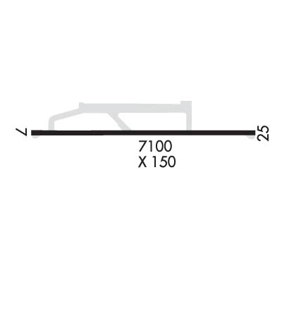
| 7100x150 | 6500' | 110.50 - 079° | 7100x150 | 6500' | ||||
| Runway ID | Single Wheel | Double Wheel | Double Tandem Wheel | Dual Double Wheel |
| 08/26 | 75,000 | 160,000 | 300,000 | N/A |
| These numbers are Advisory and are not limits. The Airport Manager should have more accurate Weight Limits | ||||
 Airport Diagram might not be current. | |
| Facility Name: | WILEY POST-WILL ROGERS MEML |
| City Name: | UTQIAGVIK |
| County: | NORTH SLOPE |
| State abbrev: | AK |
| State Name: | ALASKA |
| Ownership: | PUBLICLY OWNED |
| Use: | OPEN TO THE PUBLIC |
| Owner's Name: | ALASKA DOT&PF NORTHERN REGION |
| Address: | 2301 PEGER RD |
| FAIRBANKS, AK 99701 | |
| Owner's Phone: | 907-451-2206 |
| Manager's Name: | JOHN OLSEN |
| Address: | 30651 EMAIKSOUN ROAD |
| UTQIAGVIK, AK 99723 | |
| Phone: | 907-852-5851 |
| FAA Region: | ALASKA |
| FAA Field Office: | NONE |
| Date | Sunrise | Sunset |
|---|---|---|
| 04/22/24 Monday | 5:26 | 23:28 |
| 04/23/24 Tuesday | 5:20 | 23:33 |
| 04/24/24 Wednesday | 5:14 | 23:39 |
| 04/25/24 Thursday | 5:08 | 23:45 |
| 04/26/24 Friday | 5:01 | 23:52 |
| 04/27/24 Saturday | 4:55 | 23:58 |
| 04/28/24 Sunday | 4:48 | 24:04 |
| 04/29/24 Monday | 4:41 | 24:11 |
| 04/30/24 Tuesday | 4:34 | 24:18 |
| 05/01/24 Wednesday | 4:26 | 24:26 |
| 05/02/24 Thursday | 4:19 | 24:33 |
| 05/03/24 Friday | 4:10 | 24:42 |
| 05/04/24 Saturday | 4:02 | 24:50 |
| 05/05/24 Sunday | 3:52 | 1:00 |
| Airport Attendance Schedule | 7 Days A Week 0600-2030 |
| Airport Status | OPERATIONAL (This Status can change at any time - please check NOTAMS) |
| Airport Lighting Schedule | ACTVT MALSR RWY 08; REIL RWY 26 - CTAF. HIRL RWY 08/26 PRESET LOW INTST - INCR INTST BRW FSS 0600-2200; AFT HR - CTAF. PAPI RWY 08 & 26 ON CONSLY.; ROTG BCN ON CONSLY. |
| Airport Storage Available | Hanger |
| Extra Services Available | Cargo Handling |
| Wind Indicator | YES - (lighted) |
| Control Tower | NO |
| CTAF Frequency | 123.600 |
| Unicom Frequency | |
| Rotating Beacon Color | WG |
| Segmented Circle | YES |
| Landing Fee | NO |
| Airport Inspected | FEDERAL - performed by FAA AIRPORTS FIELD PERSONNEL |
| Inspection Date | 07/28/2022 |
| Type of Fuel Available | Grade 100LL, JET A-1 (freeze point -50C) |
| Airframe Repair Service | MINOR |
| Power Plant Repair Service | MINOR |
| Latitude | N7117.1 |
| Longitude | W15646.1 (ESTIMATED) |
| Arpt Elevation | 48ft (SURVEYED) |
| Magnetic Variation | 10E |
| 0 miles SE | of UTQIAGVIK |
| Traffic Pattern Altitude | |
| Sectional Chart | POINT BARROW |
| Operations (Reported) | Yearly | Avg. Daily |
|---|---|---|
| General Aviation Transient | 1500 | 4 |
| General Aviation Local | 3000 | 8 |
| Air Taxi | 6000 | 16 |
| Commerical | 1460 | 4 |
| Commuter | 0 | 0 |
| Military | 50 | 0 |
| Aircraft based on Field | |
|---|---|
| General Aviation Singles | 3 |
| General Aviation Multi | 1 |
| Jet Aircraft | 1 |
| General Aviation Helicopters | 3 |
| Military Aircraft | 0 |
| Gliders | 0 |
| Ultralights | 0 |
| FSS on field | YES |
| FSS tie-in | BARROW |
| FSS Phone | 852-2511 (Local call) |
| Nearby FSS | FAIRBANKS |
| Phone | 1-800-866-248-6516 |
| Who issues Notams | BRW |
| Notam D service at airport | YES |
| ARTCC Name | ANCHORAGE |
| Airport Certification | AIRPORT RECEIVING SCHEDULED AIR CARRIER SERVICE FROM CARRIERS CERTIFICATED BY THE CIVIL AERONAUTICS BOARD; CLSD TO ACR OPS MORE THAN 30 PAX SEATS EXCP PPR IN WRITING - AMGR PO BOX 367 BARROW AK 99723. |
| Aircraft Rescue & Firefighting Index | AIRPORT HAS A CERTIFICATE UNDER CFR PART 139 |
| Airport of Entry | No |
| Custom Landing Rights | No |
| Joint Civil/Military | No |
| Military Landing rights | YES |
| NATIONAL PLAN OF INTEGRATED AIRPORT SYSTEMS (NPIAS) |
| GRANT AGREEMENTS UNDER FAAP/ADAP/AIP |
| CONVEYANCE UNDER SCETION 16, FEDERAL AIRPORT ACT OF 1946 OR SECTION 23, AIRPORT AND AIRWAY DEVELOPMENT ACT OF 1970 |
| ASSURANCES PURSUANT TO TITLE VI, CIVIL RIGHTS ACT OF 1964 |
| SNOW REMOVAL, WILDLIFE CTL, COND RPRTG & ARPT MAINT SVC AVBL DURG MAINT DUTY HR 0600-2030; AFT HR - AMGR. |
| MAIN RAMP TXL NON STD WINGTIP CLNC; RWY BACK TAXI WHEN LRG ACFT PRKD ON MAIN RAMP. |
| TSA REG ARPT; SEE 49 CFR 1542. GATES & DOORS MUST BE SECURED ALL TIMES. TSNT - AMGR OR BRW FSS FOR INFO. |
| WATERFOWL INVOF ARPT SPRING-FALL. |
| ARPT SAND LRGR GRADATION THAN FAA RCMDD/SEE AC150/5200-30. |
| RCMD LRGR ACFT USE ELEPHANT EAR TO TURN AROUND. |
| WX CAMERA AVBL ON INTERNET AT HTTPS://WEATHERCAMS.FAA.GOV |
| WSO - 907-852-6484. |
Airport Communications & Frequencies:
| |||||||
| Runway: 08 | Runway: 26 | ||
| Mag heading: | 80° | Mag heading: | 260° |
| Rwy Slope: | -.16% Down | Rwy Slope: | .16% Up |
| Approach: | ILS/DME | Approach: | |
| Pattern: | Right Traffic | Pattern: | Left Traffic |
| Markings: | PRECISION INSTRUMENT | Markings: | PRECISION INSTRUMENT |
| Marking Condition: | GOOD | Marking Condition: | GOOD |
| Arresting Dev: | Arresting Dev: | ||
| Lat & Long: | N7117.1 W15647.9 | Lat. & Long.: | N7117.1 W15644.3 |
| Elev: | 48.6 ft. MSL | Elev: | 37.4 ft. MSL |
| TCH: | 51 ft. AGL | TCH: | 50 ft. AGL |
| Visual Glide Path: | 3.00 degrees | Visual Glide Path: | 3.00 degrees |
| Displaced Threshold: | 600 feet | Displaced Threshold: | 600 feet |
| Touchdown Zone: | YES | Touchdown Zone: | YES |
| Touchdown Elev.: | 48.9 feet | Touchdown Elev.: | 45.6 feet |
| Visual Glide Slope: | 4-Light PAPI on RIGHT side of Runway | Visual Glide Slope: | 4-Light PAPI on LEFT side of Runway |
| RVR Equipment: | TOUCHDOWN | RVR Equipment: | ROLLOUT |
| RVV Equipment: | NO | RVV Equipment: | NO |
| Approach Lights: | MALSR - 1,400 foot medium intensity approach lighting system with runway alignment indicator lights | Approach Lights: | |
| REIL: | NO | REIL: | YES |
| Centerline Lights: | NO | Centerline Lights: | NO |
| Touchdown lights: | NO | Touchdown lights: | NO |
| Runway Category: | Precision Instrument Runway | Runway Category: | Runway with a Non-precision Approach having visibility minimums greater than 3/4 mile |
| Declared Distances: | TORA:7100' TODA:7100' ASDA:6500' LDA:5900' | Declared Distances: | TORA:7100' TODA:7100' ASDA:6500' LDA:5900' |
| Obstructions: | Obstructions: | ANT | |
| Marked: | Marked: | LIGHTED | |
| Clearance slope: | 50:1 | Clearance slope: | 20:1 |
| Obstruction height: | Obstruction height: | 9 feet AGL | |
| Dist. from runway: | 1500 feet | Dist. from runway: | 380 feet |
| Centerline offset: | Centerline offset: | 200 feet right of centerline | |
| Comments: | Comments: |