Nassau's Premier FBO

MYNN

LYNDEN PINDLING INTL
NASSAU
Time Zone: Eastern
Lat: N 2502.3
Long: W 07728.0
Elev: 16
Var: +08
Longest Runway: 11107
Clr Del: 118.3
Dept. ATIS: 118.7
Arr. ATIS: 118.7
Ground: 121.7
Tower: 119.5

FBO & Flight Services info for MYNN

FBOs: Update your Fuel Prices

  click here  
Odyssey Aviation is the Most Reliable and Trustworthy FBO in Nassau
  • 24/7 Full Service FBO with Customs and Immigration Located in Our Facility
  • Only FBO with Private Ramp and 24 HR Surveillance and Security
  • Facilitation with Permits and Special Clearance
  • NATA Safety 1st and Comprehensive Insurance Policy
  • Ph: 242-702-0200 Fax: 242-362-0006 Freq: 130.9WebsiteE-Mail
                         
    Service
    Jet
    100LL
    SAF
    MoGas
    Fuel Avail: PRIST+$0.05/gal PRICES INCLUDE VALUE ADDED TAX
    Full6.209.30    Last Update: 04/05/2024 11:00

    Self        
    Misc. Info: VAT Tax: Value Added Tax of 10 is charged on all fuel & non-government fees
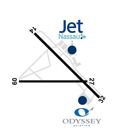
Address: PO BOX AP 59248/CORAL HARBOUR RD,   NASSAU N.P., BAHAMAS

      click here  
    Jet Nassau welcomes you to the Bahamas. Our award winning FBO offers everything you need to feel right at home. From aircraft ground support to meeting the individual requirements, we are at your service.
  • 24 Hr Operation
  • Bahamas Customs & Immigration on Site
  • Executive Terminal -VIP passengers lounge/crew lounge
  • Secured & lighted ramp w/ 24 hr security cameras
  • Quick Turns
  • Ph: 242-377-3355 Fax: 242-377-3475 Freq: 131.65WebsiteE-Mail
                         
    Service
    Jet
    100LL
    SAF
    MoGas
    Fuel Avail: Prices include 10 VAT
    Full5.8512.11    Last Update: 04/18/2024 10:31

    Self        
    Misc. Info: Address: 1 CORAL HARBOR RD,   NASSAU, N.P., BAHAMAS
    FltPlan offers handling services for this airport. To get a quote for your next trip:
    - Create your flight plan and look for the Handling message link below your international flight plan on the Active Flight Plan List.
    - Click on the link and complete the information. We will respond within 48 hours with your personalized quote.
    Ph: 786-206-6031
    -
    -
    Website-

    PIKE AVIATIONPh: 305-447-2676 Fax: 598 26003220
    -
    Service
    Jet
    100LL
    SAF
    MoGas
    Full        Caution: Fuel prices have not been updated in 58 days.   Last Update: 02/20/2024 11:34  
    Self        
    If you are an FBO, call 1-203-262-1700 to update your info or email: FltPlan.Advertising@garmin.com
    Advertise your FBO on FltPlan.com

    Runway & Approach Info for MYNN
    Rwy
    Length
    Land Dist**
    Approach*
      Rwy
    Length
    Land Dist**
    Approach*
    09
    8273x150  8273'          
     
      
    27
      8273x150  8273'          
     
    14
    11107x150  10921'          
     
      
    32
      11107x150  11107'          
     
     * only ILS, LOC, LDA, and SDF approaches to a specific runway are shown
    ** For any Declared Landing Distance Available, please see A/FD or Approach plates
    Runway Weight Capability (lbs.) Help
    Runway IDSingle WheelDouble WheelDouble Tandem WheelDual Double Wheel
    09/27N/AN/AN/AN/A
    14/32N/AN/AN/AN/A
    These numbers are Advisory and are not limits.   The Airport Manager should have more accurate Weight Limits
    Approach Charts
    FltPlan does not have IFR approach charts available for MYNN.
    Current Weather/Notams
    Customs Information Send updates to Support@FltPlan.com
    Phone 242-377-7027
    Fax N/A

    Comments U.S. Customs preclearance phone: (242) 377-7125
    A/FD
    No A/FD Information
    Database effective 04/18/2024
    Airport Diagram of MYNN
    Airport Diagram might not be current.

    Facility Name: LYNDEN PINDLING INTL
    City Name: NASSAU
    County: BAHAMAS
    State abbrev:
    State Name:
       
    Ownership: PUBLICLY OWNED
    Use: OPEN TO THE PUBLIC; FOREIGN CIV GOVT. LNDG FEES AND DIPLOMATIC CLNC MAY BE RQR.
    Owner's Name:
    Address:
     
    Owner's Phone:
      
    Manager's Name: NASSAU AIRPORT DEVELOPMENT COMPANY
    Address:
     
    Phone: 1-800-242-702-1000
       
    FAA Region:
    FAA Field Office: NONE


    Sunrise / Sunset times for LYNDEN PINDLING INTL

    DateSunriseSunset
    04/17/24 Wednesday6:4519:34
    04/18/24 Thursday6:4419:34
    04/19/24 Friday6:4319:35
    04/20/24 Saturday6:4219:35
    04/21/24 Sunday6:4219:36
    04/22/24 Monday6:4119:36
    04/23/24 Tuesday6:4019:37
    04/24/24 Wednesday6:3919:37
    04/25/24 Thursday6:3819:38
    04/26/24 Friday6:3719:38
    04/27/24 Saturday6:3719:39
    04/28/24 Sunday6:3619:39
    04/29/24 Monday6:3519:40
    04/30/24 Tuesday6:3419:40

    Airport Facilities

    Airport Attendance ScheduleCONTINUOUS
    Airport Status OPERATIONAL (This Status can change at any time - please check NOTAMS)
    Airport Lighting Schedule
    Airport Storage AvailableNONE
    Extra Services AvailableCargo Handling
    Wind IndicatorNONE
    Control TowerYES
    CTAF Frequency
    Unicom Frequency122.800
    Rotating Beacon ColorWG
    Segmented CircleNO
    Landing Fee

    Airport Inspection Data

    Airport InspectedNo Inspection Data Available performed by the OWNER
    Inspection DateUnknown

    Airport Services

    Type of Fuel AvailableGrade 100LL, JET A-1 (freeze point -50C)
    Airframe Repair ServiceNone
    Power Plant Repair ServiceNone

    Geographic Data

    LatitudeN2502.3
    LongitudeW07728.0 (ESTIMATED)
    Arpt Elevation16ft (ESTIMATED)
    Magnetic Variation08W
    7 miles Wof NASSAU
    Traffic Pattern Altitude
    Sectional ChartMIAMI

    Aircraft Data

    Operations (Reported)YearlyAvg. Daily
    General Aviation Transient 00
    General Aviation Local 00
    Air Taxi 00
    Commerical 00
    Commuter 00
    Military 00
    Aircraft based on Field
    General Aviation Singles 0
    General Aviation Multi 0
    Jet Aircraft 0
    General Aviation Helicopters 0
    Military Aircraft 0
    Gliders 0
    Ultralights 0

    FAA Services

    FSS on field NO
    FSS tie-in MIAMI; NASSAU FLT SVC FOR LCL INFO 1-242-377-7116/2006; EMERG 1-242-377-2040.
    FSS Phone 1-800-WX-BRIEF
    Who issues Notams
    Notam D service at airport No
    ARTCC Name MIAMI

    Federal Status

    Airport Certification
    Aircraft Rescue & Firefighting IndexNone
    Airport of EntryNo
    Custom Landing RightsNo
    Joint Civil/MilitaryNo
    Military Landing rightsNo

    Remarks

    FIREFIGHT EQUIP: OSHKOSH, 3,000 GALS WATER, 420 GALS FOAM, 500 LBS DRY CHM; OSHKOSH, 1,500 GALS WATER, 210 GALS FOAM, 500 LBS DRY CHM; OSHKOSH, 1,500 GALS WATER, 210 GALS FOAM, 500 LBS DRY CHM; OSHKOSH, 1,500 GALS WATER, 210 GALS FOAM; FORD, 300 GALS WATER, 20 GALS FOAM, 500 LBS DRY CHM AVBL.
    TWR HAS LTD VIS OF ACFT ON APRON 1 & STANDS 56-59.
    Airport Communications & Frequencies:
    ATIS Frequencies:   Hours(local) of Operation: CONTINUOUS
    118.7
    NASSAU Tower Frequencies:   Hours(local) of operation: CONTINUOUS   
    119.5
    134.55
    NASSAU Ground Frequencies:
    121.7
    Clearance Delivery Frequencies:
    118.3
    Unicom Frequency:
    122.800
    Remarks
  • APCH/DEP SVC PRVDD BY NASSAU APCH 121.0/PRIM & 125.3/SECONDARY (RADAR).
  • Part-time Approach Frequencies:  
    125.3
    Part-time Departure Frequencies:  
    125.3
    Runway Identifications
    Runway Identification: 09/27
    Length: 8273 ft
    Width: 150 ft
    Surface: ASPHALT
    Edge lights: Medium Intensity

    Treatment: NONE
    Weight: PCN 52 /F/C/X/T

     Runway: 09   Runway: 27
    Mag heading: 98°Mag heading: 278°
    Rwy Slope: -.01% DownRwy Slope: .01% Up
    Approach: Approach:
    Pattern: Left TrafficPattern: Left Traffic
    Markings: Markings:
    Marking Condition: Marking Condition:
    Arresting Dev: Arresting Dev:
    Lat & Long: N2502.2  W07728.9Lat. & Long.: N2502.2  W07727.4
    Elev: 14.0 ft. MSLElev: 13.0 ft. MSL
    TCH: 69 ft. AGLTCH: 70 ft. AGL
    Visual Glide Path: 3.00 degreesVisual Glide Path: 3.00 degrees
    Displaced Threshold: NoDisplaced Threshold: No
    Touchdown Zone: YESTouchdown Zone: YES
    Touchdown Elev.: 15.0 feetTouchdown Elev.: 16.0 feet
    Visual Glide Slope: 4-Light PAPI on LEFT side of RunwayVisual Glide Slope: 4-Light PAPI on LEFT side of Runway
    RVR Equipment: RVR Equipment:
    RVV Equipment: NORVV Equipment: NO
    Approach Lights: SSALS - simplified short approach lighting system; NSTD.Approach Lights:
    REIL: NOREIL: NO
    Centerline Lights: NOCenterline Lights: NO
    Touchdown lights: NOTouchdown lights: NO
    Runway Category: Runway Category:
    Declared Distances: TORA:8273' TODA:8273' ASDA:8273' LDA:8273'Declared Distances: TORA:8273' TODA:8273' ASDA:8273' LDA:8273'
    Runway Identification: 14/32
    Length: 11107 ft
    Width: 150 ft
    Surface: ASPHALT
    Edge lights: Medium Intensity

    Treatment: NONE
    Weight: PCN 52 /F/C/X/T

     Runway: 14   Runway: 32
    Mag heading: 143°Mag heading: 323°
    Rwy Slope: .02% UpRwy Slope: -.02% Down
    Approach: Approach:
    Pattern: Left TrafficPattern: Left Traffic
    Markings: Markings:
    Marking Condition: Marking Condition:
    Arresting Dev: Arresting Dev:
    Lat & Long: N2503.1  W07728.6Lat. & Long.: N2501.8  W07727.1
    Elev: 12.0 ft. MSLElev: 14.0 ft. MSL
    TCH: 75 ft. AGLTCH: 78 ft. AGL
    Visual Glide Path: 3.00 degreesVisual Glide Path: 3.00 degrees
    Displaced Threshold: 186 feetDisplaced Threshold: No
    Touchdown Zone: YESTouchdown Zone: YES
    Touchdown Elev.: 16.0 feetTouchdown Elev.: 14.0 feet
    Visual Glide Slope: 4-Light PAPI on LEFT side of RunwayVisual Glide Slope: 4-Light PAPI on LEFT side of Runway
    RVR Equipment: RVR Equipment:
    RVV Equipment: NORVV Equipment: NO
    Approach Lights: SSALS - simplified short approach lighting systemApproach Lights:
    REIL: NOREIL: NO
    Centerline Lights: NOCenterline Lights: NO
    Touchdown lights: NOTouchdown lights: NO
    Runway Category: Runway Category:
    Declared Distances: TORA:11353' TODA:11353' ASDA:11353' LDA:11143'Declared Distances: TORA:11353' TODA:11353' ASDA:11353' LDA:11353'
    C:404/P: