NOTICE: Information listed below may not be current.Airport Ident: MMJC
| Airport Name: ATIZAPAN DE ZARAGOZA, Mexico
Latitude: N1934.5 Longitude: W09917.3
Field Elevation: 8120' Variation: E6° as of 01/06
Time Zone: UTC-6(-5DT)
Daylight Savings: First Sunday in April to the last Saturday in October
Customs: N/A
|
|
| DISTANCE from: | KTEB to MMJC = 1815 nm
| KMIA to MMJC = 1114 nm
| KORD to MMJC = 1464 nm
| KDAL to MMJC = 807 nm
| KSEA to MMJC = 2015 nm
| KLAX to MMJC = 1335 nm
|
|
| AIRPORT TYPE: | | Active airports having permanent type surface runways with less than the minimum facilities. |
|
Rotating Beacon: NO
|
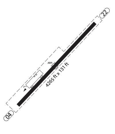
| RUNWAY INFORMATION: | Runway Ident: 22 /04
Runway Length: 4265
Runway Width: 131
Runway Surface: ASPHALT, ASPHALTIC CONCRETE, TAR MACADAM, OR BITUMEN BOUND MACADAM (INCLUDING ANY OF THESE SURFACE TYPES WITH CONCRETE ENDS).
Runway PCN Rating: -
Runway PCN Evaluation Method: N/A
Runway Open: YES
| Runway 22 Information
Runway True Heading: 227°
Takeoff Distance Available: 4465
Landing Distance Available: 4265
Runway Latitude: N1934.7
Runway Longitude: W09917.1
Runway Elevation:
Runway Slope: N/A
Runway TDZE:
Runway Lighting:
| Runway 04 Information
Runway True Heading: 47°
Takeoff Distance Available: 4265
Landing Distance Available: 4265
Runway Latitude: N1934.2
Runway Longitude: W09917.6
Runway Elevation:
Runway Slope: N/A
Runway TDZE: N/A
Runway Lighting:
|
|
|
COMMUNICATION INFORMATION
AERODROME FLIGHT INFO SERVICE - INFO
118.4
|