| |||||||||||||||||||||||||||||||||||||||||||||||||||||||||||||
| |||||||||||||||||||||||||||||||||||||||||||||||||||||||||||||
| Rwy | Rwy | |||||||
| 4001x75 | 4001' | 4001x75 | 4001' | |||||
| Runway ID | Single Wheel | Double Wheel | Double Tandem Wheel | Dual Double Wheel |
| 07/25 | 25,000 | N/A | N/A | N/A |
| These numbers are Advisory and are not limits. The Airport Manager should have more accurate Weight Limits | ||||
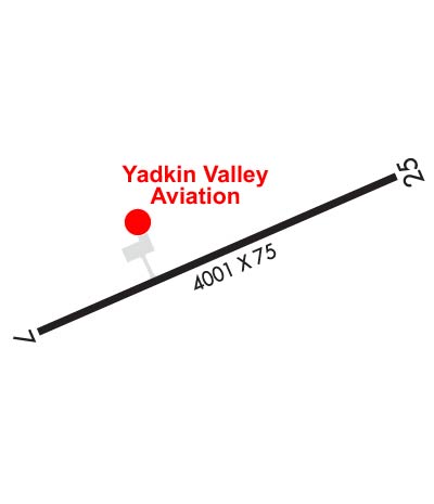 Airport Diagram might not be current. | |
| Facility Name: | ELKIN MUNI |
| City Name: | ELKIN |
| County: | SURRY |
| State abbrev: | NC |
| State Name: | NORTH CAROLINA |
| Ownership: | PUBLICLY OWNED |
| Use: | OPEN TO THE PUBLIC |
| Owner's Name: | TOWN OF ELKIN |
| Address: | TOWN HALL - PO BOX 857 |
| ELKIN, NC 28621 | |
| Owner's Phone: | (336) 794-6464 |
| Manager's Name: | STEVE (SANDY) SHORE |
| Address: | 1598 CC CAMP ROAD |
| ELKIN, NC 28621 | |
| Phone: | 336-366-3433 |
| FAA Region: | SOUTHERN |
| FAA Field Office: | MEM |
| Date | Sunrise | Sunset |
|---|---|---|
| 04/19/24 Friday | 6:44 | 20:01 |
| 04/20/24 Saturday | 6:42 | 20:02 |
| 04/21/24 Sunday | 6:41 | 20:03 |
| 04/22/24 Monday | 6:40 | 20:04 |
| 04/23/24 Tuesday | 6:39 | 20:05 |
| 04/24/24 Wednesday | 6:37 | 20:06 |
| 04/25/24 Thursday | 6:36 | 20:06 |
| 04/26/24 Friday | 6:35 | 20:07 |
| 04/27/24 Saturday | 6:34 | 20:08 |
| 04/28/24 Sunday | 6:33 | 20:09 |
| 04/29/24 Monday | 6:31 | 20:10 |
| 04/30/24 Tuesday | 6:30 | 20:11 |
| 05/01/24 Wednesday | 6:29 | 20:12 |
| 05/02/24 Thursday | 6:28 | 20:12 |
| Airport Attendance Schedule | 7 Days A Week 0900-1700 |
| Airport Status | OPERATIONAL (This Status can change at any time - please check NOTAMS) |
| Airport Lighting Schedule | ACTVT REIL RWY 07 & 25; PAPI RWY 07 & 25; MIRL RWY 07/25 - CTAF. |
| Airport Storage Available | Tie Downs, Hanger |
| Extra Services Available | Air Ambulance, Flight Instruction |
| Wind Indicator | YES - (lighted) |
| Control Tower | NO |
| CTAF Frequency | 123.050 |
| Unicom Frequency | 123.050 |
| Rotating Beacon Color | WG |
| Segmented Circle | YES |
| Landing Fee | NO |
| Airport Inspected | STATE - performed by STATE AERONAUTICAL PERSONNEL |
| Inspection Date | 07/05/2021 |
| Type of Fuel Available | Grade 100LL, JET A-1 (icing inhibitor, freeze point -50C); -1024 HR SELF SERVICE W/ CREDIT CARD. |
| Airframe Repair Service | MAJOR |
| Power Plant Repair Service | MAJOR |
| Latitude | N3616.8 |
| Longitude | W08047.2 (ESTIMATED) |
| Arpt Elevation | 1067ft (SURVEYED) |
| Magnetic Variation | 08W |
| 3 miles NE | of ELKIN |
| Traffic Pattern Altitude | MIN ALT 500 FT AGL BASE TURN TO FINAL RWY 25. |
| Sectional Chart | CINCINNATI |
| Operations (Reported) | Yearly | Avg. Daily |
|---|---|---|
| General Aviation Transient | 6000 | 16 |
| General Aviation Local | 7000 | 19 |
| Air Taxi | 0 | 0 |
| Commerical | 0 | 0 |
| Commuter | 0 | 0 |
| Military | 350 | 1 |
| Aircraft based on Field | |
|---|---|
| General Aviation Singles | 18 |
| General Aviation Multi | 1 |
| Jet Aircraft | 0 |
| General Aviation Helicopters | 1 |
| Military Aircraft | 0 |
| Gliders | 0 |
| Ultralights | 0 |
| FSS on field | NO |
| FSS tie-in | RALEIGH |
| FSS Phone | 1-800-WX-BRIEF |
| Who issues Notams | RDU |
| Notam D service at airport | YES |
| ARTCC Name | ATLANTA |
| Airport Certification | |
| Aircraft Rescue & Firefighting Index | None |
| Airport of Entry | No |
| Custom Landing Rights | No |
| Joint Civil/Military | No |
| Military Landing rights | YES |
| NATIONAL PLAN OF INTEGRATED AIRPORT SYSTEMS (NPIAS) |
| GRANT AGREEMENTS UNDER FAAP/ADAP/AIP |
| ASSURANCES PURSUANT TO TITLE VI, CIVIL RIGHTS ACT OF 1964 |
| RWY 07 SAFETY AREA HAS 80+ FT DROP-OFF AT END AND 90 FT BOTH SIDES OF CNTRLN. |
| DEER ON AND INVOF ARPT. |
| RWY 25 HAS AN UPHILL GRADE. |
| FOR SERVICE AFTER HOURS CALL (336)-874-7171, (336)-874-2931, (336)-366-7994, OR (336)-926-6243. |
| FOR CD CTC ATLANTA ARTCC AT 770-210-7692. |
| RWY 25 HAS UP TO 100+ FT DROP-OFF FIRST 600 FT AND 90 FT BOTH SIDES OF CNTRLN. |
| RWY 25 HAS UNMARKED POWER LINES 800 FT FM THR BOTH SIDES OF CNTRLN. |
Airport Communications & Frequencies:
| |||||||||
| Runway: 07 | Runway: 25 | ||
| Mag heading: | 75° | Mag heading: | 255° |
| Rwy Slope: | -.75% Down | Rwy Slope: | .75% Up |
| Approach: | Approach: | ||
| Pattern: | Left Traffic | Pattern: | Left Traffic |
| Markings: | NONPRECISION INSTRUMENT | Markings: | NONPRECISION INSTRUMENT |
| Marking Condition: | GOOD | Marking Condition: | GOOD |
| Arresting Dev: | Arresting Dev: | ||
| Lat & Long: | N3616.7 W08047.5 | Lat. & Long.: | N3616.9 W08046.8 |
| Elev: | 1067.0 ft. MSL | Elev: | 1036.8 ft. MSL |
| TCH: | 48 ft. AGL | TCH: | 42 ft. AGL |
| Visual Glide Path: | 3.00 degrees | Visual Glide Path: | 3.00 degrees |
| Displaced Threshold: | No | Displaced Threshold: | No |
| Touchdown Zone: | YES | Touchdown Zone: | YES |
| Touchdown Elev.: | 1067.2 feet | Touchdown Elev.: | 1064.8 feet |
| Visual Glide Slope: | 2-Light PAPI on LEFT side of Runway; UNUSBL 7 DEG LEFT AND RIGHT OF RCL. | Visual Glide Slope: | 2-Light PAPI on LEFT side of Runway; UNUSBL 9 DEG RIGHT OF RCL. |
| RVR Equipment: | RVR Equipment: | ||
| RVV Equipment: | NO | RVV Equipment: | NO |
| Approach Lights: | Approach Lights: | ||
| REIL: | YES | REIL: | YES |
| Centerline Lights: | NO | Centerline Lights: | NO |
| Touchdown lights: | NO | Touchdown lights: | NO |
| Runway Category: | Runway with a Non-precision Approach having visibility minimums greater than 3/4 mile | Runway Category: | Runway with a Non-precision Approach having visibility minimums greater than 3/4 mile |
| Declared Distances: | Declared Distances: | ||
| Obstructions: | TREES | Obstructions: | TREES |
| Marked: | NOT Marked/Lighted | Marked: | NOT Marked/Lighted |
| Clearance slope: | 6:1 | Clearance slope: | 2:1 |
| Obstruction height: | 29 feet AGL | Obstruction height: | 45 feet AGL |
| Dist. from runway: | 398 feet | Dist. from runway: | 329 feet |
| Centerline offset: | 141 right of centerline | Centerline offset: | 208 feet right of centerline |
| Comments: | Comments: |