
| ||||||||||||||||||||||||||||||||||||||||||||
| ||||||||||||||||||||||||||||||||||||||||||||
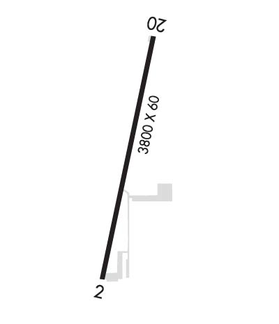
| Rwy | Rwy | |||||||
| 3800x60 | 3506' | 3800x60 | 3609' | |||||
| Runway ID | Single Wheel | Double Wheel | Double Tandem Wheel | Dual Double Wheel |
| 02/20 | N/A | N/A | N/A | N/A |
| These numbers are Advisory and are not limits. The Airport Manager should have more accurate Weight Limits | ||||
| FltPlan does not have IFR approach charts available for KZ98. |
 Airport Diagram might not be current. | |
| Facility Name: | OTTAWA EXEC |
| City Name: | ZEELAND |
| County: | OTTAWA |
| State abbrev: | MI |
| State Name: | MICHIGAN |
| Ownership: | PRIVATELY OWNED |
| Use: | OPEN TO THE PUBLIC |
| Owner's Name: | PHP INC |
| Address: | 5923 BYRON RD |
| ZEELAND, MI 49464-9331 | |
| Owner's Phone: | 616-437-3414 |
| Manager's Name: | BRAD PUGH |
| Address: | 5923 BYRON RD |
| ZEELAND, MI 49464-9331 | |
| Phone: | 616-218-6236 |
| FAA Region: | GREAT LAKES |
| FAA Field Office: | DET |

| Date | Sunrise | Sunset |
|---|---|---|
| 04/25/24 Thursday | 6:45 | 20:38 |
| 04/26/24 Friday | 6:44 | 20:40 |
| 04/27/24 Saturday | 6:42 | 20:41 |
| 04/28/24 Sunday | 6:41 | 20:42 |
| 04/29/24 Monday | 6:40 | 20:43 |
| 04/30/24 Tuesday | 6:38 | 20:44 |
| 05/01/24 Wednesday | 6:37 | 20:45 |
| 05/02/24 Thursday | 6:36 | 20:46 |
| 05/03/24 Friday | 6:34 | 20:47 |
| 05/04/24 Saturday | 6:33 | 20:49 |
| 05/05/24 Sunday | 6:32 | 20:50 |
| 05/06/24 Monday | 6:30 | 20:51 |
| 05/07/24 Tuesday | 6:29 | 20:52 |
| 05/08/24 Wednesday | 6:28 | 20:53 |
| Airport Attendance Schedule | 7 Days A Week 0800-1700 |
| Airport Status | OPERATIONAL (This Status can change at any time - please check NOTAMS) |
| Airport Lighting Schedule | ACTVT LIRL RWY 02/20 - CTAF. 5 CLICKS ON SS-SR. |
| Airport Storage Available | Tie Downs, Hanger |
| Extra Services Available | Flight Instruction, Aircraft Rental |
| Wind Indicator | YES - (lighted) |
| Control Tower | NO |
| CTAF Frequency | 122.900 |
| Unicom Frequency | |
| Rotating Beacon Color | |
| Segmented Circle | YES |
| Landing Fee |
| Airport Inspected | STATE - performed by STATE AERONAUTICAL PERSONNEL |
| Inspection Date | 02/23/2022 |
| Type of Fuel Available | Grade 100LL, JET A |
| Airframe Repair Service | MAJOR |
| Power Plant Repair Service | MAJOR |
| Latitude | N4249.0 |
| Longitude | W08555.7 (ESTIMATED) |
| Arpt Elevation | 756ft (SURVEYED) |
| Magnetic Variation | 03W |
| 3 miles E | of ZEELAND |
| Traffic Pattern Altitude | |
| Sectional Chart | CHICAGO |
| Operations (Reported) | Yearly | Avg. Daily |
|---|---|---|
| General Aviation Transient | 5000 | 14 |
| General Aviation Local | 8000 | 22 |
| Air Taxi | 0 | 0 |
| Commerical | 0 | 0 |
| Commuter | 0 | 0 |
| Military | 0 | 0 |
| Aircraft based on Field | |
|---|---|
| General Aviation Singles | 41 |
| General Aviation Multi | 6 |
| Jet Aircraft | 0 |
| General Aviation Helicopters | 1 |
| Military Aircraft | 0 |
| Gliders | 0 |
| Ultralights | 0 |
| FSS on field | NO |
| FSS tie-in | LANSING |
| FSS Phone | 1-800-WX-BRIEF |
| Who issues Notams | LAN |
| Notam D service at airport | YES |
| ARTCC Name | CHICAGO |
| Airport Certification | |
| Aircraft Rescue & Firefighting Index | None |
| Airport of Entry | No |
| Custom Landing Rights | No |
| Joint Civil/Military | No |
| Military Landing rights | No |
| RWY SLOPES UP FM SOUTH TO NORTH. |
| 200 FT LGTD ANT APRXLY 1900 FT NE OF RWY 20. |
| FOR CD CTC GREAT LAKES APCH AT 269-459-3345, WHEN APCH CLSD CTC CHICAGO ARTCC AT 630-906-8921. |
| 4 CLICKS ON CTAF FOR WIND, TEMP, & ALTM INFO. |
| Runway: 02 | Runway: 20 | ||
| Mag heading: | 15° | Mag heading: | 195° |
| Rwy Slope: | 1.08% Up | Rwy Slope: | -1.08% Down |
| Approach: | Approach: | ||
| Pattern: | Left Traffic | Pattern: | Left Traffic |
| Markings: | BASIC | Markings: | BASIC |
| Marking Condition: | GOOD | Marking Condition: | GOOD |
| Arresting Dev: | Arresting Dev: | ||
| Lat & Long: | N4248.7 W08555.8 | Lat. & Long.: | N4249.3 W08555.6 |
| Elev: | 715.0 ft. MSL | Elev: | 756.0 ft. MSL |
| TCH: | TCH: | ||
| Visual Glide Path: | Visual Glide Path: | ||
| Displaced Threshold: | 294 feet | Displaced Threshold: | 191 feet |
| Touchdown Zone: | NO | Touchdown Zone: | NO |
| Touchdown Elev.: | Touchdown Elev.: | ||
| Visual Glide Slope: | Visual Glide Slope: | ||
| RVR Equipment: | RVR Equipment: | ||
| RVV Equipment: | NO | RVV Equipment: | NO |
| Approach Lights: | Approach Lights: | ||
| REIL: | NO | REIL: | NO |
| Centerline Lights: | NO | Centerline Lights: | NO |
| Touchdown lights: | NO | Touchdown lights: | NO |
| Runway Category: | Runway with a Visual Approach | Runway Category: | Runway with a Visual Approach |
| Declared Distances: | Declared Distances: | ||
| Comments: | +16 FT ROAD, 125 FT DIST; +8 FT CROPS DURG SUMMER MONTHS. | Comments: |