Approach Charts
| FltPlan does not have IFR approach charts available for KX58. |
Current Weather/Notams (Metars, TAFs, Notams, NWS Forecast, PIREPS, and nearby weather)
Customs Information Send updates to Support@FltPlan.com
Customs Not Available
Database effective 04/18/2024
| Facility Name: | INDIANTOWN |
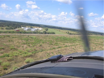
| City Name: | INDIANTOWN |
| County: | MARTIN |
| State abbrev: | FL |
| State Name: | FLORIDA |
| | |
| Ownership: | PRIVATELY OWNED |
| Use: | OPEN TO THE PUBLIC |
| Owner's Name: | INDIANTOWN INTERNATIONAL INC.; CONTACT PERSON: CLYDE DAWSON |
| Address: | PO BOX 1234 |
| | INDIANTOWN, FL 34956-1234 |
| Owner's Phone: | 772-597-5800 |
| | |
| Manager's Name: | CLYDE DAWSON; APT PHYS ADS: 20654 SOUTHWEST CITRUS BOULEVARD, INDIANTOWN FL 34956. |
| Address: | PO BOX 1234 |
| | INDIANTOWN, FL 34956-1234 |
| Phone: | 772-597-5800 |
| | |
| FAA Region: | SOUTHERN |
| FAA Field Office: | ORL |
Runway Identifications
Runway Identification: 13/31Length: 6300 ft
Width: 75 ft
Surface: GRASS-GOOD CONDITION
Edge lights: Treatment: NONE
| | Runway: 13 | | Runway: 31 |
| Mag heading: | N/A | Mag heading: | N/A |
| Approach: | | Approach: | |
| Pattern: | Left Traffic | Pattern: | Left Traffic |
| Markings: | | Markings: | |
| Marking Condition: | RY 13 /31 DSPLCD THLDS & RY SIDES MKD WITH WHITE PAVING STONES AND WHITE PVC MARKERS. | Marking Condition: | |
| Arresting Dev: | | Arresting Dev: | |
| Lat & Long: | N2702.6 W08026.9 | Lat. & Long.: | N2701.9 W08026.0 |
| Elev: | N/A | Elev: | N/A |
| TCH: | | TCH: | |
| Visual Glide Path: | | Visual Glide Path: | |
| Displaced Threshold: | 600 feet | Displaced Threshold: | 300 feet |
| Touchdown Zone: | NO | Touchdown Zone: | NO |
| Touchdown Elev.: | | Touchdown Elev.: | |
| Visual Glide Slope: | | Visual Glide Slope: | |
| RVR Equipment: | | RVR Equipment: | |
| RVV Equipment: | NO | RVV Equipment: | NO |
| Approach Lights: | | Approach Lights: | |
| REIL: | NO | REIL: | NO |
| Centerline Lights: | NO | Centerline Lights: | NO |
| Touchdown lights: | NO | Touchdown lights: | NO |
| Runway Category: | Runway with a Visual Approach | Runway Category: | Runway with a Visual Approach |
| Declared Distances: | | Declared Distances: | |
| Obstructions: | TREE | Obstructions: | ROAD |
| Marked: | NOT Marked/Lighted | Marked: | NOT Marked/Lighted |
| Clearance slope: | 32:1 | Clearance slope: | 20:1 |
| Obstruction height: | 37 feet AGL | Obstruction height: | 14 feet AGL |
| Dist. from runway: | 1175 feet | Dist. from runway: | 280 feet |
| Centerline offset: | | Centerline offset: | 125 feet right of centerline |
| Comments: | | Comments: | |