Approach Charts
| FltPlan does not have IFR approach charts available for KX10. |
Current Weather/Notams (Metars, TAFs, Notams, NWS Forecast, PIREPS, and nearby weather)
Customs Information Send updates to Support@FltPlan.com
Customs Not Available
Database effective 05/16/2024
Airport Diagram might not be current.
|
| Facility Name: | BELLE GLADE STATE MUNI |
| City Name: | BELLE GLADE |
| County: | PALM BEACH |
| State abbrev: | FL |
| State Name: | FLORIDA |
| | |
| Ownership: | PUBLICLY OWNED |
| Use: | OPEN TO THE PUBLIC |
| Owner's Name: | CITY OF BELLE GLADE; CONTACT PERSON: ROBERT REASE 561-992-1610 |
| Address: | 110 DR MARTIN LUTHER KING JR BLVD |
| | BELLE GLADE, FL 33430-3900 |
| Owner's Phone: | 561-996-0100 |
| | |
| Manager's Name: | DIANA HUGHES |
| Address: | 110 DR MARTIN LUTHER KING JR BLVD |
| | BELLE GLADE, FL 33430 |
| Phone: | 561-992-1610 |
| | |
| FAA Region: | SOUTHERN |
| FAA Field Office: | ORL |
Runway Identifications
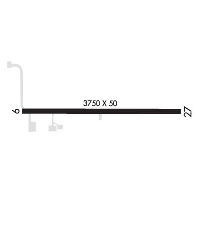
Runway Identification: 09/27Length: 3455 ft
Width: 50 ft
Surface: ASPHALT
Edge lights: Low IntensityTreatment: NONE
Weight: PCN 13 /F/A/X/T
| | Runway: 09 | | Runway: 27 |
| Mag heading: | 93° | Mag heading: | 273° |
| Rwy Slope: | -.09% Down | Rwy Slope: | .09% Up |
| Approach: | | Approach: | |
| Pattern: | Left Traffic | Pattern: | Left Traffic |
| Markings: | BASIC | Markings: | BASIC |
| Marking Condition: | FAIR | Marking Condition: | FAIR |
| Arresting Dev: | | Arresting Dev: | |
| Lat & Long: | N2641.9 W08039.9 | Lat. & Long.: | N2641.9 W08039.3 |
| Elev: | 14.0 ft. MSL | Elev: | 11.0 ft. MSL |
| TCH: | | TCH: | |
| Visual Glide Path: | | Visual Glide Path: | |
| Displaced Threshold: | No | Displaced Threshold: | No |
| Touchdown Zone: | NO | Touchdown Zone: | NO |
| Touchdown Elev.: | | Touchdown Elev.: | |
| Visual Glide Slope: | | Visual Glide Slope: | |
| RVR Equipment: | | RVR Equipment: | |
| RVV Equipment: | NO | RVV Equipment: | NO |
| Approach Lights: | | Approach Lights: | |
| REIL: | NO | REIL: | NO |
| Centerline Lights: | NO | Centerline Lights: | NO |
| Touchdown lights: | NO | Touchdown lights: | NO |
| Runway Category: | Runway with a Visual Approach | Runway Category: | Runway with a Visual Approach |
| Declared Distances: | TORA:3750' TODA:3750' | Declared Distances: | TORA:3750' TODA:3750' |
| Obstructions: | TREE | Obstructions: | POLE |
| Marked: | NOT Marked/Lighted | Marked: | NOT Marked/Lighted |
| Clearance slope: | 16:1; RWY 09 APCH RATIO 20:1 AT AER. | Clearance slope: | 23:1 |
| Obstruction height: | 44 feet AGL | Obstruction height: | 50 feet AGL |
| Dist. from runway: | 910 feet | Dist. from runway: | 1342 feet |
| Centerline offset: | 70 left of centerline | Centerline offset: | 20 feet left of centerline |
| Comments: | | Comments: | |

