
| ||||||
| ||||||
|
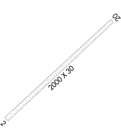
| Rwy | Rwy | |||||||
| 2000x30 | 1500' | 2000x30 | 2000' | |||||
| Runway ID | Single Wheel | Double Wheel | Double Tandem Wheel | Dual Double Wheel |
| 02/20 | N/A | N/A | N/A | N/A |
| These numbers are Advisory and are not limits. The Airport Manager should have more accurate Weight Limits | ||||
| FltPlan does not have IFR approach charts available for KWSM. |
 Airport Diagram might not be current. | |
| Facility Name: | WISEMAN |
| City Name: | WISEMAN |
| County: | YUKON-KOYUKUK |
| State abbrev: | AK |
| State Name: | ALASKA |
| Ownership: | PUBLICLY OWNED |
| Use: | OPEN TO THE PUBLIC |
| Owner's Name: | ALASKA DOT&PF NORTHERN REGION |
| Address: | 2301 PEGER RD, 2301 PEGER RD |
| FAIRBANKS, AK 99709 | |
| Owner's Phone: | 907-451-2200 |
| Manager's Name: | JEFF RUSSELL |
| Address: | 2301 PEGER RD |
| FAIRBANKS, AK 99709 | |
| Phone: | 907-451-2207 |
| FAA Region: | ALASKA |
| FAA Field Office: | NONE |
| Date | Sunrise | Sunset |
|---|---|---|
| 04/19/24 Friday | 5:51 | 22:09 |
| 04/20/24 Saturday | 5:47 | 22:13 |
| 04/21/24 Sunday | 5:43 | 22:17 |
| 04/22/24 Monday | 5:39 | 22:21 |
| 04/23/24 Tuesday | 5:34 | 22:25 |
| 04/24/24 Wednesday | 5:30 | 22:29 |
| 04/25/24 Thursday | 5:26 | 22:33 |
| 04/26/24 Friday | 5:21 | 22:37 |
| 04/27/24 Saturday | 5:17 | 22:41 |
| 04/28/24 Sunday | 5:12 | 22:45 |
| 04/29/24 Monday | 5:08 | 22:50 |
| 04/30/24 Tuesday | 5:04 | 22:54 |
| 05/01/24 Wednesday | 4:59 | 22:58 |
| 05/02/24 Thursday | 4:55 | 23:02 |
| Airport Attendance Schedule | UNATTENDED |
| Airport Status | OPERATIONAL (This Status can change at any time - please check NOTAMS) |
| Airport Lighting Schedule | |
| Airport Storage Available | Tie Downs |
| Extra Services Available | NONE |
| Wind Indicator | YES - (unlit) |
| Control Tower | NO |
| CTAF Frequency | 122.900 |
| Unicom Frequency | |
| Rotating Beacon Color | |
| Segmented Circle | NO |
| Landing Fee | NO |
| Airport Inspected | CONTRACTOR - performed by PRIVATE CONTRACT PERSONNEL |
| Inspection Date | 07/06/2023 |
| Type of Fuel Available | None |
| Airframe Repair Service | NONE |
| Power Plant Repair Service | NONE |
| Latitude | N6724.3 |
| Longitude | W15007.3 (ESTIMATED) |
| Arpt Elevation | 1195ft (ESTIMATED) |
| Magnetic Variation | 28E |
| 1 miles SSW | of WISEMAN |
| Traffic Pattern Altitude | |
| Sectional Chart | FAIRBANKS |
| Operations (Reported) | Yearly | Avg. Daily |
|---|---|---|
| General Aviation Transient | 150 | 0 |
| General Aviation Local | 0 | 0 |
| Air Taxi | 120 | 0 |
| Commerical | 0 | 0 |
| Commuter | 0 | 0 |
| Military | 0 | 0 |
| Aircraft based on Field | |
|---|---|
| General Aviation Singles | 0 |
| General Aviation Multi | 0 |
| Jet Aircraft | 0 |
| General Aviation Helicopters | 0 |
| Military Aircraft | 0 |
| Gliders | 0 |
| Ultralights | 0 |
| FSS on field | NO |
| FSS tie-in | FAIRBANKS |
| FSS Phone | 1-800-866-248-6516 |
| Who issues Notams | FAI |
| Notam D service at airport | YES |
| ARTCC Name | ANCHORAGE |
| Airport Certification | |
| Aircraft Rescue & Firefighting Index | None |
| Airport of Entry | No |
| Custom Landing Rights | No |
| Joint Civil/Military | No |
| Military Landing rights | YES |
| NATIONAL PLAN OF INTEGRATED AIRPORT SYSTEMS (NPIAS) |
| SKI PLANE OPNS ONLY IN WINTER; SNOW REMOVAL NOT AVBL. |
| RY NOT MAINTAINED & CONDITION NOT MONITORED, RECOMMEND VISUAL INSPECTION PRIOR TO LANDING. |
| TREES TO 35 FT WITHIN 75 FT EACH SIDE OF RY CENTERLINE. |
| RECMD DOGLEG APPROACH RY 02 DUE TO HILL. |
| WX CAMERA AVBL ON INTERNET AT HTTPS://WEATHERCAMS.FAA.GOV |
| RWY 02/2 0 BE ALERT: BACKCOUNTRY STRIP IN MTN VALLEY; HIGH TERRAIN ALL QUADRANTS. |
| RWY 02/2 0 6 INCH ROCKS & 24 INCH GRASS ALONG RY SFC; 48 INCH SAPLINGS IN RY 02 SAFETY AREA. |
| Runway: 02 | Runway: 20 | ||
| Mag heading: | 19° | Mag heading: | 199° |
| Rwy Slope: | .65% Up | Rwy Slope: | -.65% Down |
| Approach: | Approach: | ||
| Pattern: | Left Traffic | Pattern: | Right Traffic |
| Markings: | Markings: | ||
| Marking Condition: | 02/20 MARKED WITH REFLECTIVE MARKERS & CONES. | Marking Condition: | |
| Arresting Dev: | Arresting Dev: | ||
| Lat & Long: | N6724.2 W15007.6 | Lat. & Long.: | N6724.4 W15006.9 |
| Elev: | 1182.0 ft. MSL | Elev: | 1195.0 ft. MSL |
| TCH: | TCH: | ||
| Visual Glide Path: | Visual Glide Path: | ||
| Displaced Threshold: | 500 feet | Displaced Threshold: | No |
| Touchdown Zone: | NO | Touchdown Zone: | NO |
| Touchdown Elev.: | Touchdown Elev.: | ||
| Visual Glide Slope: | Visual Glide Slope: | ||
| RVR Equipment: | RVR Equipment: | ||
| RVV Equipment: | NO | RVV Equipment: | NO |
| Approach Lights: | Approach Lights: | ||
| REIL: | NO | REIL: | NO |
| Centerline Lights: | NO | Centerline Lights: | NO |
| Touchdown lights: | NO | Touchdown lights: | NO |
| Runway Category: | Runway with a Visual Approach | Runway Category: | Runway with a Visual Approach |
| Declared Distances: | Declared Distances: | ||
| Obstructions: | TREES | Obstructions: | TREES |
| Marked: | NOT Marked/Lighted | Marked: | NOT Marked/Lighted |
| Clearance slope: | Clearance slope: | ||
| Obstruction height: | 32 feet AGL | Obstruction height: | 33 feet AGL |
| Dist. from runway: | 0 feet | Dist. from runway: | 0 feet |
| Centerline offset: | 80 right of centerline | Centerline offset: | 74 feet right of centerline |
| Comments: | Comments: |
