Approach Charts
| FltPlan does not have IFR approach charts available for KWBB. |
Current Weather/Notams (Metars, TAFs, Notams, NWS Forecast, PIREPS, and nearby weather)
Customs Information Send updates to Support@FltPlan.com
Customs Not Available
Database effective 04/18/2024
Airport Diagram might not be current.
|
| Facility Name: | STEBBINS |
| City Name: | STEBBINS |
| County: | NOME |
| State abbrev: | AK |
| State Name: | ALASKA |
| | |
| Ownership: | PUBLICLY OWNED |
| Use: | OPEN TO THE PUBLIC |
| Owner's Name: | ALASKA DOT&PF NORTHERN REGION |
| Address: | 2301 PEGER RD, 2301 PEGER RD |
| | FAIRBANKS, AK 99709 |
| Owner's Phone: | 907-451-2200 |
| | |
| Manager's Name: | JOHN WILSON |
| Address: | PO BOX 192 |
| | UNALAKLEET, AK 99684 |
| Phone: | (907) 625-1025 |
| | |
| FAA Region: | ALASKA |
| FAA Field Office: | NONE |
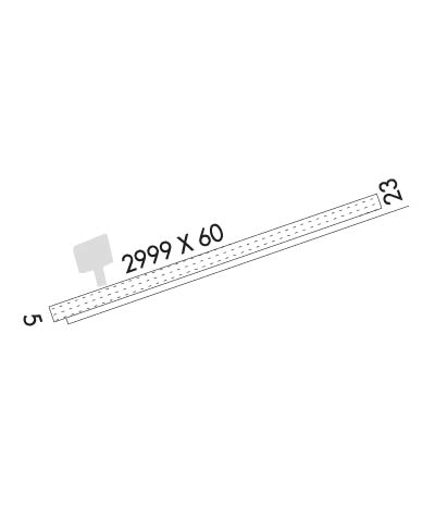
Runway Identifications
Runway Identification: 05/23Length: 2999 ft
Width: 60 ft
Surface: GRAVEL-GOOD CONDITION
Edge lights: Medium IntensityTreatment: NONE
| | Runway: 05 | | Runway: 23 |
| Mag heading: | 45° | Mag heading: | 225° |
| Rwy Slope: | -.08% Down | Rwy Slope: | .08% Up |
| Approach: | | Approach: | |
| Pattern: | Right Traffic | Pattern: | Left Traffic |
| Markings: | | Markings: | |
| Marking Condition: | | Marking Condition: | |
| Arresting Dev: | | Arresting Dev: | |
| Lat & Long: | N6330.9 W16217.2 | Lat. & Long.: | N6331.1 W16216.2 |
| Elev: | 17.9 ft. MSL | Elev: | 15.6 ft. MSL |
| TCH: | | TCH: | |
| Visual Glide Path: | | Visual Glide Path: | |
| Displaced Threshold: | No | Displaced Threshold: | No |
| Touchdown Zone: | YES | Touchdown Zone: | YES |
| Touchdown Elev.: | 19.4 feet | Touchdown Elev.: | 19.4 feet |
| Visual Glide Slope: | | Visual Glide Slope: | |
| RVR Equipment: | | RVR Equipment: | |
| RVV Equipment: | NO | RVV Equipment: | NO |
| Approach Lights: | | Approach Lights: | |
| REIL: | NO | REIL: | NO |
| Centerline Lights: | NO | Centerline Lights: | NO |
| Touchdown lights: | NO | Touchdown lights: | NO |
| Runway Category: | Runway with a Visual Approach | Runway Category: | Runway with a Visual Approach |
| Declared Distances: | | Declared Distances: | |
| Obstructions: | HILL | Obstructions: | |
| Marked: | NOT Marked/Lighted | Marked: | |
| Clearance slope: | 31:1 | Clearance slope: | 50:1 |
| Obstruction height: | 38 feet AGL | Obstruction height: | |
| Dist. from runway: | 1226 feet | Dist. from runway: | |
| Centerline offset: | 150 right of centerline | Centerline offset: | |
| Comments: | | Comments: | |

